
[Source: USGS Landsat]
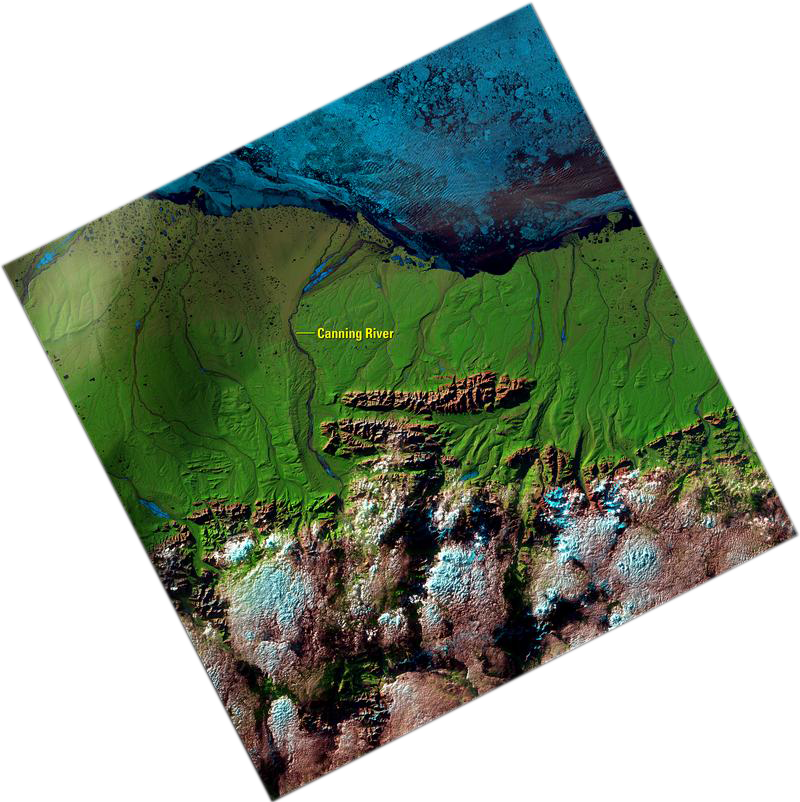
This Landsat 8 image acquired on June 27, 2017, represents one of those 7 million scenes contained in the archive. In this image, across the lower portion of this image in northeastern Alaska, clouds cover the Franklin Mountains area of the Brooks Range. Several rivers flow north from the mountains into the Beaufort Sea.
The Canning River marks the western border of the Arctic National Wildlife Refuge, a largely primitive and undisturbed region.
The prominent mountain range in the center of the image running east to west is the Sadlerochit Mountains. North of the mountains, the land becomes a flat-to-hilly treeless area called the North Slope coastal plain tundra. Off the coast, sea ice floats on the Beaufort Sea, and dark represents open water in this summer scene.
Northern Alaska receives sunlight 24 hours a day this time of year. Landsat normally acquires imagery only during the day on the descending part of its polar orbit, when the surface of the Earth is in sunlight. But at these high latitudes, Landsat 8 takes the opportunity during summer to acquire imagery during the ascending nighttime part of its orbit.
The day-lit ascending campaigns in high latitude regions increase the Landsat coverage in these persistently cloudy areas. The sun angle is different from a typical Landsat scene, providing a twilight glow to the scene.
View the video version of this image.

Be Part of What’s Next: Emerging Applications of Landsat at AGU24
Anyone making innovative use of Landsat data to meet societal needs today and during coming decades is encouraged to submit and abstract for the upcoming “Emerging Science Applications of Landsat” session at AGU24.


