For three days as February leaped into March this year, more than 11,500 people gathered in Houston, Texas, to attend the 2024 Commodity Classic—a massive agriculture conference led by farmers and focused on the latest agricultural technologies available to make the business of growing food and feeding families successful.
NASA Earth Science participated in the event for the third year, sharing information about freely and openly available data and visualization tools that can aid farmers. Information about Landsat—a joint NASA-U.S. Geological Survey program—was shared with farmers, educators, and policymakers during the event.
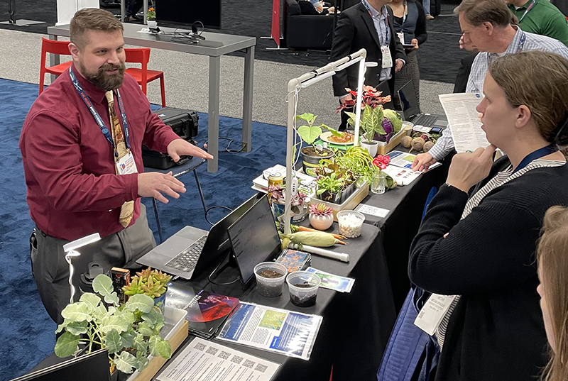
Landsat outreach team member, Mike Taylor, was stationed at the NASA exhibit booth where he spoke with conference attendees about the history of Landsat and its use in agriculture stretching back to the 1970s. Many farmers were familiar with the use of Landsat data and a vegetation greenness/health index known as NDVI.
Taylor guided booth visitors through the development of NDVI and derivative indices using a handheld, do-it-yourself instrument called STELLA. Then, after taking infrared and red irradiance measurements of plants on the exhibit table those values were used to calculate NDVI. On Friday, March 1, Taylor led a demonstration titled “Landsat in Your Hands.” This hands-on demo utilized STELLA to elucidate how Landsat spectral measurements are made and how vegetation health indices are derived.
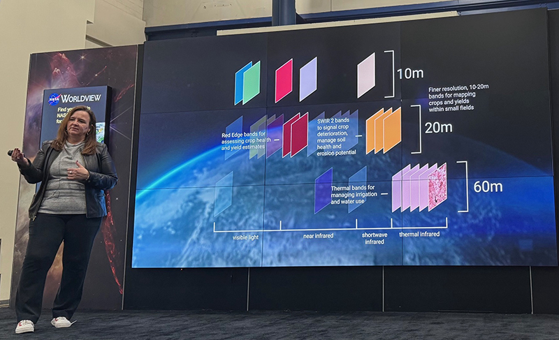
Farmers were pleased to learn that the Harmonized Landsat Sentinel-2 (HLS) data product could provide them with data updates every 2 to 3 days. They also expressed satisfaction with increased temporal resolution of Landsat Next—a three-satellite constellation which will have a combined six-day repeat cycle compared to the current 16-day repeat cycle of Landsat 9 (8-days when Landsat 8 and 9 are combined)—as well as the mission’s increased spectral and spatial resolutions.

A new animation highlighting Landsat Next’s capabilities was shared by NASA Earth Science Division Director, Karen St. Germain, during her hyperwall presentation which highlighted how farmer’s information needs inform satellite mission design, and how that connection benefits us all.
Additionally, on Tuesday, February 27, the day before the Commodity Classic began, Taylor helped run a workshop at NASA’s Johnson Space Center with fellow outreach specialists Elizabeth Joyner, Brianna Lind, and Tine Hart-Ballinger.
Twenty-five informal educators along with three University of Houston students participated in the remote sensing-focused training that introduced the Worldview visualization tool, the GLOBE citizen science program, and three NASA spaceborne sensors: Landsat’s Operational Land Imager (OLI), Terra and Aqua’s Moderate Resolution Imaging Spectroradiometer (MODIS), and the GEDI ecosystem lidar aboard the international space station. Participants used handheld STELLA instruments to make spectral measurements outside; they learned how to convert those measurements to reflectance in the computer lab; and they learned how this process relates to the systematic, spaceborne measurements made by Landsat and other optical satellites.

