
The exhibit will be on display April 3-12 in the Bismarck State College Gannon Gallery, on the second floor of the Library, English, Art Hall at the corner of Schafer Street and Edwards Avenue (map). The exhibit will then move to the University of Mary at 7500 University Drive (map), where it will be displayed April 14-28 in the galleries within Clairmont Hall and Welder Library.
A gallery reception will be held for the exhibit on Tuesday, April 4, from 4-6:30 p.m. at the Gannon Gallery. At 7 p.m. on April 4, USGS scientist Karen Ryberg will give a talk as part of the Visiting Scientists Series at the Bismarck State College National Energy Center of Excellence Building on the third floor of the Basin Auditorium. Ryberg will describe some of the images from this and previous Earth as Art exhibits and the earth processes they highlight.
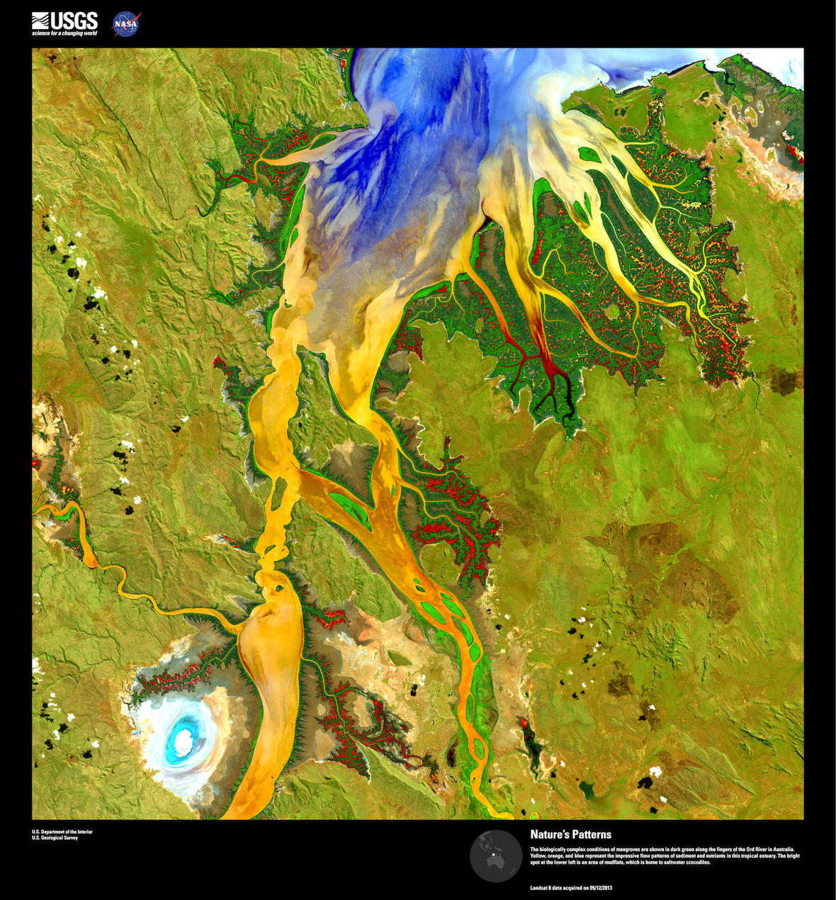
Landsat satellites capture hundreds of images of the planet’s surface every day to help document the condition of land areas and reveal how those areas are changing over time. Landsat sensors detect certain wavelengths, or bands, of both visible and invisible light. When different bands are combined in Landsat images, striking patterns, colors and shapes emerge from nature, transforming an image of a section of the earth’s surface into what closely resembles abstract art.
In 2002, staff from the USGS Earth Resources Observation and Science (EROS) Center, which maintains the Landsat archive, began collecting images of deserts, mountains, river valleys and glaciers that struck them as extraordinary. They transformed the digital images into framed prints and launched the Earth as Art series.
Landsat 8, the most recent Landsat program satellite that was launched by NASA in 2013, acquired all 37 images in the current Earth as Art 4 exhibit. The USGS selected these images solely for their aesthetic appeal rather than any role they might play in scientific research. Many have been digitally manipulated to enhance color variations or details.
Additional contacts for the exhibit are:
Andrea Fagerstrom, Bismarck State College, andrea.fagerstrom@bismarckstate.edu
Barb Thorsen, Bismarck State College, barbara.thorsen@bismarckstate.edu
Merek Dojs, University of Mary, mrdojs@umary.edu
For more information about the USGS Earth as Art series, please visit the USGS EROS website.

Be Part of What’s Next: Emerging Applications of Landsat at AGU24
Anyone making innovative use of Landsat data to meet societal needs today and during coming decades is encouraged to submit and abstract for the upcoming “Emerging Science Applications of Landsat” session at AGU24.


