International Relations: Landsat on the Agenda

International Relations: Landsat on the Agenda

Landsat 8 image of the Philippines' Tawitawi Island.
Landsat 8 image of the Philippines’ Tawitawi Island. Image credit: NASA’s Earth Observatory; USGS/NASA Landsat

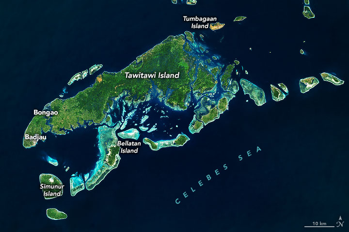
Strengthened space cooperation between the U.S. and Philippines will include bilateral cooperation on the Landsat Program according to a fact sheet released by the White House on May 1, 2023:

“The countries will collaborate on the use of space-based technology in the areas of disaster management and emergency response, healthcare, mapping of resources and accessibility, pollution monitoring, deforestation, land use and infrastructure planning, and maritime awareness. The leaders welcome the strengthening of bilateral cooperation on the Landsat Program, including the possibility for the Philippines to download imagery directly from Landsat satellites to its ground stations.”

Post Last Updated on May 22, 2023
On Key

Recent Posts

A headshot of Brian Markham. Tree branches can be seen in the background; Brian is smiling.

Data as Good as it Gets:
A Discussion with Brian Markham

Why do we calibrate Landsat data? We spoke with Brian Markham, a key figure of Landsat calibration science for four decades. He said that it all comes down to this: “If we’re using a system to quantify changes on the Earth, we must make sure the system we’re using is not changing.”

Read More »
On Key

Related Posts