
The Details
- Launch Date: October 5, 1993
- Status: lost at launch
- Sensor: ETM
+ read about the history of Landsat 6

+ read about the history of Landsat 6
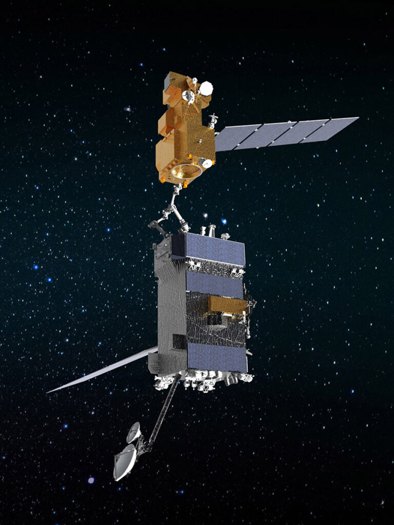
OSAM-1 Lead Systems Engineer Wendy Morgenstern discusses NASA’s On-orbit Servicing, Assembly, and Manufacturing 1 mission to robotically refuel Landsat 7, a satellite that wasn’t designed to be serviced.
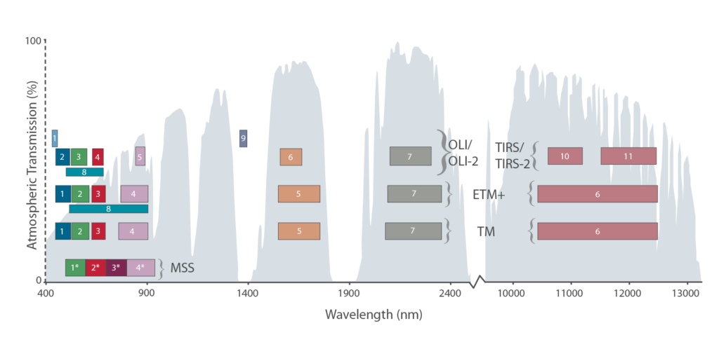
Learn more about the atmospheric transmission data used for our Landsat spectral band comparison graphic.
The measured wavelength locations of the ETM+ spectral bands are compared to Landat 5’s TM in Table 8.1 The spectral bandwidths are determined by the combined response of all optical

OSAM-1 Lead Systems Engineer Wendy Morgenstern discusses NASA’s On-orbit Servicing, Assembly, and Manufacturing 1 mission to robotically refuel Landsat 7, a satellite that wasn’t designed to be serviced.

Learn more about the atmospheric transmission data used for our Landsat spectral band comparison graphic.
