
OLI-2 will fly aboard Landsat 9 taking measurements in the visible, near infrared, and shortwave infrared portions of the electromagnetic spectrum. The spatial resolution of its images will be 15 m (49 ft) for the panchromatic band and 30 m (98 ft) for the multispectral bands. The image swath will be 185 km (115 mi) wide, covering wide areas of the Earth’s landscape while providing sufficient resolution to distinguish land cover features like urban centers, farms, and forests.
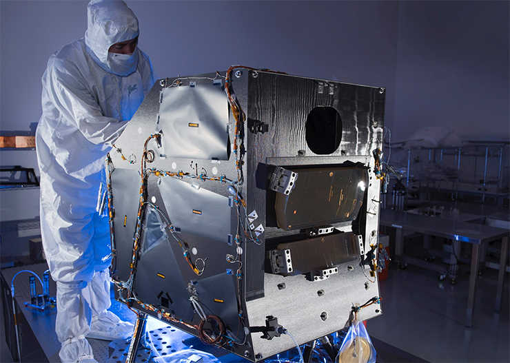
The OLI-2 design is a copy of Landsat 8’s OLI. The OLI-2 instrument will include an optical telescope, Focal Plane Array / Focal Plane Electronics (FPA/FPE), calibration hardware, and instrument support electronics.
OLI-2 is being built by Ball Aerospace in Boulder, Colorado.
+ More about OLI-2

Be Part of What’s Next: Emerging Applications of Landsat at AGU24
Anyone making innovative use of Landsat data to meet societal needs today and during coming decades is encouraged to submit and abstract for the upcoming “Emerging Science Applications of Landsat” session at AGU24.


