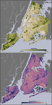
 An Avenza Map Award was recently given to a vegetation and temperature map of New York City created using Landsat data. Rob Simmon, a data visualizer with NASA’s Earth Observatory and the map’s author, created the map for an Earth Observatory story about urban heat islands.
The Earth Observatory story explains how scientist have used Landsat’s thermal band to create detailed temperature maps of urban heat islands in places like New York City.
+ Read the full Earth Observatory article


