

Landsat-based National Land Cover Database (NLCD) helps predict hurricane wind risk to homes and other structures.

Using data from Harmonized Landsat and Sentinel-2 (HLS), researchers developed a new algorithm to better monitor reservoir water levels in the contiguous U.S.

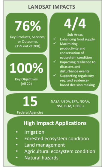
The Landsat satellite program, with its unparalleled 53-year historic record, can reveal changes through the Annual National Land Cover Database (NLCD).

Landsat-based National Land Cover Database (NLCD) helps predict hurricane wind risk to homes and other structures.

Using data from Harmonized Landsat and Sentinel-2 (HLS), researchers developed a new algorithm to better monitor reservoir water levels in the contiguous U.S.
