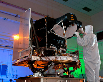
Special Topics: LDCM and LDCM Components

The Operational Land Imager (OLI) is being built by the Ball Aerospace and Technologies Corporation. The Ball contract was awarded in July 2007. OLI improves on past Landsat sensors using a technical approach demonstrated by a sensor flown on NASA’s experimental EO-1 satellite. OLI is a push-broom sensor with a four-mirror telescope and 12-bit quantization. OLI will collect data for visible, near infrared, and short wave infrared spectral bands as well as a panchromatic band. It has a five-year design life.

Be Part of What’s Next: Emerging Applications of Landsat at AGU24
Anyone making innovative use of Landsat data to meet societal needs today and during coming decades is encouraged to submit and abstract for the upcoming “Emerging Science Applications of Landsat” session at AGU24.


