By Laura E.P. Rocchio

September 23, 2021 • Adventurers, explorers, and satellite lovers alike descended on Lompoc, California, Sunday, Sept. 19 to kick-off Southern California’s first GeoTour: The History of Landsat in Lompoc.
The GeoTour—which runs for a year—includes nine different geocaches that guide participants through the West Coast launch-mecca of Lompoc. Since 1972, every Landsat satellite has lifted-off from the Vandenberg Space Force Base just outside the town of Lompoc, and Landsat 9 will join their ranks on Monday, Sept. 27, 2021.
Geocaches are hidden containers that geocachers navigate to using their smart phones (or GPS devices) and their puzzle-solving skills.
In celebration of the upcoming Landsat 9 launch, NASA, the U.S. Geological Survey, and Explore Lompoc created the nine-stop adventure that guides geocachers through both the city and the history of Landsat.

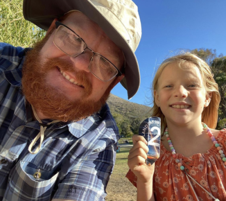
For the kick-off event, geocachers from San Diego to San Francisco drove in to try their hand at locating all nine GeoTour geocaches. The roughly 110 participants gathered at the Lompoc Community Center to get their Landsat GeoTour Passport , get oriented with a quick “Trip Through Time with Landsat,” and set out on their adventure.
By the end of the day, 68 geocachers had found all nine geocaches and turned in their passports for a commemorative Landsat geocoin. The first 500 geocachers to complete the tour will earn the commemorative geocoin. The GeoTour runs through September 2022 in celebration of the Landsat Program’s 50th anniversary.
Of the nine Landsat history-themed geocaches, the Pioneer of Earth Observation mystery cache and the Mother of Landsat gadget cache proved to be participant favorites, earning the most participant accolades.
“The Landsat GeoTour was a roaring success,” geocaching-enthusiast and local volunteer G. Scott Miller (gsmX2) shared. “Explore Lompoc, the City of Lompoc, and some geocache builders went out of their way to make the day special.”
Adventure seekers will be happy to know that there is also a 15-stop Landsat-themed Adventure Lab (and bonus cache) along the Santa Ynez Valley. Each location highlights a different benefit brought to society by Landsat and shares how satellites help land managers make informed decisions about the lands they manage.
GeoTour Hatching
Inspired by the Lompoc Art Hunt, Ginger Butcher, a Landsat Outreach lead, started brainstorming about a Landsat-themed adventure in November 2020. Allison Nussbaum, from the Landsat Outreach team, suggested geocaching, and the spark for this GeoTour was born.
The President of Explore Lompoc, Gilda Cordova, and Mario Guerrero from the City of Lompoc helped make the GeoTour possible, while G. Scott Miller provided on-the-ground logistical support.
The intricate Landsat-themed gadget cache mechanism was designed by Butcher and her husband Chris who crafted the cache in the style of Lompoc’s La Purisima Mission, with support from Nussbaum, and her father Mike.
The Pioneer of Observation mystery cache, which blends in with its surroundings, was skillfully crafted by Sharon Revering Carlson (ShareBear64).
+ How to Play, Explore Lompoc website
Any use of trade, firm, or product names is for descriptive purposes only and does not imply endorsement by the U.S. Government.


