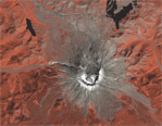
 Thirty years ago, Mount St. Helens roared back into major activity with a massive eruption that leveled surrounding forest, blasted away over a thousand feet of the mountain’s summit, and claimed 57 human lives.
This short video shows the catastrophic eruption – and amazing recovery – through the eyes of the Landsat satellites, which have been imaging our planet for almost forty years.
Visit:
NASA Earth Science Video Gallery
NASA Earth Observatory

Be Part of What’s Next: Emerging Applications of Landsat at AGU24
Anyone making innovative use of Landsat data to meet societal needs today and during coming decades is encouraged to submit and abstract for the upcoming “Emerging Science Applications of Landsat” session at AGU24.


