Letter Contract for Landsat 9 Imager-2 Awarded

Letter Contract for Landsat 9 Imager-2 Awarded

NASA has awarded a sole source letter contract to Ball Aerospace & Technologies Corporation, Boulder, Colo., to build the Operational Land Imager-2 instrument for the Landsat 9 project.

The estimated value of this Cost-plus Award-Fee Letter Contract is $19.3 million with a period of performance from Dec. 31, 2015 through Mar 31, 2021.

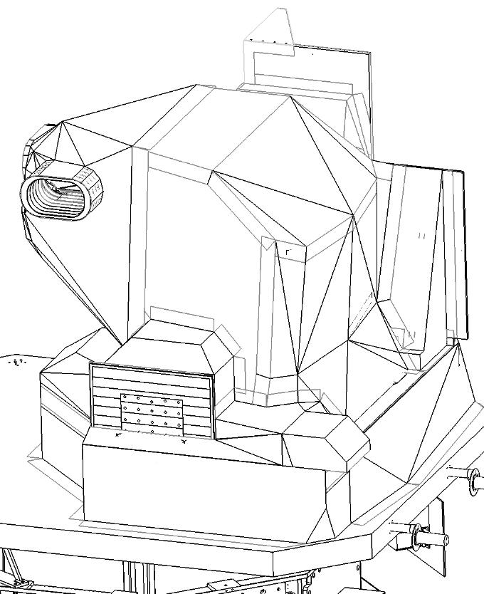
The contractor will build a second Operational Land Imager (OLI) for the Landsat 9 project. The OLI is a reflective, multi-channel, earth-imaging instrument that provides highly calibrated imagery to detect and quantify the affect natural and human-induced activities on the Earth’s surface. The OLI has eight detection bands ranging in wavelengths from 433 nm to 2300 nm with spatial resolutions of 30 meters and one panchromatic band with a spatial resolution of 15 meters. The OLI satisfies stringent image quality performance standards for radiometric, spectral, spatial, uniformity, and calibration that are critical for producing data that meets the users’ needs in analyzing deforestation, agricultural yield estimates, spread of pest infestations, urbanization, water resources, and many other operational and research applications.

Sketch of the Operational Land Imager built by Ball Aerospace & Technologies Corp.

For information about NASA and agency programs, visit: http://www.nasa.gov
-end-
Cynthia M. O’Carroll
Goddard Space Flight Center, Greenbelt, Md.
301-286-4787
cynthia.m.ocarroll@nasa.gov

Get the latest from Landsat in your inbox.


By submitting this form, you are consenting to receive marketing emails from: Landsat Science. You can revoke your consent to receive emails at any time by using the SafeUnsubscribe® link, found at the bottom of every email. Emails are serviced by Constant Contact
On Key

Recent Posts

Map shows South Korea with waterways highlighted. In the top right corner is a north arrow and in the bottom left corner is a legend of different rivers in South Korea.

Monitoring Water Quality in South Korea

South Korea is facing a water quality problem. Researchers Hyunglok Kim and Seongjun Lee from the Gwangju Institute of Science and Technology (GIST) embarked on developing a model to predict water quality indicators in near real-time.

Read More »
Landsat outreach specialist Allison Nussbaum and GEDI/UMD Faculty Specialist Talia Schwelling hold Landsat/GEDI postcards at the NASA exhibit booth at AGU24.

Landsat at AGU24

The NASA Landsat Science and Outreach teams attended the American Geophysical Union’s annual meeting in DC in December. At AGU24, they shared research and educated the public about Landsat.

Read More »
On Key

Related Posts

Map shows South Korea with waterways highlighted. In the top right corner is a north arrow and in the bottom left corner is a legend of different rivers in South Korea.

Monitoring Water Quality in South Korea

South Korea is facing a water quality problem. Researchers Hyunglok Kim and Seongjun Lee from the Gwangju Institute of Science and Technology (GIST) embarked on developing a model to predict water quality indicators in near real-time.

Read More »