
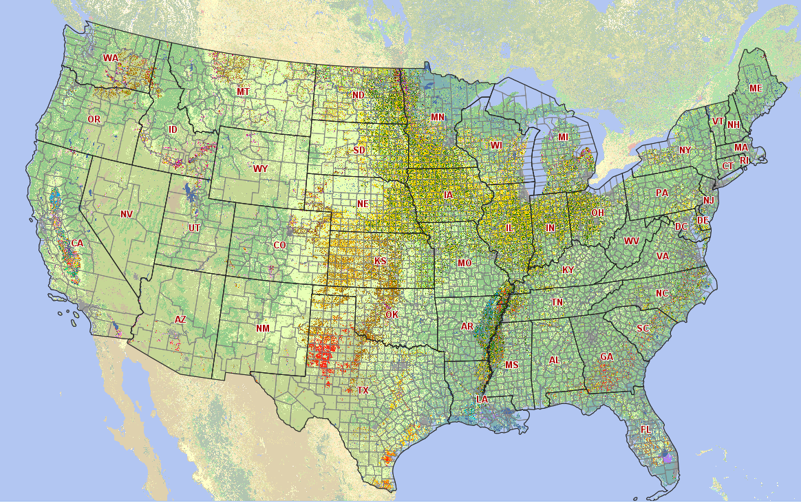
These new Cropland Data Layer products, which are derived from satellite image observations at 30-meter (0.22 acres per pixel) resolution, help users visualize U. S. crop planted area during the last calendar year. Three earth observing satellites were used for the production of this product, including; the newly launched Landsat 8, and Disaster Monitoring Constellation’s Deimos-1 and UK2.
NASS developed CropScape in cooperation with the Center for Spatial Information Science and Systems at George Mason University in Fairfax, Va. This tool is available online.

Be Part of What’s Next: Emerging Applications of Landsat at AGU24
Anyone making innovative use of Landsat data to meet societal needs today and during coming decades is encouraged to submit and abstract for the upcoming “Emerging Science Applications of Landsat” session at AGU24.


