
Landsat 8 measures Earth’s radiance from its orbit 438 miles (705 km) above. Because the atmosphere is between the satellite and the Earth’s surface, light gets scattered by atmospheric aerosols. This means that the radiance that Landsat measures at the top of the atmosphere can differ from radiance measured at the surface (think of how your visibility is limited on hazy days). The concept of atmospheric correction is to account for this light scatter and then correct for it. This correction, together with knowledge of the amount of incoming solar radiation, makes it possible to turn Landsat’s top-of-atmosphere radiance measurements into surface reflectance. Scientifically, using surface reflectance makes for more accurate land change assessments. Visually, it translates into clearer looking imagery.
Eric Vermote, a Research Physical Scientist at NASA Goddard Space Flight Center and a Landsat 8 Science Team member, together with his team of collaborators, is responsible for developing the sophisticated atmospheric correction methodology used to create Landsat 8 surface reflectance. In June, the U.S. Geological Survey (USGS) began offering Landsat 8 surface reflectance products created using Eric’s method. Mapbox is now implementing this same processing method into its Landsat-live pipeline.
We talked with Camila Mahon, an imagery specialist at Mapbox, who along with her team—Damon Burgett, Carol Hansen, Young Hahn, Sean Gillies, Charlie Loyd, Jacques Tardie, Virginia Yung—is behind this major implementation project.
What will be the biggest advantages for your Landsat-live users once the Landsat 8 data behind the map is atmospherically corrected?
We see huge visual improvements in the map: reduced haze, more vibrant colors—all the things you would expect in atmospherically corrected imagery. Of course, it also makes the data more useful for quantitative purposes.
How did you first learn about Eric’s efforts?
Eric Vermote’s name comes up any time you look into the topic of atmospheric correction. Since we work with Landsat so much and have integrated the LEDAPS product into our imagery pipeline in the past, it was a natural progression to ask about working with Landsat 8 Surface Reflectance (L8SR) next.
What has the prototype implementation process been like?
Because the Landsat 8 surface reflectance package (L8SR) is partly in Fortran and makes certain assumptions about its environment, it took a little bit of work to get it running perfectly. Once the L8SR code was set up, we built a wrapper around it to allow us to link it in to our Landsat-live pipeline. The process is complicated a bit by the ancillary data that is needed for the L8SR code to do its full adjustments. If you look at the metadata of the imagery after it has gone through our pipeline you’ll notice that the L8SR layer is processed a few days later than the normal Landsat-live imagery, even though they use the same base imagery. This is because the ancillary files, giving us information about atmospheric conditions, take a little extra time to acquire.
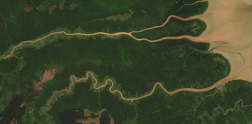
On what types of scenes do you notice the most striking impact of the atmospherically corrected data?
It’s amazing to see parts of the world that are typically hidden from clear view due to persistent weather patterns. The single most impressive effect is when it cuts through tropical haze. The air in the intertropical convergence zone that hovers around the equator is filled with moisture most of the time. This (with other aerosol loads) increases the probability of light to be scattered, making it much harder for Landsat to get a clear picture of the ground. To be able to virtually nullify that effect is incredibly powerful. In addition, it brings out the vivid colors of scenes in arid regions without distortion.
What future plans do you have for Landsat 8 surface reflectance data?
We see atmospheric correction as an important way to add value to Landsat (and other) imagery. We look forward to incremental improvements in L8SR that will make its products even more attractive as well as more accurate. We’re always searching for ways to serve imagery faster, so when L8SR is open source we’ll explore closer integrations with our pipelines, and perhaps optimizations as well.
USGS is currently at work on open-sourcing Eric’s native code and upon completion it will be made publicly available.
Mapbox, like many other geospatial organizations, has taken advantage of the free Landsat data archive and cloud-based data hosting and processing services (Amazon Web Services’ Simple Storage Service; Google Earth Engine; NASA’s Earth Exchange) to come up with creative new uses for Landsat data.
High quality, free Landsat data combined with new big data approaches and international collaborations are leading to many innovations. As Landsat Science Team member, Curtis Woodcock, said at their most recent meeting: “The future looks really exciting.”
Any use of trade, firm, or product names does not imply endorsement by the U.S. Government.

Be Part of What’s Next: Emerging Applications of Landsat at AGU24
Anyone making innovative use of Landsat data to meet societal needs today and during coming decades is encouraged to submit and abstract for the upcoming “Emerging Science Applications of Landsat” session at AGU24.


