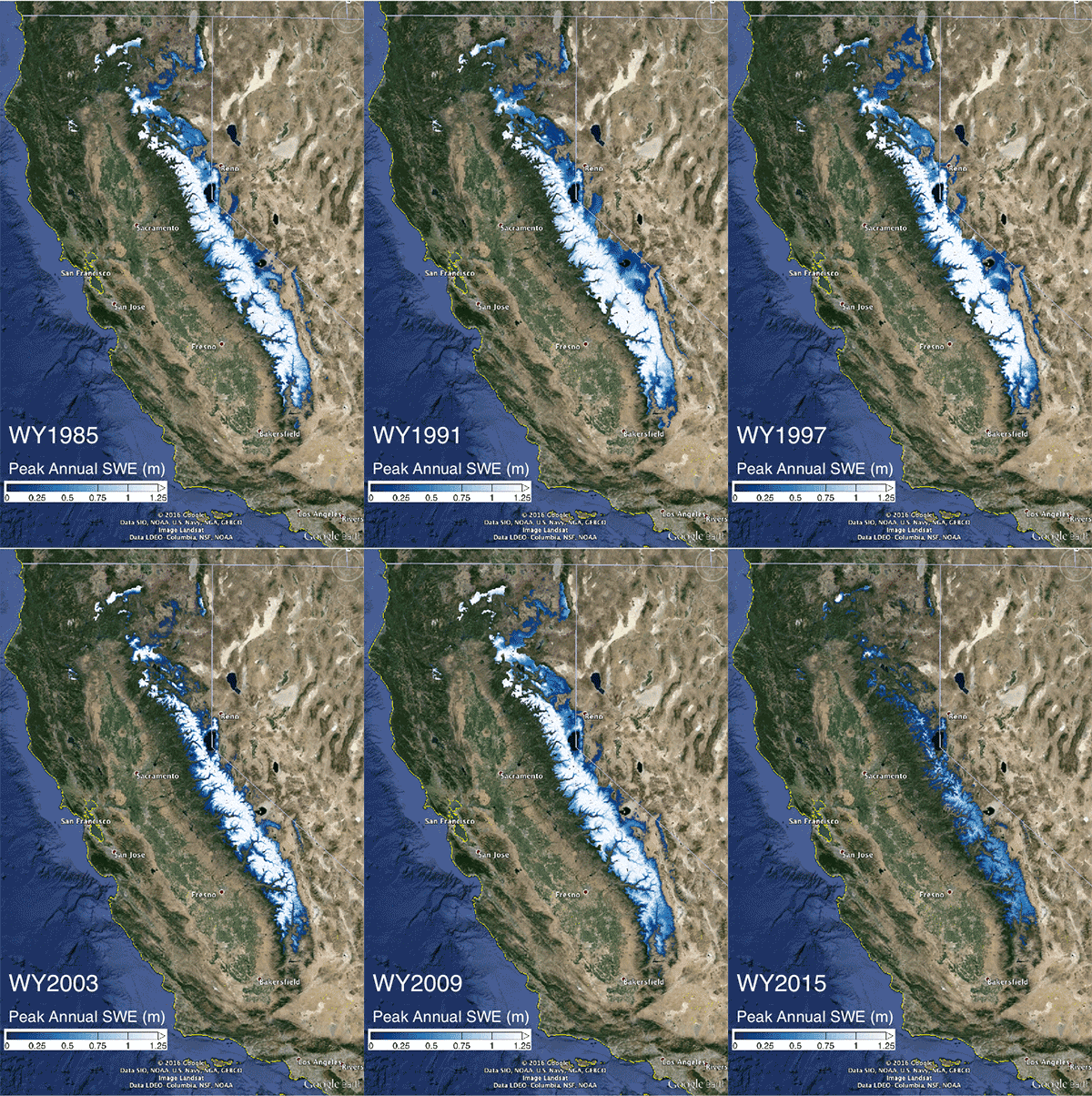
Additionally, researchers suggest their new method, which provided unprecedented detail and precision, could be useful in characterizing water in the snowpack in other mountains, including ranges in western North America, the Andes or the Himalayas. These areas currently have much less on-site monitoring than in the Sierra Nevada.
The new study was published today in Geophysical Research Letters, a journal of the American Geophysical Union. “With the consecutive years of ongoing drought, the Sierra Nevada snowpack’s total water volume is in deficit and our analysis shows it will to take a few years for a complete recovery, even if there are above-average precipitation years,” said Steve Margulis, professor of civil and environmental engineering at the UCLA Henry Samueli School of Engineering and Applied Science and the study’s lead author.
Much of California’s water comes from the when the Sierra Nevada snowpack melts. The winter of 2015 capped four consecutive years of drought that resulted in the largest cumulative drought deficit spanning the 65 years that have been examined. The water volume of the snowpack in 2015 was just 2.9 cubic kilometers (0.7 cubic miles), when a typical year is about 18.6 cubic kilometers (4.46 cubic miles).
“It is critical for regions like California, that rely on their regional snowpack for water supply, to understand the dynamics of the system,” Margulis said. “Our new tool could help not just California, but other regions, gain insight about their regional snowpack.”
The researchers created a dataset covering 31 years (from 1985 to 2015), using measurements from Landsat satellites, which provide maps of the full Sierra Nevada snowpack that have about 10 times sharper resolution than previously available. While there are on-site sensors throughout the mountain range, they are typically in the middle elevations and do not provide a full, high-resolution picture of the entire range, particularly at higher elevations, Margulis said. The researchers combined their new dataset with other snow survey data, collected by the state’s Department of Water Resources, to extend the time series of range-wide snowpack volumes back 65 years to 1951.
Using the data, the researchers applied probabilistic modeling methods to make predictions of snowpack water availability. Accounting for the four-year snowpack deficit from the 2012-2015 drought, the researchers say it will likely take until 2019 to get back to pre-drought conditions.
“Our larger goal is to build a very detailed, continuous picture of the historical snowpack, diagnose the primary factors that cause it to vary, and then ultimately improve models for predicting how much water will be available from it,” Margulis said. “This unprecedented information can help policy makers make more informed decisions with regard to this critical resource, especially as climate change affects it.”
Reference:
Margulis, S. A., G. Cortés, M. Girotto, L. S. Huning, D. Li, and M. Durand (2016), Characterizing the extreme 2015 snowpack deficit in the Sierra Nevada (USA) and the implications for drought recovery, Geophys. Res. Lett., 43, doi:10.1002/2016GL068520.


