
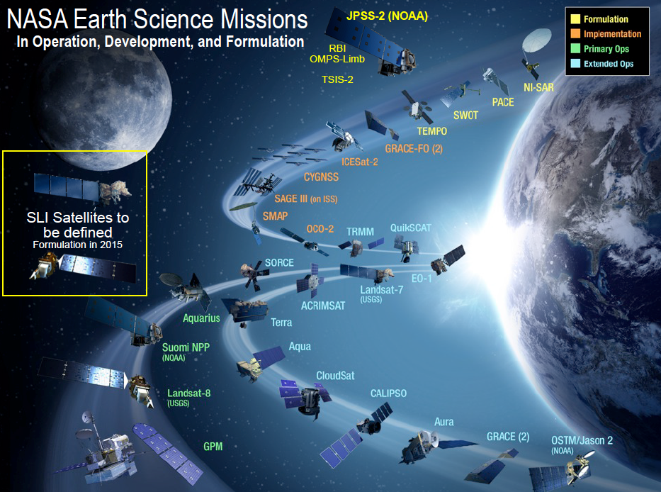
In the President’s proposed fiscal year 2014 budget released in April 2013, the Administration directed NASA to design for implementation a spaceborne system to provide global, continuous Landsat-quality multispectral and thermal infrared measurements for at least the next 20 years and to submit the program recommendations to the Office of Science and Technology Policy (OSTP) in August 2014. The Administration directed NASA to lead the overall system architecture study with participation from the Department of the Interior’s U.S. Geological Survey (DOI/USGS).
To spur innovation and enable efficiencies across programs and platforms, the study identifies and evaluates a range of solutions including large and small dedicated spacecraft, formation flying, hosted instruments, and integration of other land imaging data sets, as available, as well as possible international and private sector collaborations. The study has included careful consideration of the current and future planned ground system capabilities provided by the established USGS Earth Resources Observation and Science (EROS) Center. The study was undertaken with guidance that lowering the system’s cost to the nation is an important goal and that implementing a system that stays within the allocated budget is an essential programmatic requirement for the U.S. government.
At the April 1 public forum, NASA, with technical experts from the SLI Architecture Study Team, provided a status on the preliminary findings regarding the metrics used to compare architectures while taking into account the program requirements for performance, continuity, affordability and robustness; the range of architectures under consideration; and how candidate architectures are being assessed against the metrics. At the meeting NASA solicited feedback on initial findings and presented plans for the remainder of the study.
+ Sustainable Land Imaging Architecture Study website

Be Part of What’s Next: Emerging Applications of Landsat at AGU24
Anyone making innovative use of Landsat data to meet societal needs today and during coming decades is encouraged to submit and abstract for the upcoming “Emerging Science Applications of Landsat” session at AGU24.


