A Long Road to Launch
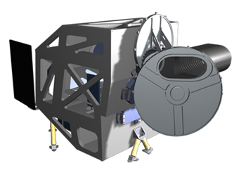
Efforts to implement the LDCM have been ongoing since the launch of Landsat 7 in 1999. After eight years and three different implementation tactics, NASA released the official solicitation for the procurement of the LDCM imaging radiometer on January 9, 2007. Industry proposals were submitted by February 23, 2007, and Ball Aerospace was selected on July 16, 2007. Procurement activities for the LDCM spacecraft are ongoing and NASA will likewise be procuring the Mission Operations Element (MOE) portion of the ground system for the U.S. Geological Survey (USGS). The MOE will consist of the Command and Control System, Mission Scheduling, Flight Dynamics, and data Long-Term Trending and Analysis system. USGS will procure all LDCM ground segment resources necessary for comprehensive and timely global data acquisition. To minimize any data gap, the LDCM project must maintain the technical integrity of the mission and strive to meet an aggressive development schedule.
A Potential Data Gap
The Landsat series of satellites have provided multispectral data of Earth’s surface on a global basis, at a spatial resolution consistent with human-scale activities and concerns for over 35 years, but as the waning days of Landsat 5 and 7 meet the nascent days of LDCM, the possibility of a Landsat data gap looms large.
Landsat Applications
As the first U.S. satellites designed for observing land surfaces, the Landsat imaging radiometers have provided the longest continuous record of Earth’s surface as seen from space. Landsat gave the world the first unabridged perspective of human-induced large-scale environmental changes such as the rapid expansion of desert cities like Dubai and Las Vegas, the deforestation of the Amazon rainforest, and the disappearance of the Aral Sea.
Landsat-related research has led to the implementation of many socially beneficial applications, such as improved water management techniques, crop insurance fraud reduction, natural disaster relief planning, continental-scale carbon estimates, and extensive cartographic advances.
Data Use
Because of Landsat’s long history and unparalleled data record, data continuity with prior Landsat missions is paramount. “The LDCM mission is charged with collecting data sufficiently consistent with data from early Landsat satellites to allow comparisons for regional and global change detection,” explains NASA LDCM Project Scientist Jim Irons. “Although other satellite systems acquire similar data, the LDCM is being designed and developed specifically to enable multidecadal studies of global land cover and land use change using the historic Landsat data record.”
LDCM Requirements
The decree for data continuity is easily discernable from the LDCM requirements which include: a minimum field of view of 185-km cross-track swath width at the equator, spectral bands similar to those of the Landsat 7 mission (see table below), a pixel ground sampling distance of between 28 and 30 m for all spectral bands except the panchromatic band (pixel size between 14 and 15 m). The nominal spacecraft altitude will be 705 km. Absolute geodetic accuracy of 65 m and relative geodetic accuracy of 25 m (excluding terrain effects), and a geometric accuracy of 12 m or better (including compensation for terrain effects) are required.
| Band Number | Band Name | Min. Lower Band Edge (nm) | Max. Upper Band Edge (nm) | Ground Sampling Distance (m) |
|---|---|---|---|---|
| 1 | Coastal/Aerosol | 433 | 453 | 28–30 |
| 2 | Blue | 450 | 515 | 28–30 |
| 3 | Green | 525 | 600 | 28–30 |
| 4 | Red | 630 | 680 | 28–30 |
| 5 | NIR | 845 | 885 | 28–30 |
| 6 | SWIR 1 | 1560 | 1660 | 28–30 |
| 7 | SWIR 2 | 2100 | 2300 | 28–30 |
| 8 | Panchromatic | 500 | 680 | 14–15 |
| 9 | Cirrus | 1360 | 1390 | 28–30 |
What’s New?
Although there are no plans for a thermal instrument on LDCM—unlike Landsats 4, 5, and 7—the satellite will include evolutionary advances in technology and performance. LDCM will have two new spectral bands, one tailored especially for detecting cirrus clouds and the other for coastal zone observation. Additionally, LDCM will be required to return 400 scenes per day to the USGS data archive (150 more than Landsat 7), increasing the probability of capturing cloud-free scenes for the global landmass.
“The LDCM will continue to improve upon the Landsat 7 strategy of capturing seasonal coverage of the global land surface into a single archive affording access to the general public,” says Irons. “No other satellite system affords even annual global coverage of the land surface at the landscape scale where changes to land use can be observed and characterized.”
Ground Segment
The LDCM data archive will be operated and maintained by USGS. “For LDCM to further advance our global observing capabilities, innovative strategies for significantly increasing the number of daily global acquisitions, improving access to LDCM data, and providing those data in a Geographic Information System (GIS)-ready format to users at the lowest possible cost are driving the design,” explains USGS Landsat Science Team Chair, Tom Loveland. “This should significantly increase large-area operational land-monitoring applications, including studies of land change, vegetation condition, and disaster assessments.”
LDCM Project Partners
LDCM is made possible by a partnership between NASA and USGS that builds upon a strong relationship developed during previous Landsat missions. NASA brings its Earth observation innovations and space segment expertise to the table, and USGS provides experience and expertise in managing ground systems.
Mission Success
“We believe the success of the mission depends on LDCM integration with past, present, and future Landsat and other Earth observation data,” Loveland explains. Successful integration hinges on accurate calibration. Coordinated calibration efforts of USGS and NASA will again be part of the LDCM calibration strategy. “Calibration and characterization of Landsat 7 has set a standard for other passive optical systems,” says Irons.
Contributors: Laura Rocchio and Bill Ochs


