Source: USGS News Release
Contact: Gene Fosnight, 605-594-605

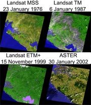
- The U.S. Geological Survey (USGS) Center for Earth Resources Observation and Science (EROS), in cooperation with the National Aeronautics and Space Administration (NASA), is pleased to announce the upcoming release of the TerraLook data product. TerraLook consists of a collection of JPEG images created from ASTER images from the Land Processes Distributed Active Archive Center and Landsat Orthorectified images from the USGS EROS archive.
The TerraLook images are user-selected, geo-registered, simulated natural color bundled with footprints of the images and standards-compliant metadata that describe the collection. Each collection will be delivered as a single zipped file.
TerraLook products will be available at no charge, and may be selected and ordered through the USGS Global Visualization Viewer (GloVIS). The expected release date is January 2007.
TerraLook builds on the success of the NASA Jet Propulsion Laboratory’s Protected Area Archive project with additional support from The Nature Conservancy, the World Bank Development Grant Facility Program’s Inter-American Biodiversity Information Network Connectivity Project, the U.S. State Department, the Gordon and Betty Moore Foundation Amazon Protected Area Network project and the IUCN – the World Conservation Union.
For More Information
USGS Center for EROS Phone: (800) 252-4547
Customer Services TDD: (605) 594-6933
Mundt Federal Building Fax: (605) 594-6589
Sioux Falls, South Dakota 57198-0001 Email: custserv@usgs.gov
EROS website: http://eros.usgs.gov/


