USGS Report Updates Economic Value of Landsat Archive

USGS Report Updates Economic Value of Landsat Archive

Source: USGS Landsat

economic value image
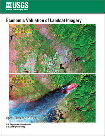
A new USGS report estimates an increase in the domestic and international economic benefits to society provided by the Landsat archive to about $3.45 billion in 2017, compared to $2.19 billion in 2011.
The analysis is based on the number of scenes downloaded from the USGS and the price that users would be willing to pay per scene. It does not include scenes downloaded by cloud vendors or other downstream economic benefits for things such as value-added products and environmental monitoring.

In addition to the economic benefit, the report also looked at what the consequences would be for charging for Landsat data. If the cost was just $56 per Landsat scene, the number of users would decrease by 50%. At $183 per scene, only 17% of current users would be willing to pay for the data. The report finds that “much of the societal value of Landsat stems from the free and open data policy that allows users to access as much imagery as is necessary for their analysis at no cost.”

Read the full report here: doi.org/10.3133/ofr20191112

Related reading:
New Report Values Economic Benefits of Landsat Archive at $3.45 billionGIS Lounge

Get the latest from Landsat in your inbox.


By submitting this form, you are consenting to receive marketing emails from: Landsat Science. You can revoke your consent to receive emails at any time by using the SafeUnsubscribe® link, found at the bottom of every email. Emails are serviced by Constant Contact
On Key

Recent Posts

Map shows South Korea with waterways highlighted. In the top right corner is a north arrow and in the bottom left corner is a legend of different rivers in South Korea.

Monitoring Water Quality in South Korea

South Korea is facing a water quality problem. Researchers Hyunglok Kim and Seongjun Lee from the Gwangju Institute of Science and Technology (GIST) embarked on developing a model to predict water quality indicators in near real-time.

Read More »
Landsat outreach specialist Allison Nussbaum and GEDI/UMD Faculty Specialist Talia Schwelling hold Landsat/GEDI postcards at the NASA exhibit booth at AGU24.

Landsat at AGU24

The NASA Landsat Science and Outreach teams attended the American Geophysical Union’s annual meeting in DC in December. At AGU24, they shared research and educated the public about Landsat.

Read More »
On Key

Related Posts

Map shows South Korea with waterways highlighted. In the top right corner is a north arrow and in the bottom left corner is a legend of different rivers in South Korea.

Monitoring Water Quality in South Korea

South Korea is facing a water quality problem. Researchers Hyunglok Kim and Seongjun Lee from the Gwangju Institute of Science and Technology (GIST) embarked on developing a model to predict water quality indicators in near real-time.

Read More »