

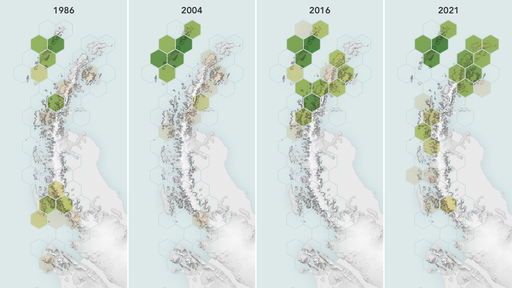
Satellites Reveal a Greener Antarctic Peninsula
Using observations from Landsat 5 through Landsat 8, scientists determined that the area of vegetated land on the Antarctic Peninsula grew from 0.86 to 11.95 square kilometers (0.33 to 4.61 square miles) between 1986 and 2021.
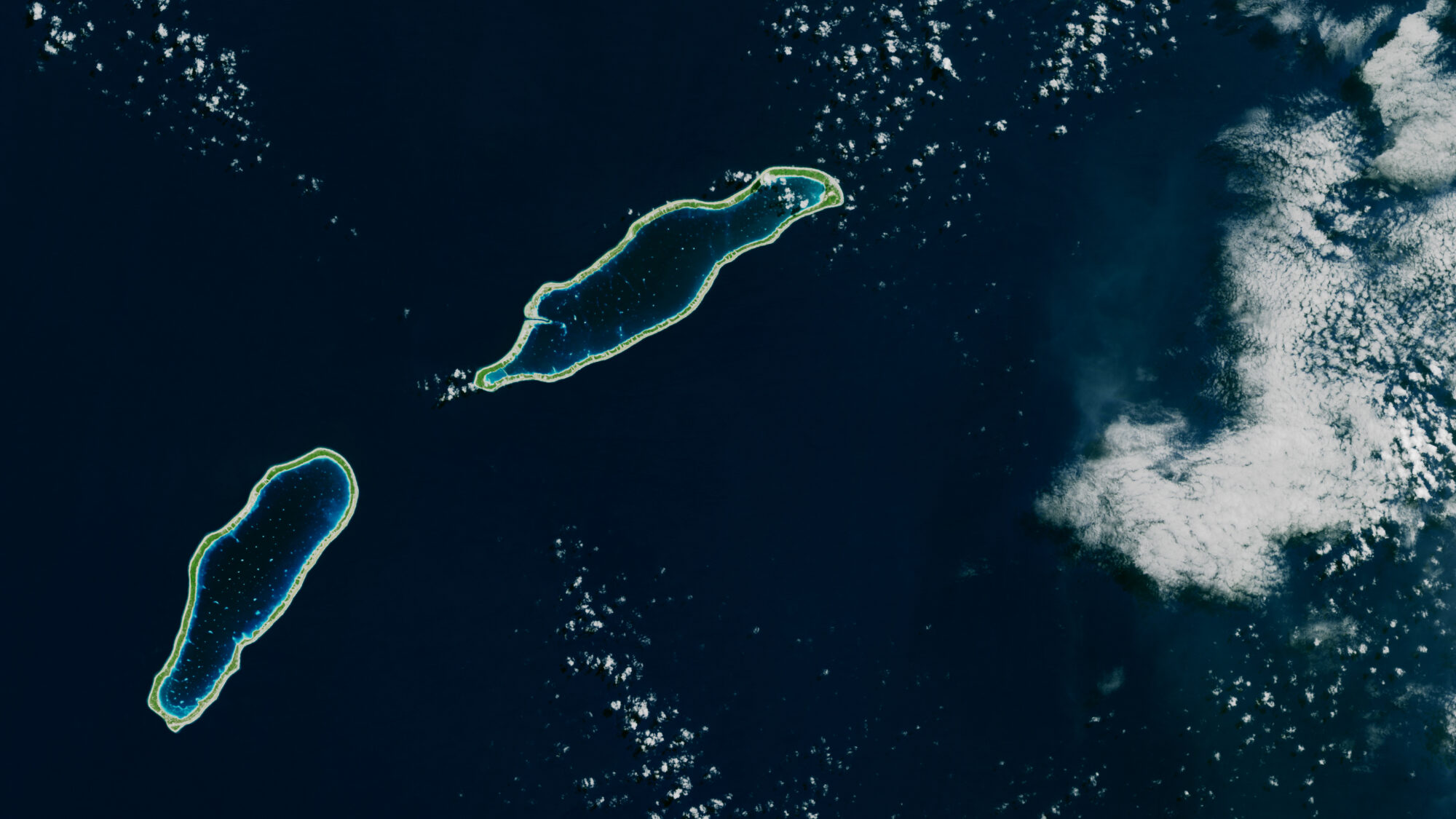
Landsat Takes the Temperature of Atoll Lagoons
Monitoring the temperature of tiny atoll lagoons is important for the local economy and ecosystem. A new study shows that Landsat can help.

Tony Willardson, Water Watcher
With Landsat-based ET embedded in more and more water rights and conservation tools, Willardson and the Western States Water Council are eager to see Landsat Next with its higher spatial resolution, more frequent observations, and additional spectral bands, built and launched.
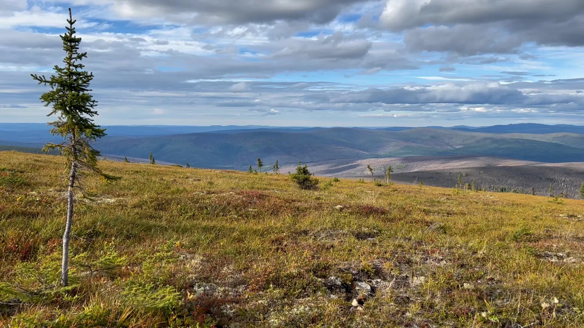
Tundra Vegetation to Grow Taller, Greener Through 2100, NASA Study Finds
Warming global climate is changing the vegetation structure of forests in the far north. It’s a trend that will continue at least through the end of this century, according to NASA researchers.

Landsat Observations Key Resource for Many Federal Agencies
In the FY23 Aeronautics and Space Report released on May 23, 2024, a multitude of Federal agencies report work informed by Landsat data.
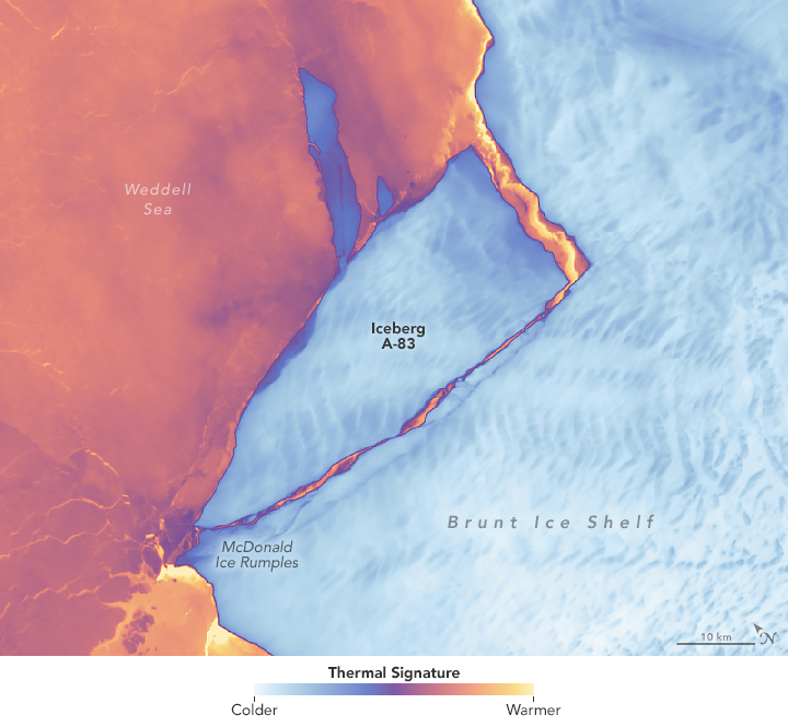
Antarctic Ice Shelf Spawns Iceberg A-83
The Brunt Ice Shelf lost a large wedge of floating ice, the third sizeable iceberg to calve from the shelf in recent years. The TIRS instrument on Landsat 9 captured false-color images of the calving.
