Landsat's Role in Understanding Climate Change
Long-term weather patterns averaged over 30 years or more make up our climate. Human well-being—our infrastructure and agriculture—depend on a reliable climate. This reliability allows farmers to plant seeds in the spring with confidence that temperatures and rainfall will sustain crops in the coming months. It allows communities to build and maintain roads, buildings, and drainage systems best suited to local conditions. Earth’s climate is controlled by the amount of energy that flows through the atmosphere, oceans, and land. By adding heat-trapping gases to the atmosphere—primarily carbon dioxide—people are increasing the amount of energy in the Earth system that would otherwise escape to space. This increase in energy is changing Earth’s climate, and consequently, the weather patterns that people rely on are shifting. Changes in long-term weather patterns have wide-ranging impacts on ecosystems and peoples’ lives. Designed to observe land and coastal ecosystems, Landsat instruments provide an unparalleled space-based record of the impact of climate change on Earth’s landscapes, the growth and loss of carbon- storing.
![Map of northern New Mexico showing a large burn scar.](https://landsat.gsfc.nasa.gov/wp-content/uploads/2023/04/TerraPulse_screenshot.jpg)
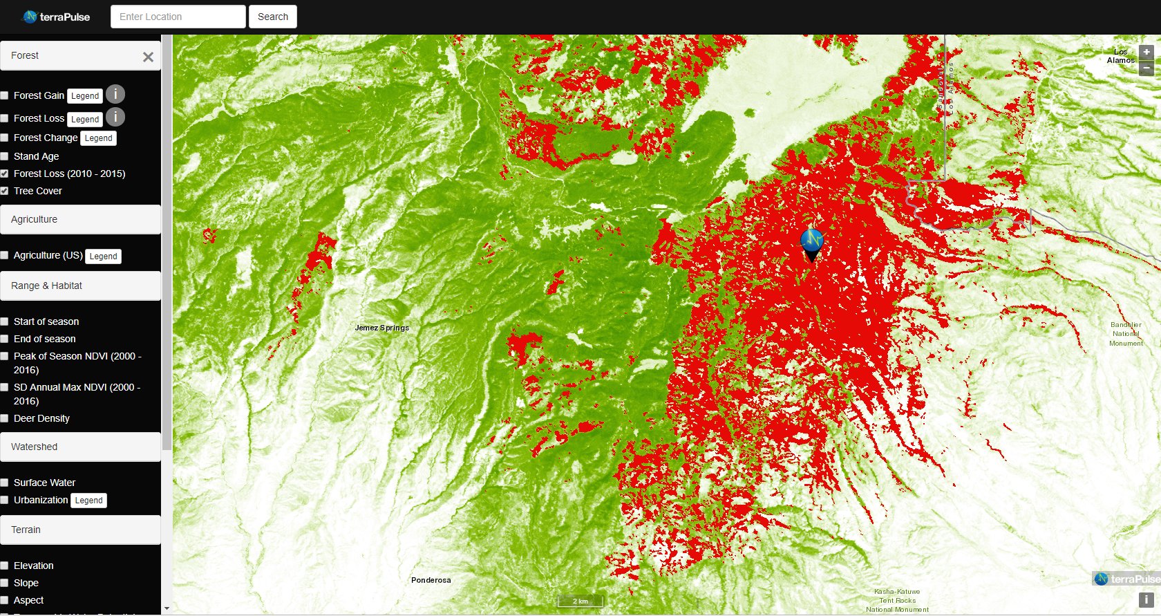
Taking the Pulse of Earth
Applying AI to Earth data—including Landsat—helps terraPulse reveal sustainable options for farming, reforestation, and land management.
![Meandering Lake Powell as seen by Landsat 8 in 2014. Dark blue deep waters change to green-grey shallow waters from image left (west) to right (east).](https://landsat.gsfc.nasa.gov/wp-content/uploads/2023/04/1-Lake_Powell.width-th.jpg)
NASA-Led Project Tracking Changes to Water, Ecosystems, Land Surface
Merging data from multiple satellites, OPERA can help government agencies, disaster responders, and the public access data about natural and human impacts to the land.
![Dr. Robert Washington-Allen](https://landsat.gsfc.nasa.gov/wp-content/uploads/2023/04/RobertWA-LA-CMth.jpg)
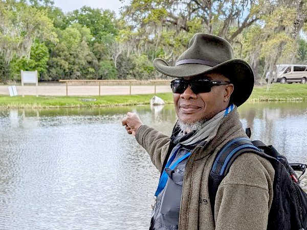
Robert Washington-Allen and the Next Frontier of Dryland Research
Washington-Allen is a longtime Landsat data user working towards drylands restoration and sustainability solutions.
![Circles of green on the image top left give way to turquoise blue waters in the image center that is connected by a blue line of a canal to a darker blue body of water at the image bottom center. Image shows an area near Sadat City in Egypt.](https://landsat.gsfc.nasa.gov/wp-content/uploads/2023/05/nasa-ibm_fields-in-egypt_500x500_news.jpg)
NASA and IBM Collaborate to Apply AI to Earth Science Data
The collaboration between NASA and IBM is a unique application of artificial intelligence (AI) foundation model technology to NASA Earth observation data.
![The fractured front of Crosson Ice Shelf](https://landsat.gsfc.nasa.gov/wp-content/uploads/2023/01/Landsat9-CrossonIceShelf.png)
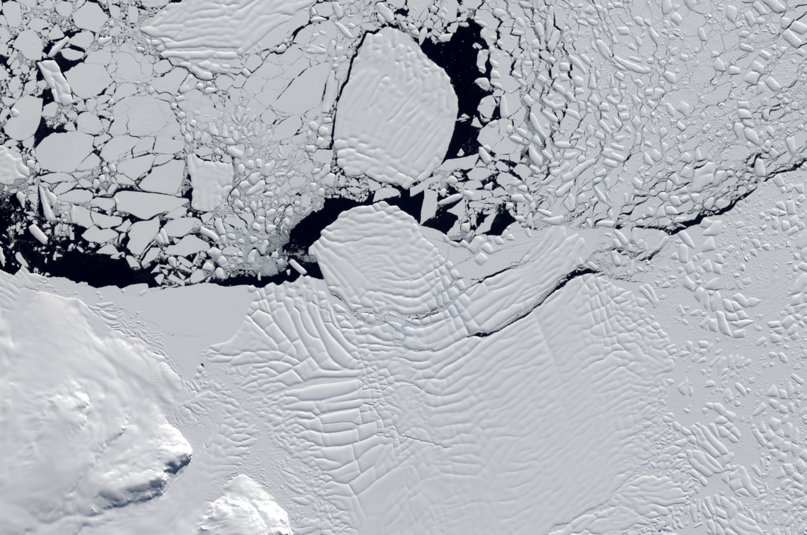
Influencing Factors: Satellites Help Decipher the Fate of West Antartica
An international team of researchers has combined satellite imagery and climate and ocean records to obtain the most detailed understanding yet of how the West Antarctic Ice Sheet – which contains enough ice to raise global sea level by 3.3 metres – is responding to climate change.
![Landsat 9 image of Yangtze River Delta in 2022](https://landsat.gsfc.nasa.gov/wp-content/uploads/2022/12/L9-yangtze_thumbnail.png)
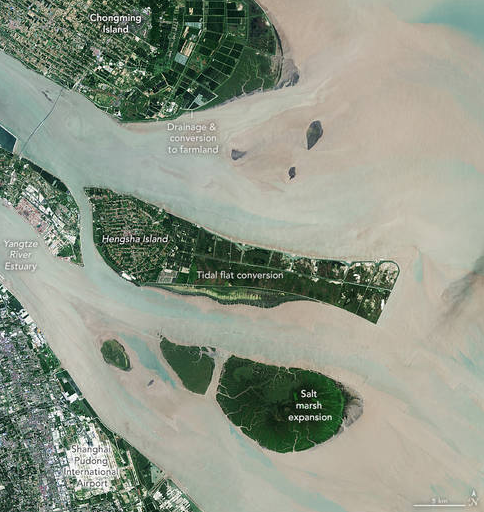
NASA Scientists Map Global Salt Marsh Losses and Their Carbon Impact
The world has lost 561 square miles (1,453 square kilometers) of salt marshes over the past 20 years.