Landsat's Role in Understanding Climate Change
Long-term weather patterns averaged over 30 years or more make up our climate. Human well-being—our infrastructure and agriculture—depend on a reliable climate. This reliability allows farmers to plant seeds in the spring with confidence that temperatures and rainfall will sustain crops in the coming months. It allows communities to build and maintain roads, buildings, and drainage systems best suited to local conditions. Earth’s climate is controlled by the amount of energy that flows through the atmosphere, oceans, and land. By adding heat-trapping gases to the atmosphere—primarily carbon dioxide—people are increasing the amount of energy in the Earth system that would otherwise escape to space. This increase in energy is changing Earth’s climate, and consequently, the weather patterns that people rely on are shifting. Changes in long-term weather patterns have wide-ranging impacts on ecosystems and peoples’ lives. Designed to observe land and coastal ecosystems, Landsat instruments provide an unparalleled space-based record of the impact of climate change on Earth’s landscapes, the growth and loss of carbon- storing.
![semi-aquatic muskrat](https://landsat.gsfc.nasa.gov/wp-content/uploads/2018/11/20181126_nu1-1024x683-1.png)
Stanford Researchers Find That a Drying Canadian Delta has Driven Muskrat Population Decline
Stanford research shows the drying trend in Canada’s Peace-Athabasca Delta is linked to the long-term decline in populations of the semi-aquatic muskrat.
Despite Recovery, Widespread Evidence of Deforestation Remains a Half-Century Later
The patterns of large-scale tropical deforestation endure across landscapes, even after more than a half-century of tropical rainforest expansion and growth.
Landsat Used To Predict Tree Species Distributions in Peruvian Lowland Amazonia
Researchers have succeeded in producing distribution maps for a selection of important tropical tree species in Peruvian lowland Amazonia.
Seeing Hidden Worlds Under Melting Ice
Multi-year comparison of Landsat images can unmask previously unknown geography.
New Study: The Arctic Carbon Cycle is Speeding Up
Carbon in Alaska’s North Slope tundra ecosystems spends about 13 percent less time locked in frozen soil than it did 40 years ago.
![Megafire amongst trees](https://landsat.gsfc.nasa.gov/wp-content/uploads/2018/07/20180725_nu1-1.png)
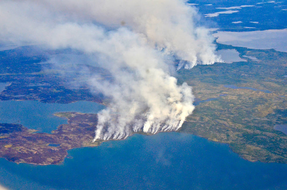
Fires, Floods and Satellite Views: Modeling the Boreal Forest’s Future
The 2014 megafires in Canada’s Northwest Territories burned 7 million acres of forest, making it one of the most severe fire events in Canadian history.