Landsat’s Role in Managing Ecosystems and Biodiversity
Our world is made of complex networks of living things and physical elements that constantly interact and affect each other. Such networks are known as “ecosystems.” Healthy and economically important ecosystems such as temperate forests, wetlands, grasslands, coastal zones, coral reefs, and rainforests all play roles in human life. For example, farm and rangeland ecosystems must be healthy to produce the grains and livestock on which we depend as a nation. Marine ecosystems depend on the health of land ecosystems, because coastal areas provide habitat needed to support the productivity and diversity of aquatic organisms. Landsat has brought valuable capabilities to ecosystem studies. Landsat instruments measure reflected light in visible and infrared wavelengths. Because plants reflect little visible light and a lot of infrared light when they are healthy, the measurement of both types of light simultaneously gives scientists a way to assess plant health and density over a landscape. Measurements are detailed enough while still covering a wide area that ecologists can expand their interpretations of local events and processes, such as an insect infestation in a specific forest, to a regional scale. This helps them to gauge the health of larger ecosystems. Because Landsat data are accurately mapped to reference points on the ground and adjusted for topographic relief, they can be integrated with other geographic data sets and models to explore more complex studies of ecosystems and biodiversity across space and time.
App Helps Ecologists Map Vulnerable Ecosystems Within Minutes
A mapmaking app that can fast-track large-scale ecosystem analysis from months to minutes.
Landsat, Sentinel Harmony Effort Shows Promising Results in Great Basin
New research from EROS on dryland phenology, is poised to aid land managers’ fight against invasive, fire-prone species that wreak havoc on native landscapes.
Data Record for Tropical Forest Monitoring Extended with New Cloud-Detection Method
A new, highly accurate, automated way to detect clouds and their shadows from satellite images over unusually cloudy places.
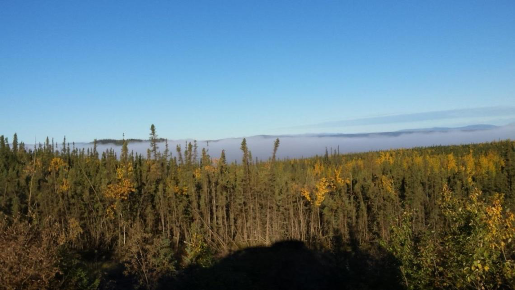
New Study Provides the First Comprehensive, Long-term Look at Alaska’s Changing Ecosystems
This is the first study to document more than three decades of land and water changes across Alaska.
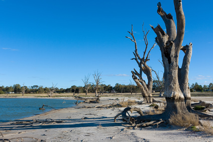
Rain Showers, Flowers, and Floods—Understanding How Vegetation Responds to Flooding and Drought in Australia’s Breadbasket
Using a quarter century of Landsat data, geospatial researchers have mapped and modeled how vegetation responds to water availability across the entire Murray-Darling Basin.
Watching A Quarter Century of North American Forest Dynamics with Landsat
Annual maps of the lower-48 United States produced from Landsat satellite data illustrate how these dynamic systems changed from 1986-2010.