

Landsat-Based Insect Atlas Gives Best View of Outbreaks in Forests
Scientists for the first time have simultaneously compared widespread impacts from two of the most common forest insects in the West—mountain pine beetle and western spruce budworm – an advance that could lead to more effective management policies.
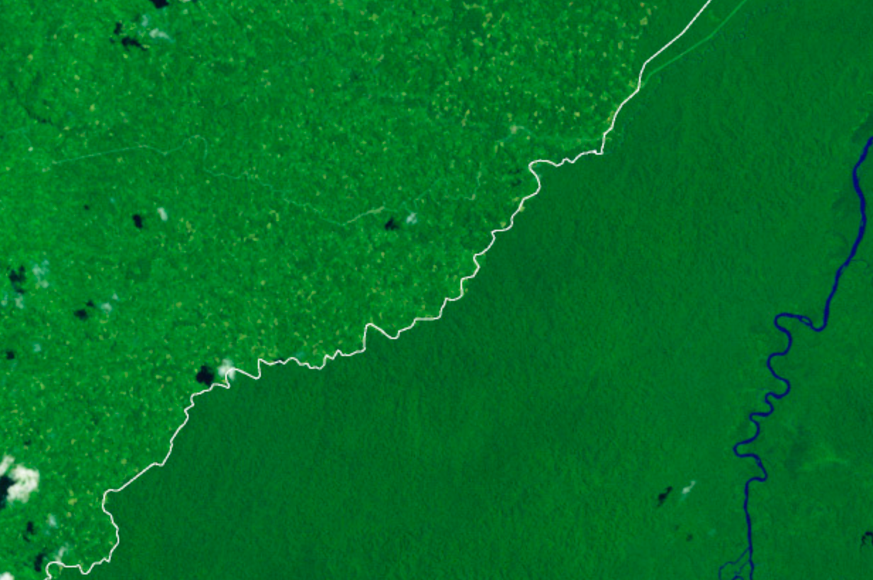
Landsat Shows Felling of Tropical Trees Has Soared
The rate at which tropical forests were cut, burned or otherwise lost from the 1990s through the 2000s accelerated by 62 percent, according to a new study which dramatically reverses a previous estimate of a 25 percent slowdown over the same period. That previous estimate, from the U.N.’s Food and Agriculture Organization’s (FAO) Forest Resource Assessment, was based on a collection of reports from dozens of countries. The new estimate, in contrast, is based on vast amounts of Landsat image data which directly record the changes to forests over 20 years.
Wrangling a Petabyte of Data to Better View the Earth
When viewed from space, clouds largely obscure the Earth. It isn’t a matter of time of day, angle or distance. It’s just the way it is – unless, of course, you are gazing at the planet using Google Earth. The story of how Google Earth offers images of the planet — without letting clouds get in the way — began in the foothills of the Santa Cruz Mountains in California.
U.S. Forest Service Uses Landsat to Improve Estimates of Forest Disturbance
Each year the U.S. Forest Service takes a census of trees, chronicling the nation’s forest heath and timber resources. Forest managers use this information to project what U.S. forests will be like in coming decades and, if needed, to adjust their forest management practices in order to safeguard sustainability.
Mapping South Asia's Mangroves
Along the sea’s edge in Bangladesh, India, Pakistan, and Sri Lanka, the dense coastal population lives largely in symbiosis with the region’s mangrove forests.
Mangroves—a vast network of intertidal trees and shrubs with their characteristic tangle of above ground roots—give safety, sustenance, and spectacle to coastal denizens in a multitude of ways. Namely, by stabilizing shorelines, safeguarding water quality, influencing stable microclimates, controlling flooding, and providing transportation, forest products, hunting and fishing grounds, and recreation and protecting people and property from storms.
A Closer Look at Old-Growth Forest Loss in Indonesia
A group of researchers from the University of Maryland, the Indonesian Ministry of Forestry, and the World Resource Institute joined forces to remedy the lack of consensus about the amount of old-growth forest clearing occurring in Indonesia.
