

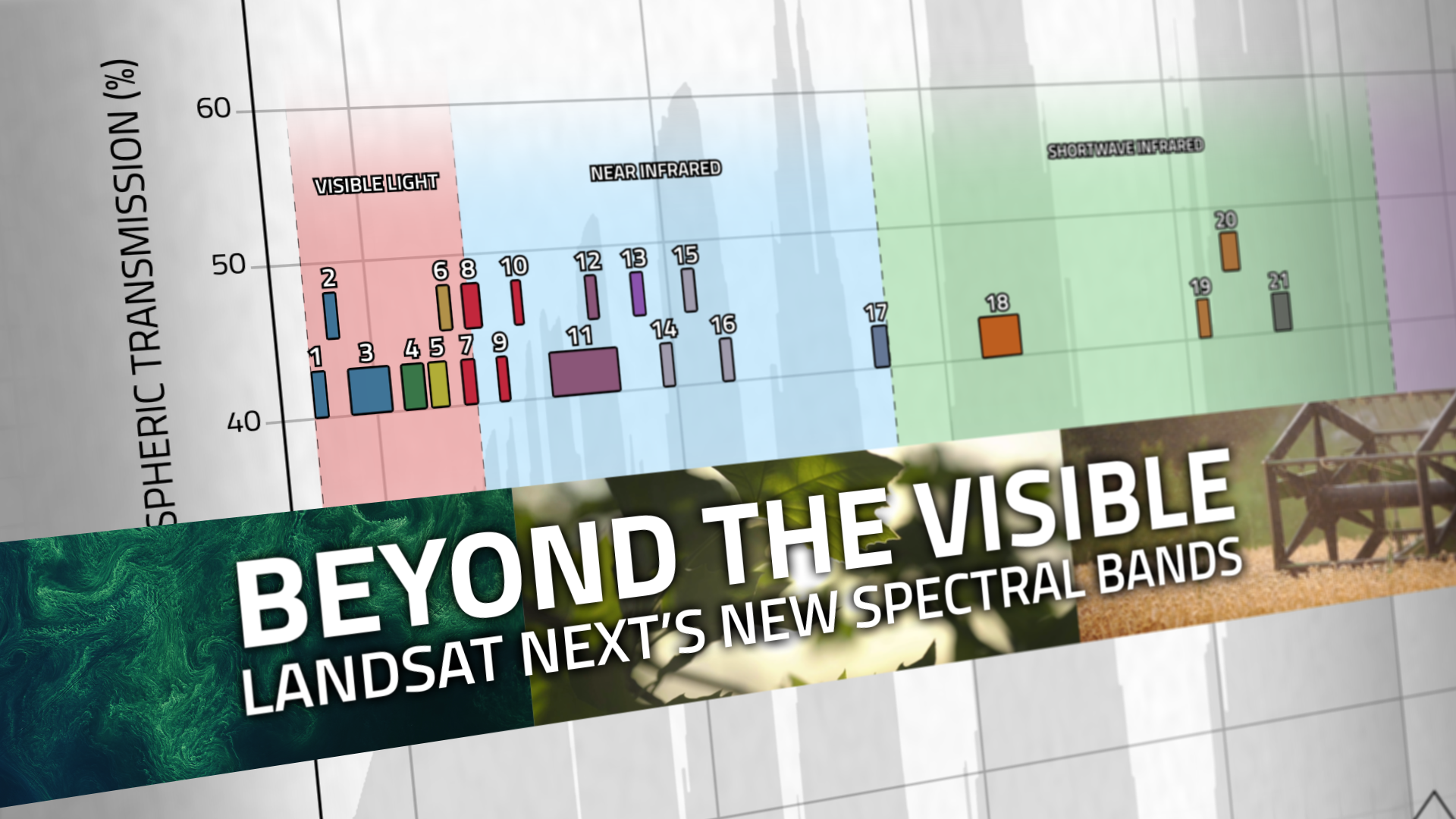
Beyond the Visible: Landsat Next’s New Spectral Bands
With Landsat Next’s 26 new spectral bands, we’ll be able to see our planet like never before. Landsat Next’s enhanced capabilities will provide scientists, farmers, and decision-makers with critical data to tackle global challenges.
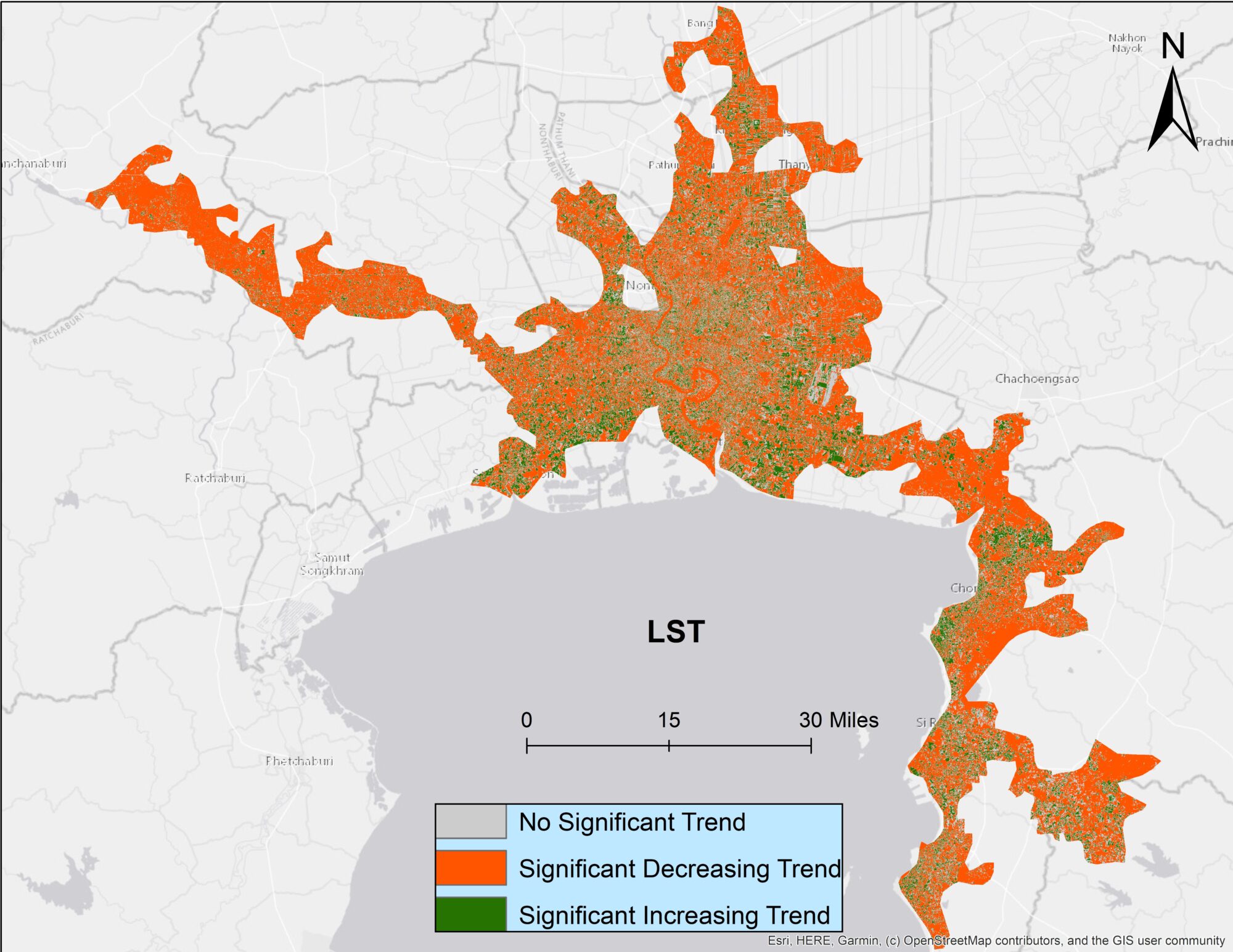
Urban Heat in the Lower Mekong Delta
Looking at urban heat islands, researchers found that changing trends in vegetation influence land surface temperature in the Lower Mekong Delta cities.
Landsat Reveals Role of Green Spaces in Cooling Cities
As any urban dweller who has lived through a heat wave knows, a shady tree can make all the difference. But what happens when there’s no shade available?

Landsat Observations Key Resource for Many Federal Agencies
In the FY23 Aeronautics and Space Report released on May 23, 2024, a multitude of Federal agencies report work informed by Landsat data.
NASA-Led Project Tracking Changes to Water, Ecosystems, Land Surface
Merging data from multiple satellites, OPERA can help government agencies, disaster responders, and the public access data about natural and human impacts to the land.
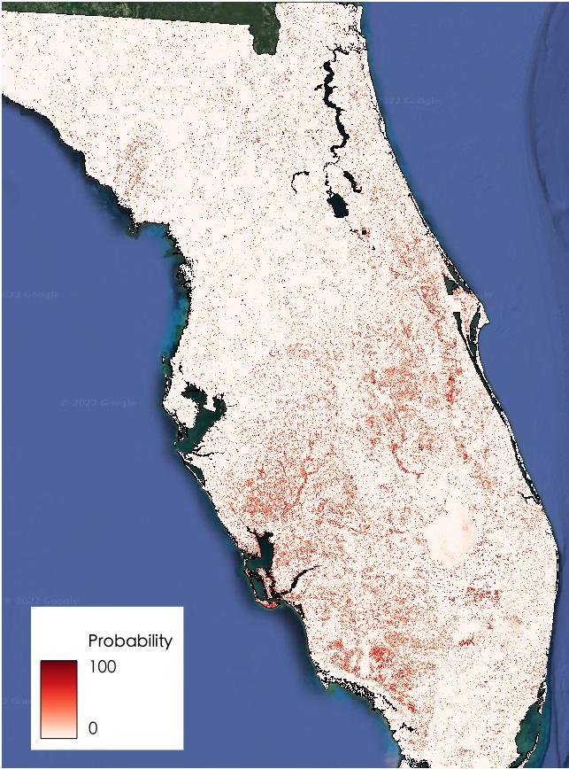
Quickly Assessing the Aftermath of Hurricane Ian with Satellites
UCONN remote sensing experts used Harmonized Landsat Sentinel-2 imagery to quickly assess damage caused by the storm’s aftermath, providing spatially-relevant situational awareness that could aid rescue efforts.
