
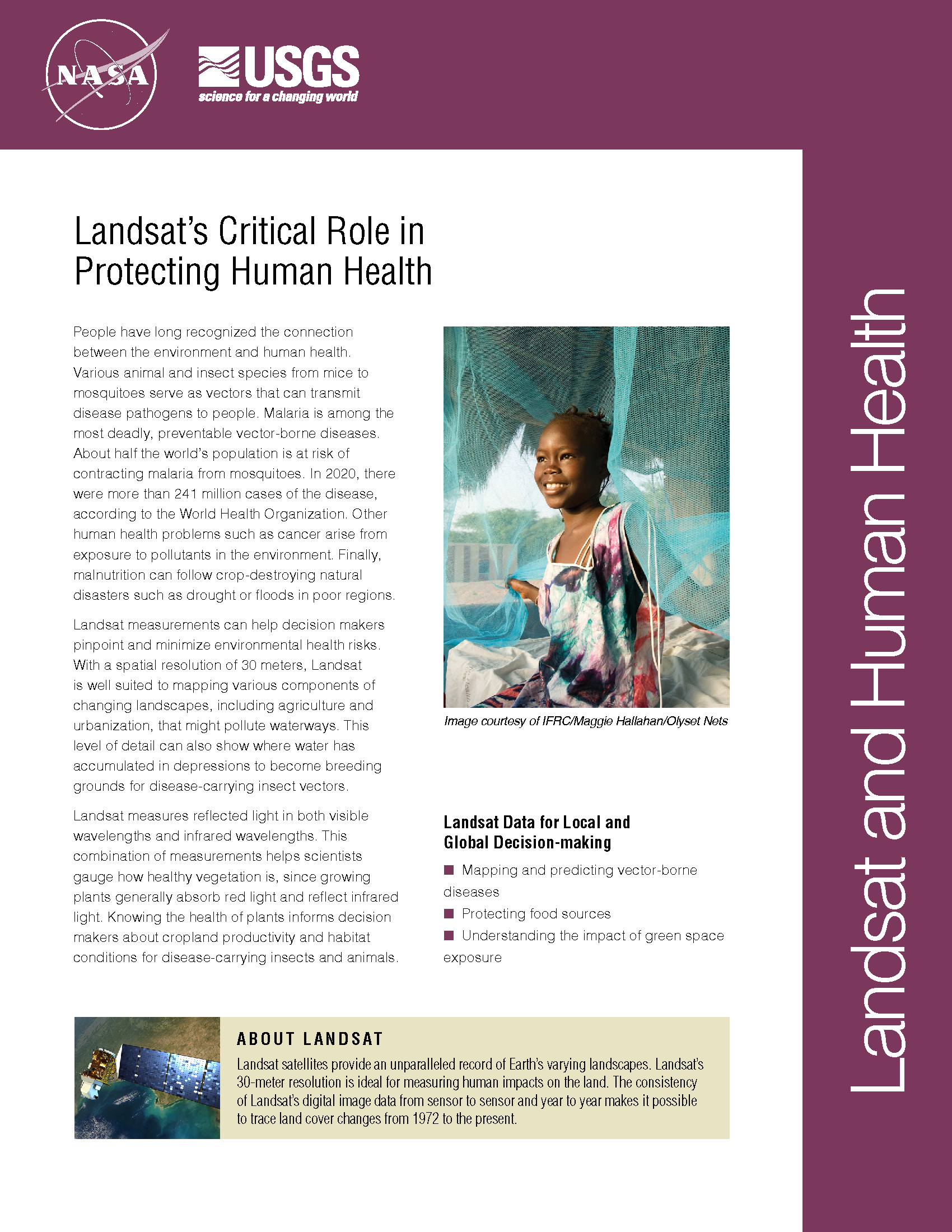
Using Landsat to Detect Human Rights Violations
Over 2500 villages were destroyed during six years of conflict in Darfur between 2002 and 2008. Dr. Andrew Marx, a 2013 fellow at the Center for the Prevention of Genocide at the U.S. Holocaust Memorial Museum, has found that this type of destruction—associated with human rights violations—can be detected using freely available Landsat data.
Vast Water Reserves Found in Drought-Prone Northern Kenya
Large underground water reserves have been found in Turkana, one of Kenya’s driest and poorest regions. The discoveries were made by the natural resources exploration firm, Radar Technologies International, during the course of a survey of groundwater conducted for the Kenyan Government on behalf of the UN. The aquifers were detected with the WATEX System, RTI’s state-of-the-art, space-based exploration technology.
It Takes a Satellite To Feed the World
Source: Charles L. Walthall, USDA Agricultural Research Service Forum It’s ironic that just when Earth-monitoring satellites are needed more than ever to address the food and freshwater demands of a burgeoning
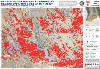
NASA Data Helps Pinpoint Impacted Populations in Disaster Aftermath
Contact: Gretchen Cook-Anderson, NASA/GSFC When two catastrophic natural disasters struck within days of each other in May 2008, disaster relief, humanitarian aid, and health officials, as well as members of the
U.S. Uses Landsat Satellite Data To Fight Hunger, Poverty
Remote sensing is a critical tool for agriculture, land use worldwide Source: Cheryl Pellerin, America.gov, U.S. Department of State Over the 35 years that U.S. Landsat Earth-observation satellites have collected images
