Landsat’s Role in Managing Water Resources
Water is essential for life. A third of Earth’s populace has unreliable access to clean water. With current population growth and environmental trends, the U.N. Environmental Program estimates that 1.8 billion people will face water scarcity by 2025. Water means survival for people and other species we rely upon to thrive, making proper stewardship of our water resources vital. Good decisions require good data. Since 1972 the Landsat series of satellites has been providing such data. Landsat-based decisions on how to manage limited water resources have impacted millions of people worldwide. From finding water for refugees in arid nations to reducing pollution in our national waterways, Landsat enables decisions that directly help people.
Survival of a Tropical Glacier
William Kochtitzky, a student from Dickinson College, presented a poster on glacial changes on Peru’s Nevado Coropuna volcano at #AGU15.
Landsat Helps Inform Restoration Decisions in the Great Lakes
Charles Perry, a Research Soil Scientist with the USDA’s Forest Inventory and Analysis group, gave a talk about his research that uses Landsat to monitor land use and land cover change in watersheds surrounding the Great Lakes at #AGU15. He is able to link the land use and land cover change information with other ancillary data to predict water quality, such as the amount of phosphorus (which feeds algae) in the lakes.
Despite Warming, Landsat Reveals Decadal Slowdowns on Greenland Ice Sheet
Ice sheets are in perpetual motion, making their way downslope like a river. If the amount of snow that an ice sheet accumulates does not keep pace with its loss to the sea, sea level will rise. As temperatures have climbed, positive feedback loops have led to an accelerated loss of ice sheet sections that touch the sea, but in an unexpected twist to the global warming saga, scientists have just discovered a negative feedback loop that is slowing down the Greenland Ice Sheet sections that end on land—a sliver of good news for sea-level rise.

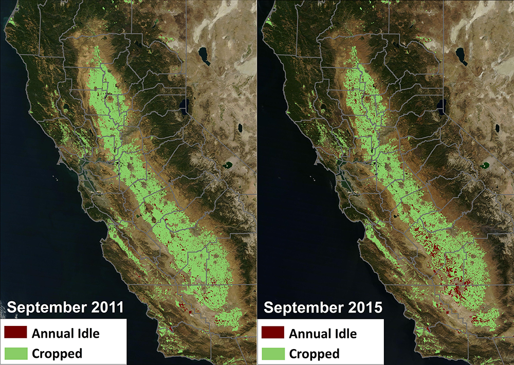
Federal Agencies Release Data Showing California Central Valley Idle Farmland Doubling During Drought
NASA, in collaboration with the United States Department of Agriculture (USDA), United States Geological Survey (USGS), and the California Department of Water Resources, released data today showing the effect the current drought has had on agricultural production and the idling of California farmlands.

Tracking Agricultural Water Use on a Smartphone
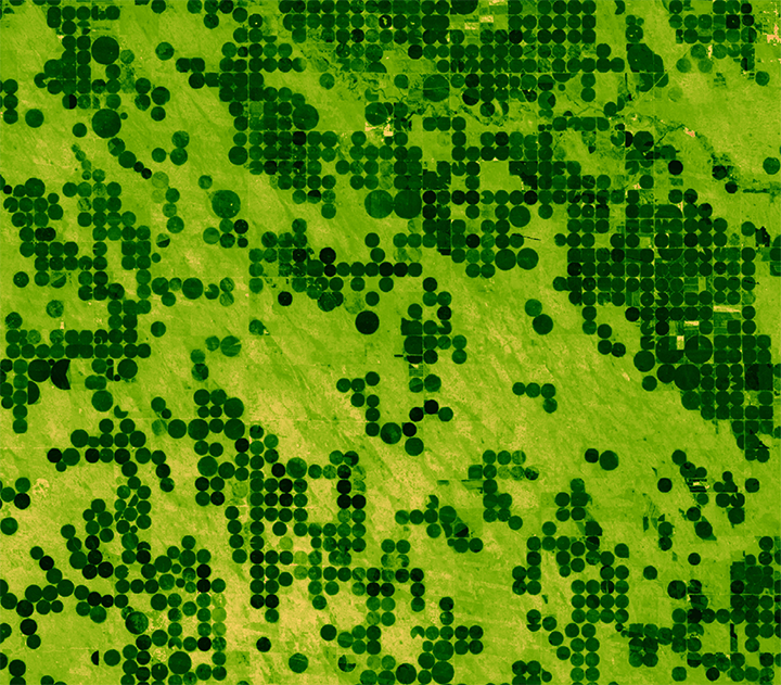
This fall scientists at the University of Nebraska, with partners at Google Inc., the University of Idaho and the Desert Research Institute, introduced the latest evolution of METRIC technology—an application called EEFLUX, which will allow anyone in the world to produce field-scale maps of water consumption.
Landsat Images Advance Watershed Restoration in Western Tanzania
For those who live along its shores, Lake Tanganyika in east Africa is the backbone of local transportation and serves as an essential source of household water and protein. Every night, fishers lure nocturnal, sardine-like fish called dagaa with compression lamps that are strung between their boats. From the shore, the lake sparkles with the lights of miniature moons as people gather the treasured catch.


