
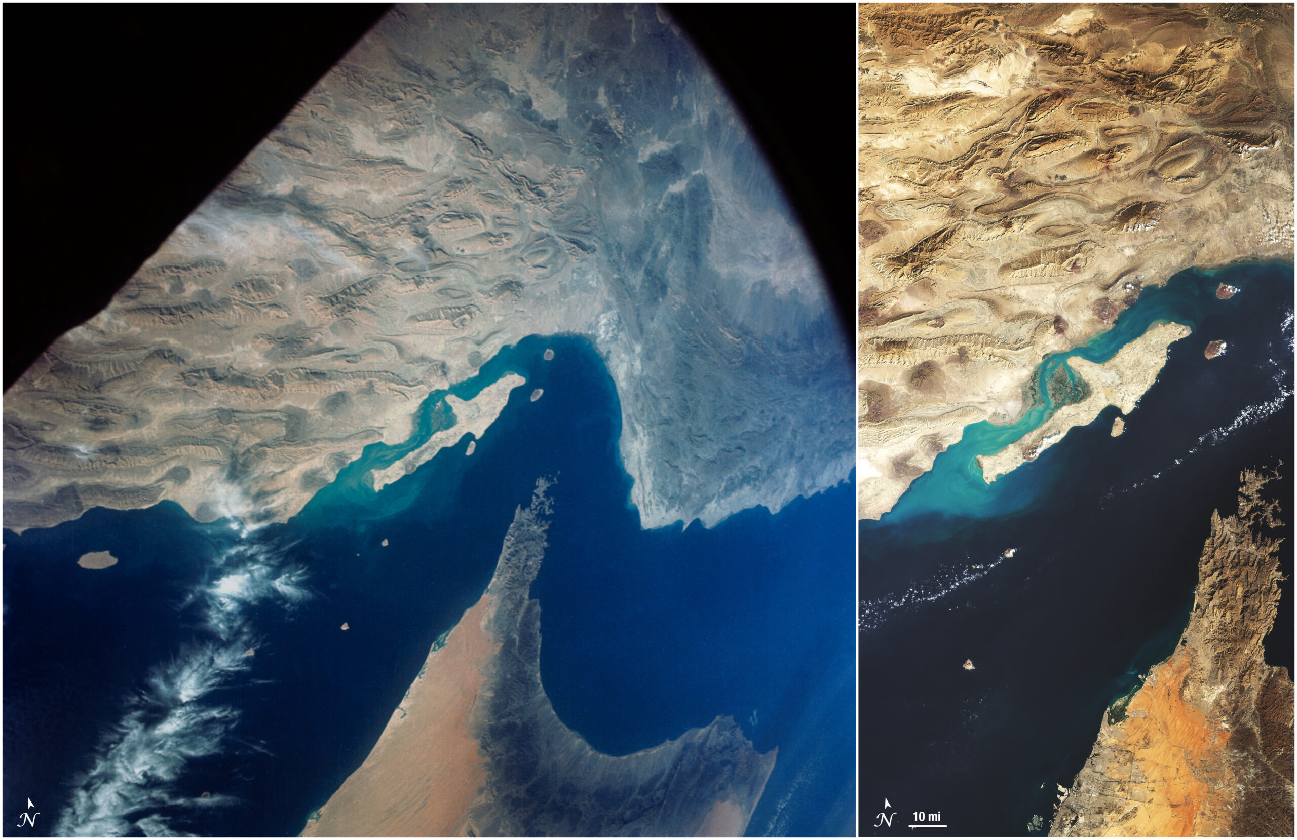
How Early Astronaut Photographs Inspired the Landsat Program
In the 1960s, NASA was pioneering a new era of human spaceflight—and astronaut photography—that would change Earth observation forever.
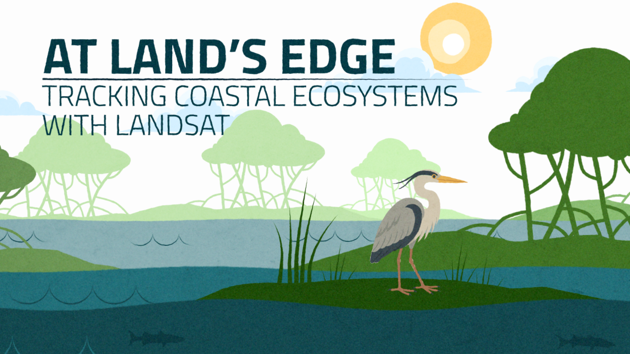
At Land’s Edge – Tracking Coastal Ecosystem with Landsat
Discover how Landsat’s 50-year record of Earth helps scientists track the health of coastal ecosystems while providing tools to monitor water quality and reveal changes at the edge of land and sea.

Landsat at Work: Preparing Residents Where Hurricanes Threaten
Landsat-based National Land Cover Database (NLCD) helps predict hurricane wind risk to homes and other structures.
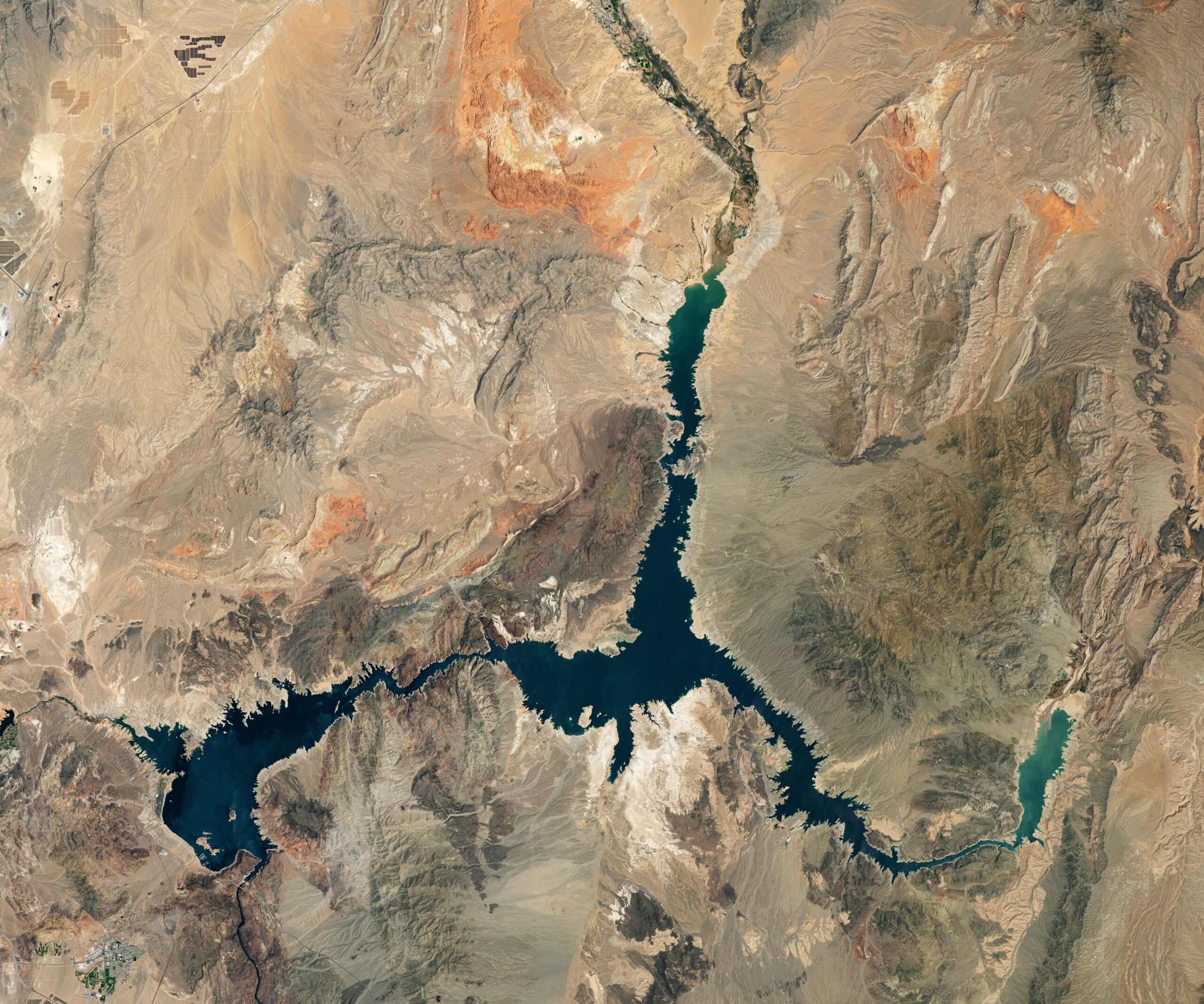
Mapping Reservoirs for Better Water Management
Using data from Harmonized Landsat and Sentinel-2 (HLS), researchers developed a new algorithm to better monitor reservoir water levels in the contiguous U.S.

Annual NLCD’s Insights Rely on Long Landsat Record
The Landsat satellite program, with its unparalleled 53-year historic record, can reveal changes through the Annual National Land Cover Database (NLCD).

A New and Improved Harmonized Landsat and Sentinel-2 Dataset
In July, 2025, a team of researchers unveiled the Harmonized Landsat and Sentinel-2 (HLS) version 2.0 surface reflectance dataset and algorithms.

Deforestation in Paraguay’s Gran Chaco
The Gran Chaco—South America’s second largest forest—is disappearing. Watch decades of forest change, as captured by Landsat satellites.

Remote Sensing Symbiosis: How Government and Commercial Sectors Work Together
As an avid Landsat user and an expert in commercial satellite data, Dr. Francois Smith spoke to how the private and public remote sensing sectors work together.
How Early Astronaut Photographs Inspired the Landsat Program
In the 1960s, NASA was pioneering a new era of human spaceflight—and astronaut photography—that would change Earth observation forever.
At Land’s Edge – Tracking Coastal Ecosystem with Landsat
Discover how Landsat’s 50-year record of Earth helps scientists track the health of coastal ecosystems while providing tools to monitor water quality and reveal changes at the edge of land and sea.
Landsat at Work: Preparing Residents Where Hurricanes Threaten
Landsat-based National Land Cover Database (NLCD) helps predict hurricane wind risk to homes and other structures.
Mapping Reservoirs for Better Water Management
Using data from Harmonized Landsat and Sentinel-2 (HLS), researchers developed a new algorithm to better monitor reservoir water levels in the contiguous U.S.
Annual NLCD’s Insights Rely on Long Landsat Record
The Landsat satellite program, with its unparalleled 53-year historic record, can reveal changes through the Annual National Land Cover Database (NLCD).
A New and Improved Harmonized Landsat and Sentinel-2 Dataset
In July, 2025, a team of researchers unveiled the Harmonized Landsat and Sentinel-2 (HLS) version 2.0 surface reflectance dataset and algorithms.
Deforestation in Paraguay’s Gran Chaco
The Gran Chaco—South America’s second largest forest—is disappearing. Watch decades of forest change, as captured by Landsat satellites.
Remote Sensing Symbiosis: How Government and Commercial Sectors Work Together
As an avid Landsat user and an expert in commercial satellite data, Dr. Francois Smith spoke to how the private and public remote sensing sectors work together.
Celebrating 53 Years Since Landsat 1’s Launch
When the first Landsat satellite launched in 1972, it posed the following question: could we manage our natural resources using remotely–sensed data? The answer, 53 years on, is a resounding “yes.”
