
NASA Study Finds Potential Carbon Sink in Boreal Forest Growth
New research led by Landsat 8/9 Project Scientist Chris Neigh used Landsat and ICESat-2 data to investigate how boreal forests growth could sequester carbon.
Spotting Disruptions to Earth’s Vegetation
Using NASA data, researchers can track vegetation changes around the planet, not just in forests but also in grasslands and savannas like the Brazilian Cerrado.
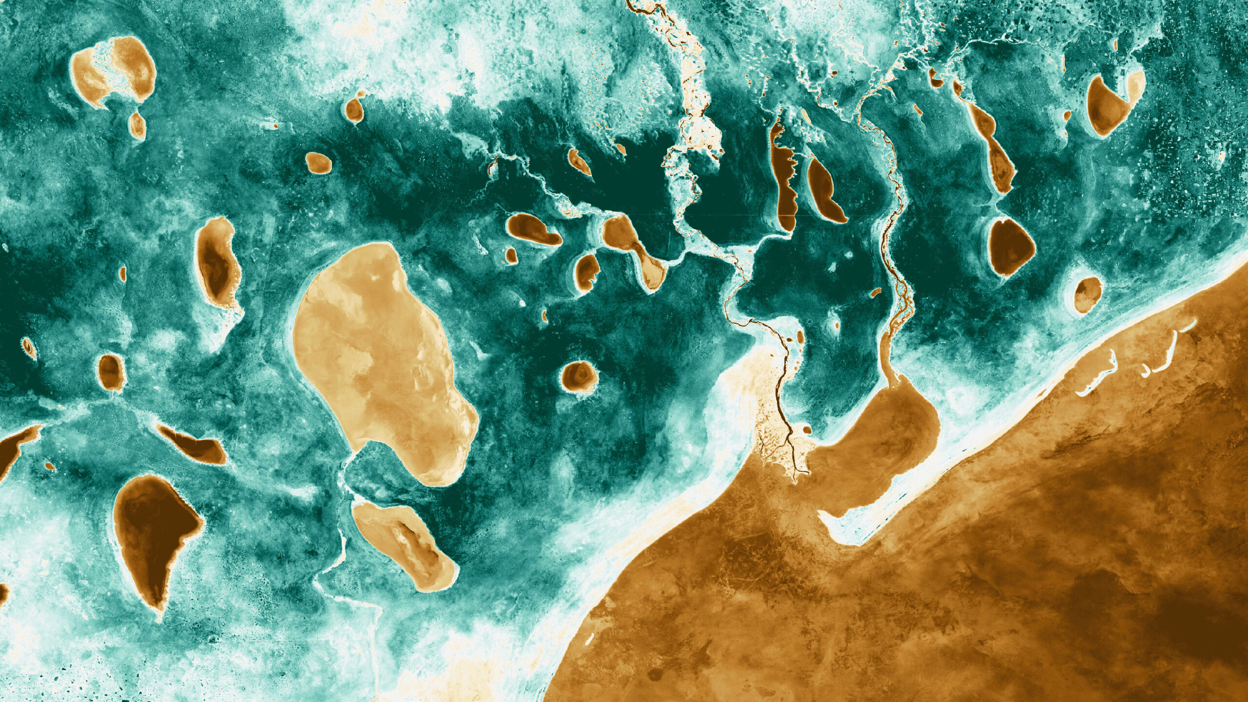
NASA Open Data Turns Science Into Art
Numerous artists have incorporated NASA science data into their work, further engaging the public in science discovery.
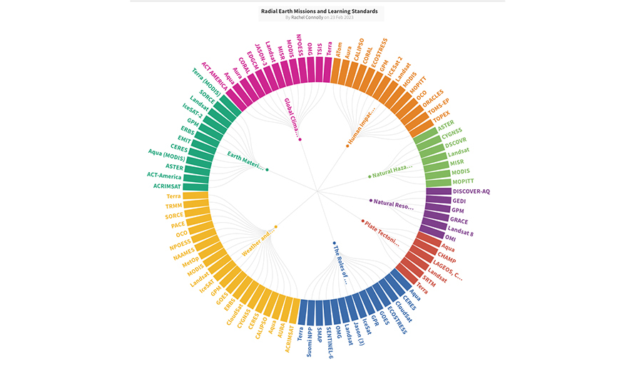
Landsat and Earth Science Education: Mapping NASA Earth Data to Next Generation Science Standards
NASA’s Science Activation team has created a graphic to help K-12 teachers find out which NASA Earth Science missions can provide real-world data most relevant to their Next Generation Science-based lessons.
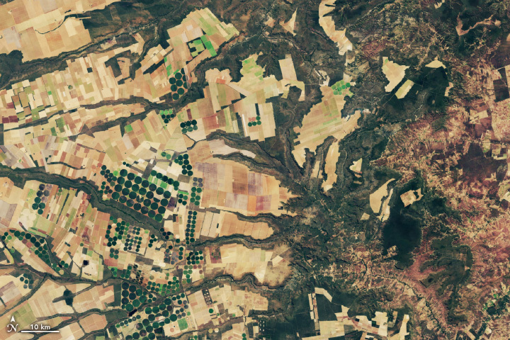
Mapping Grasslands: An Underappreciated Ecosystem
Grasslands tend to get left out of conservation discussion. New research from the World Resources Institute maps how they’ve changed over the past 20 years.

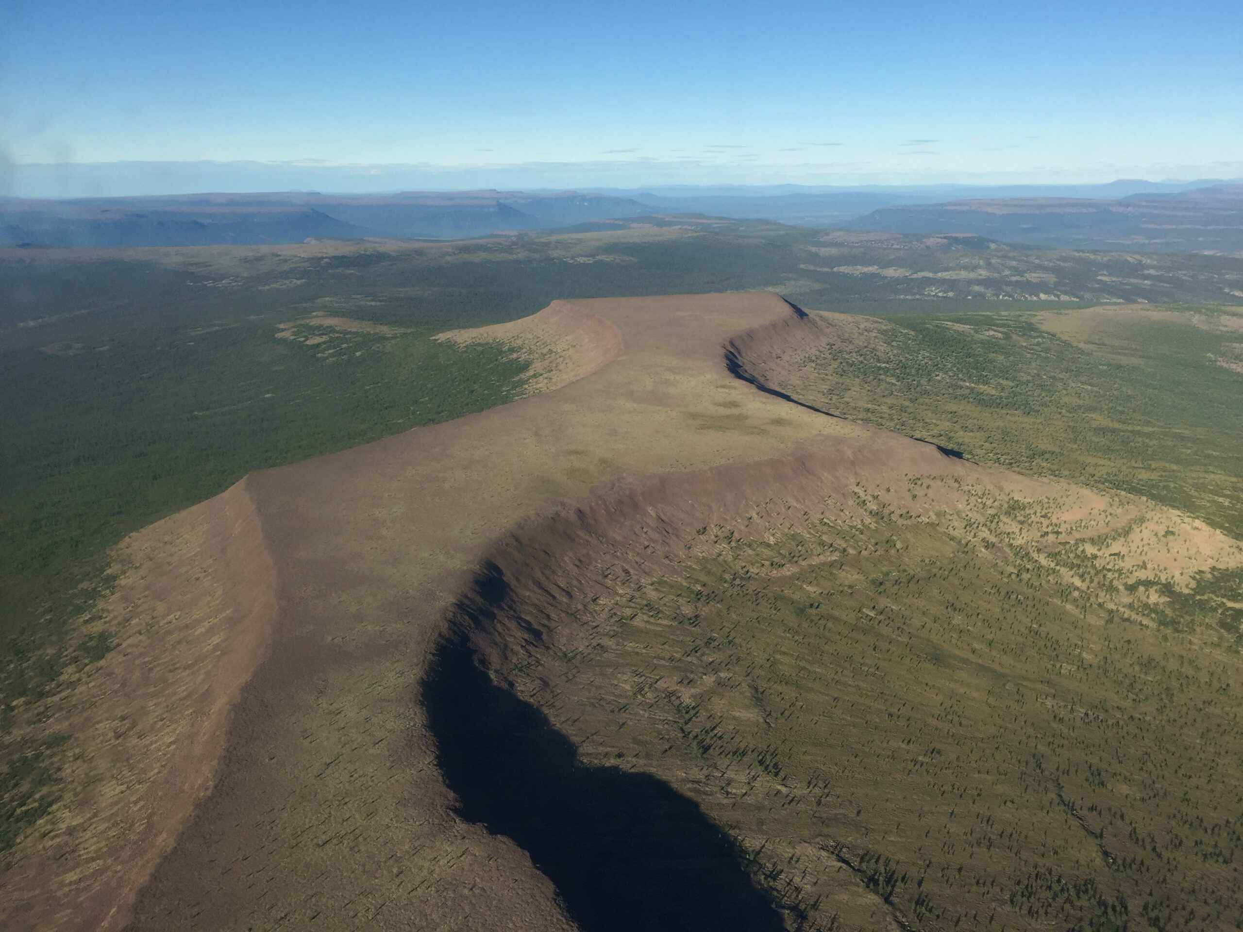
Understanding Forests After Fire With Landsat and LiDAR
Wildfires have been increasing in frequency and size across North America in recent years. British Columbia is no exception to that trend; more than 4% of the heavily-forested province has burned since 2017. In 2023, Canada saw its worst wildfire season in recorded history. These high intensity fires affect ecosystem health and local economies, as timber is a major industry in BC.
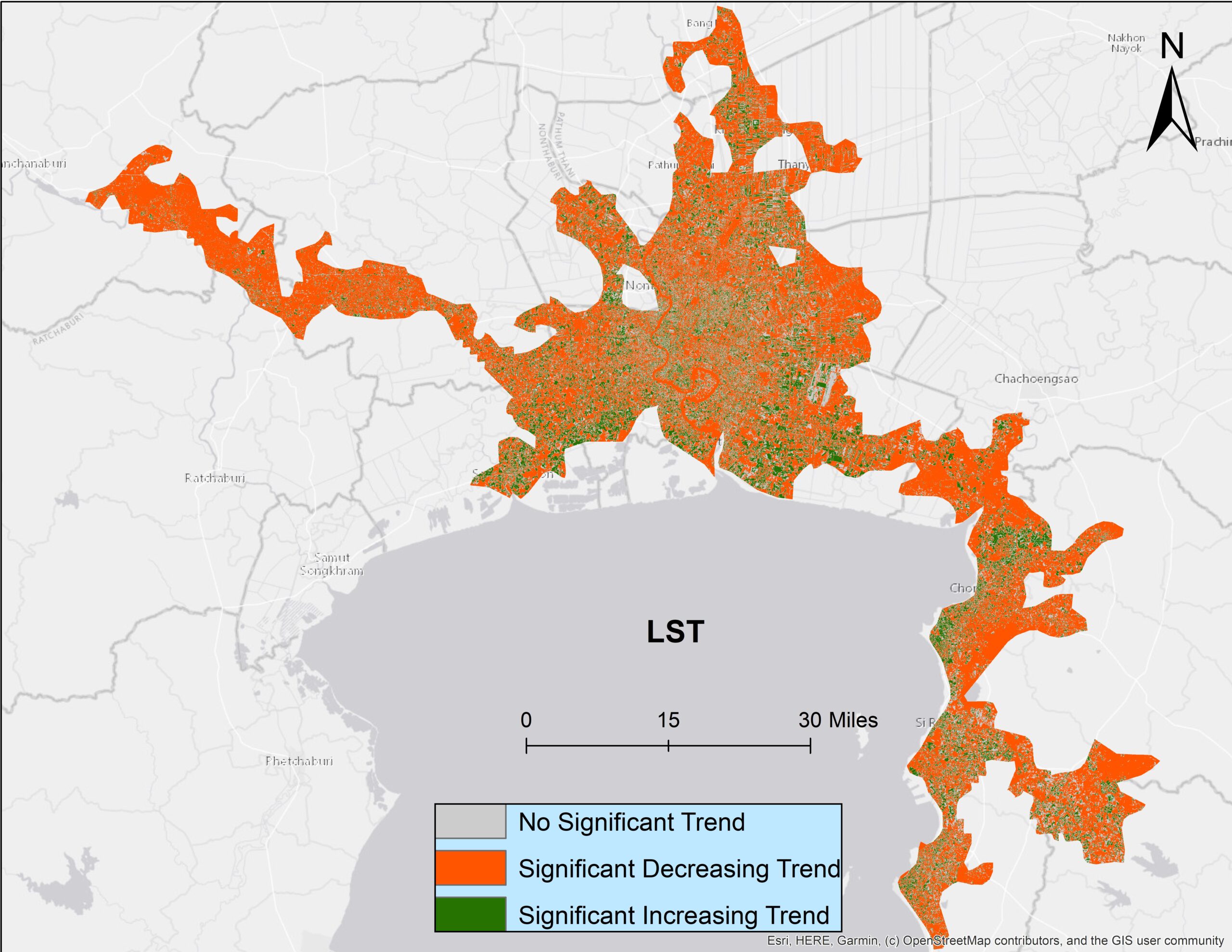
Urban Heat in the Lower Mekong Delta
Looking at urban heat islands, researchers found that changing trends in vegetation influence land surface temperature in the Lower Mekong Delta cities.

Virginia Norwood Recognized by National Inventors Hall of Fame
Virginia Norwood is being posthumously recognized for designing the Landsat multispectral scanner system.
Spotting Disruptions to Earth’s Vegetation
Using NASA data, researchers can track vegetation changes around the planet, not just in forests but also in grasslands and savannas like the Brazilian Cerrado.
NASA Open Data Turns Science Into Art
Numerous artists have incorporated NASA science data into their work, further engaging the public in science discovery.
Landsat and Earth Science Education: Mapping NASA Earth Data to Next Generation Science Standards
NASA’s Science Activation team has created a graphic to help K-12 teachers find out which NASA Earth Science missions can provide real-world data most relevant to their Next Generation Science-based lessons.
Mapping Grasslands: An Underappreciated Ecosystem
Grasslands tend to get left out of conservation discussion. New research from the World Resources Institute maps how they’ve changed over the past 20 years.
Understanding Forests After Fire With Landsat and LiDAR
Wildfires have been increasing in frequency and size across North America in recent years. British Columbia is no exception to that trend; more than 4% of the heavily-forested province has burned since 2017. In 2023, Canada saw its worst wildfire season in recorded history. These high intensity fires affect ecosystem health and local economies, as timber is a major industry in BC.
Urban Heat in the Lower Mekong Delta
Looking at urban heat islands, researchers found that changing trends in vegetation influence land surface temperature in the Lower Mekong Delta cities.
Virginia Norwood Recognized by National Inventors Hall of Fame
Virginia Norwood is being posthumously recognized for designing the Landsat multispectral scanner system.

USGS Invites Federal and International Partners to Join the Next Landsat Science Team
The USGS, in partnership with NASA, is calling for applications to staff the next Landsat Science Team to serve a 5-year term from 2025 to 2030.
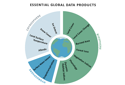
Maximizing the Benefit of Medium-Resolution Satellite Data: A Blueprint
A cadre of former Landsat Science Team members posit that realizing progress towards global sustainability goals would be substantially aided by 13 essential, regularly-updated global data products made with open-access and freely-available Landsat and Sentinel-2 datasets.
Spotting Disruptions to Earth’s Vegetation
Using NASA data, researchers can track vegetation changes around the planet, not just in forests but also in grasslands and savannas like the Brazilian Cerrado.
NASA Open Data Turns Science Into Art
Numerous artists have incorporated NASA science data into their work, further engaging the public in science discovery.
Landsat and Earth Science Education: Mapping NASA Earth Data to Next Generation Science Standards
NASA’s Science Activation team has created a graphic to help K-12 teachers find out which NASA Earth Science missions can provide real-world data most relevant to their Next Generation Science-based lessons.
Mapping Grasslands: An Underappreciated Ecosystem
Grasslands tend to get left out of conservation discussion. New research from the World Resources Institute maps how they’ve changed over the past 20 years.
Understanding Forests After Fire With Landsat and LiDAR
Wildfires have been increasing in frequency and size across North America in recent years. British Columbia is no exception to that trend; more than 4% of the heavily-forested province has burned since 2017. In 2023, Canada saw its worst wildfire season in recorded history. These high intensity fires affect ecosystem health and local economies, as timber is a major industry in BC.
Urban Heat in the Lower Mekong Delta
Looking at urban heat islands, researchers found that changing trends in vegetation influence land surface temperature in the Lower Mekong Delta cities.
Virginia Norwood Recognized by National Inventors Hall of Fame
Virginia Norwood is being posthumously recognized for designing the Landsat multispectral scanner system.
USGS Invites Federal and International Partners to Join the Next Landsat Science Team
The USGS, in partnership with NASA, is calling for applications to staff the next Landsat Science Team to serve a 5-year term from 2025 to 2030.
Maximizing the Benefit of Medium-Resolution Satellite Data: A Blueprint
A cadre of former Landsat Science Team members posit that realizing progress towards global sustainability goals would be substantially aided by 13 essential, regularly-updated global data products made with open-access and freely-available Landsat and Sentinel-2 datasets.
