

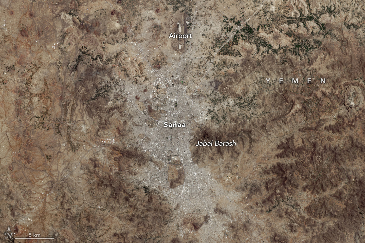
USGS Invites Federal and International Partners to Join the Next Landsat Science Team
The USGS, in partnership with NASA, is calling for applications to staff the next Landsat Science Team to serve a 5-year term from 2025 to 2030.
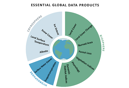
Maximizing the Benefit of Medium-Resolution Satellite Data: A Blueprint
A cadre of former Landsat Science Team members posit that realizing progress towards global sustainability goals would be substantially aided by 13 essential, regularly-updated global data products made with open-access and freely-available Landsat and Sentinel-2 datasets.
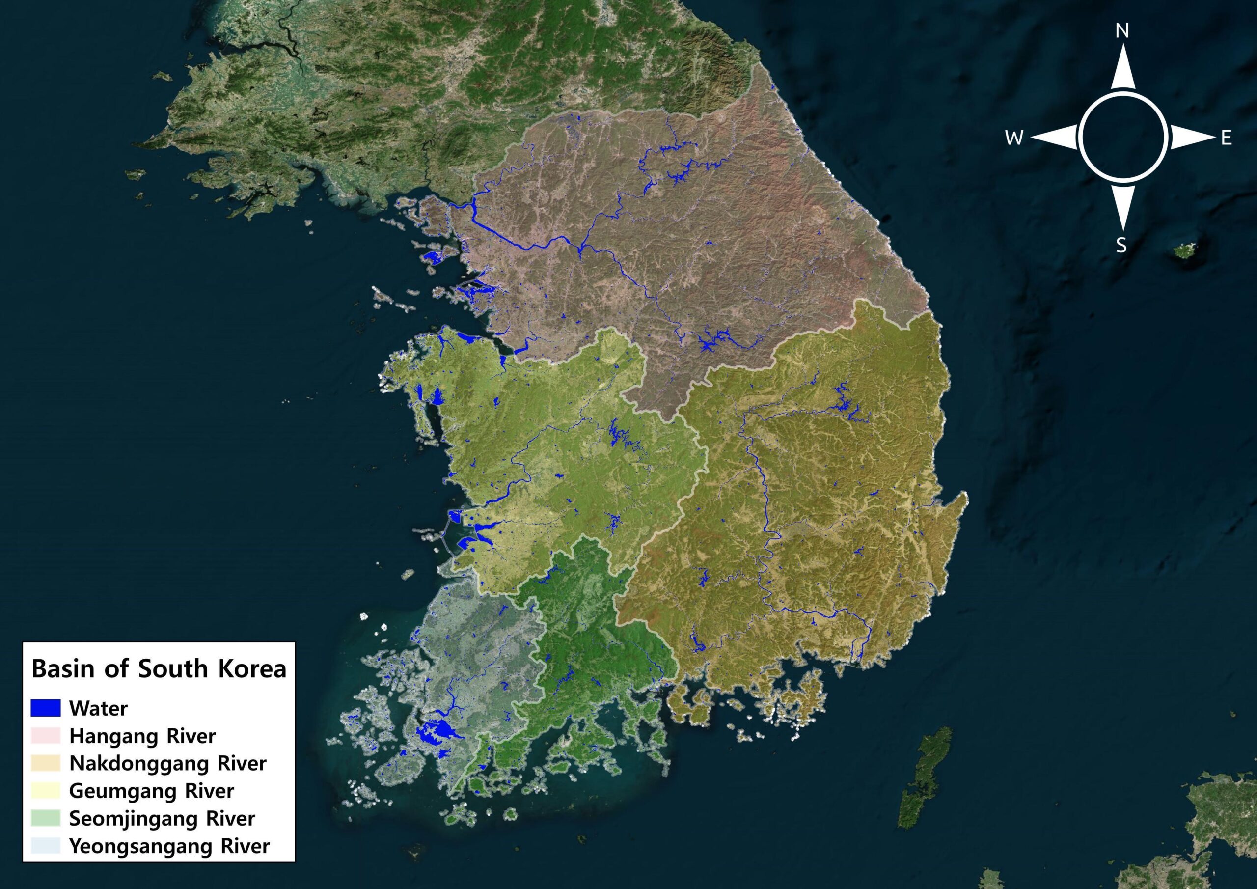
Monitoring Water Quality in South Korea
South Korea is facing a water quality problem. Researchers Hyunglok Kim and Seongjun Lee from the Gwangju Institute of Science and Technology (GIST) embarked on developing a model to predict water quality indicators in near real-time.
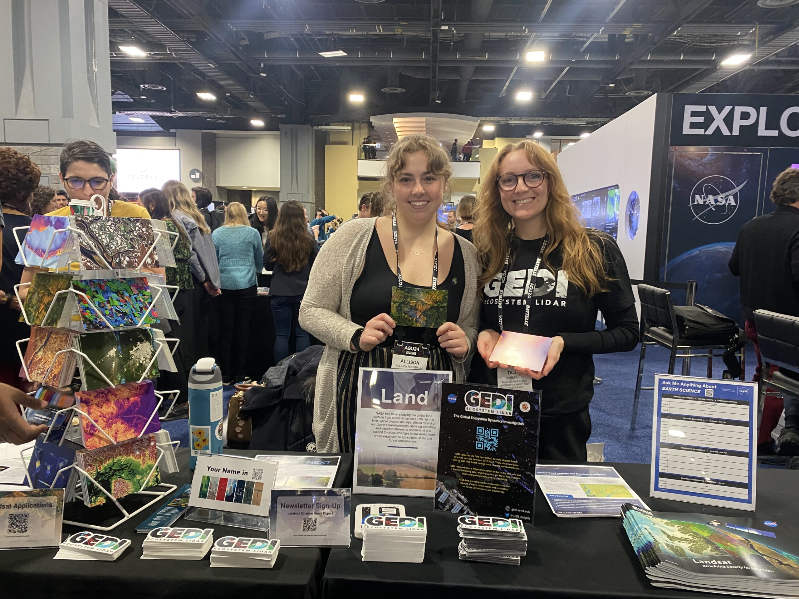
Landsat at AGU24
The NASA Landsat Science and Outreach teams attended the American Geophysical Union’s annual meeting in DC in December. At AGU24, they shared research and educated the public about Landsat.

Space Out: Landsat
Sit back and relax as NASA’s Landsat program takes you on a journey around the world – soar high above the towering cliffs of the Grand Canyon, catch the seasons changing in the Appalachian Mountains and watch as the Indus River crests its banks, all part of the vast archive of imagery collected by Landsat since the program’s first launch in 1972.
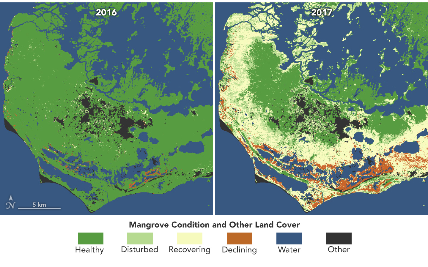
Mangroves Are Losing Their Resilience
Mangroves, the iconic trees and shrubs of the Florida Everglades, are under increased stress due to more frequent, intense hurricanes.

Satellites Reveal a Greener Antarctic Peninsula
Using observations from Landsat 5 through Landsat 8, scientists determined that the area of vegetated land on the Antarctic Peninsula grew from 0.86 to 11.95 square kilometers (0.33 to 4.61 square miles) between 1986 and 2021.
Landsat Reveals Role of Green Spaces in Cooling Cities
As any urban dweller who has lived through a heat wave knows, a shady tree can make all the difference. But what happens when there’s no shade available?
Monitoring Water Quality in South Korea
South Korea is facing a water quality problem. Researchers Hyunglok Kim and Seongjun Lee from the Gwangju Institute of Science and Technology (GIST) embarked on developing a model to predict water quality indicators in near real-time.
Landsat at AGU24
The NASA Landsat Science and Outreach teams attended the American Geophysical Union’s annual meeting in DC in December. At AGU24, they shared research and educated the public about Landsat.
Space Out: Landsat
Sit back and relax as NASA’s Landsat program takes you on a journey around the world – soar high above the towering cliffs of the Grand Canyon, catch the seasons changing in the Appalachian Mountains and watch as the Indus River crests its banks, all part of the vast archive of imagery collected by Landsat since the program’s first launch in 1972.
Mangroves Are Losing Their Resilience
Mangroves, the iconic trees and shrubs of the Florida Everglades, are under increased stress due to more frequent, intense hurricanes.
Satellites Reveal a Greener Antarctic Peninsula
Using observations from Landsat 5 through Landsat 8, scientists determined that the area of vegetated land on the Antarctic Peninsula grew from 0.86 to 11.95 square kilometers (0.33 to 4.61 square miles) between 1986 and 2021.
Landsat Reveals Role of Green Spaces in Cooling Cities
As any urban dweller who has lived through a heat wave knows, a shady tree can make all the difference. But what happens when there’s no shade available?

Finding Your Name in Landsat
More than 715,000 visitors have transcribed their names and messages into Landsat letters using the “Your Name in Landsat” tool since it was unveiled in August as part of Camp Landsat 2024.
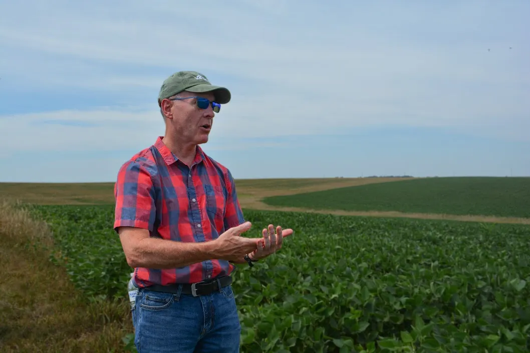
NASA’s Brad Doorn Brings Farm Belt Wisdom to Space-Age Agriculture
From his South Dakota roots to leading NASA’s agricultural program, Brad Doorn’s mission has remained the same: help farmers feed the world.
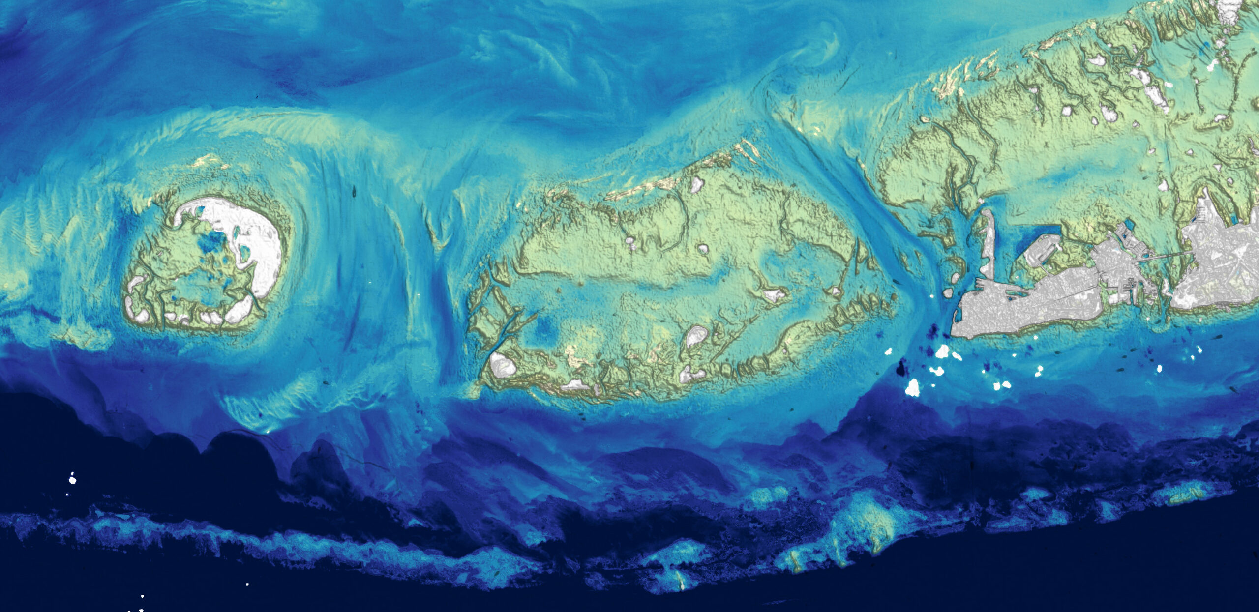
Landsat Plumbs the (Shallow) Depths
Scientists at the U.S. Geological Survey have developed a new way to measure ocean depth, or bathymetry, in shallow nearshore environments using Landsat data.
Monitoring Water Quality in South Korea
South Korea is facing a water quality problem. Researchers Hyunglok Kim and Seongjun Lee from the Gwangju Institute of Science and Technology (GIST) embarked on developing a model to predict water quality indicators in near real-time.
Landsat at AGU24
The NASA Landsat Science and Outreach teams attended the American Geophysical Union’s annual meeting in DC in December. At AGU24, they shared research and educated the public about Landsat.
Space Out: Landsat
Sit back and relax as NASA’s Landsat program takes you on a journey around the world – soar high above the towering cliffs of the Grand Canyon, catch the seasons changing in the Appalachian Mountains and watch as the Indus River crests its banks, all part of the vast archive of imagery collected by Landsat since the program’s first launch in 1972.
Mangroves Are Losing Their Resilience
Mangroves, the iconic trees and shrubs of the Florida Everglades, are under increased stress due to more frequent, intense hurricanes.
Satellites Reveal a Greener Antarctic Peninsula
Using observations from Landsat 5 through Landsat 8, scientists determined that the area of vegetated land on the Antarctic Peninsula grew from 0.86 to 11.95 square kilometers (0.33 to 4.61 square miles) between 1986 and 2021.
Landsat Reveals Role of Green Spaces in Cooling Cities
As any urban dweller who has lived through a heat wave knows, a shady tree can make all the difference. But what happens when there’s no shade available?
Finding Your Name in Landsat
More than 715,000 visitors have transcribed their names and messages into Landsat letters using the “Your Name in Landsat” tool since it was unveiled in August as part of Camp Landsat 2024.
NASA’s Brad Doorn Brings Farm Belt Wisdom to Space-Age Agriculture
From his South Dakota roots to leading NASA’s agricultural program, Brad Doorn’s mission has remained the same: help farmers feed the world.
Landsat Plumbs the (Shallow) Depths
Scientists at the U.S. Geological Survey have developed a new way to measure ocean depth, or bathymetry, in shallow nearshore environments using Landsat data.
