
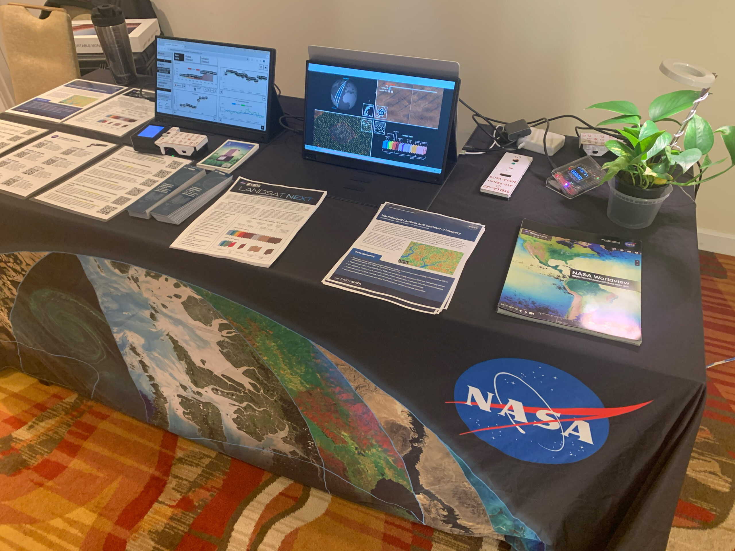
Landsat & LCLUC: Science Meeting Highlights
Outreach specialists from the Landsat Communications and Public Engagement team participated in community engagement efforts at the joint NASA and University of Maryland Land Cover Land Use Change (LCLUC) meeting.
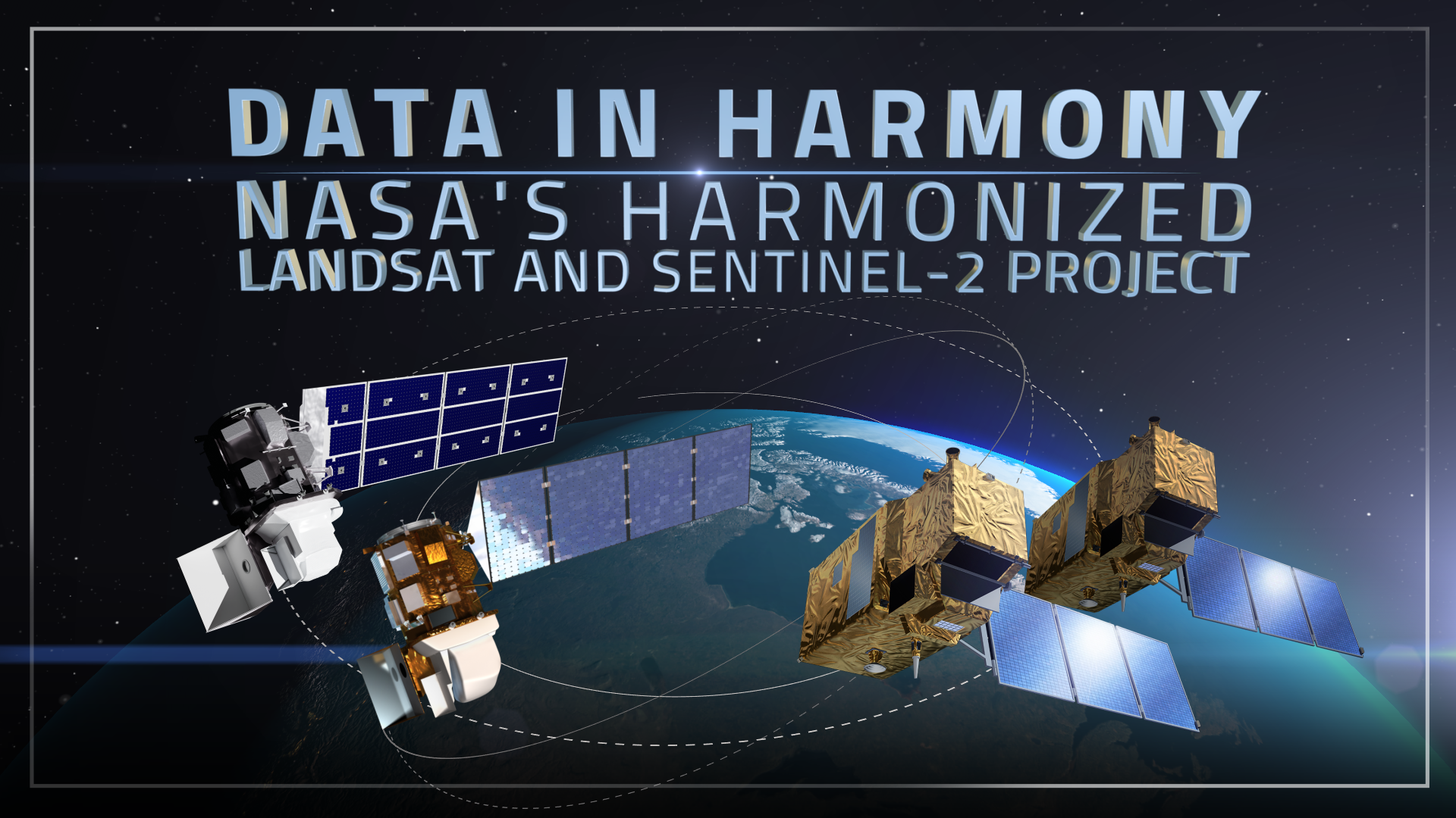
Data in Harmony: NASA’s Harmonized Landsat and Sentinel-2 Project
NASA’s Harmonized Landsat and Sentinel-2 (HLS) project is a groundbreaking initiative that combines data from Landsats 8 & 9 with the European Space Agency’s Sentinel-2A & 2B satellites.

Scenes from the Polar Night
Landsat satellites have begun regularly acquiring images of ice at the poles during the winter, with enlightening results.
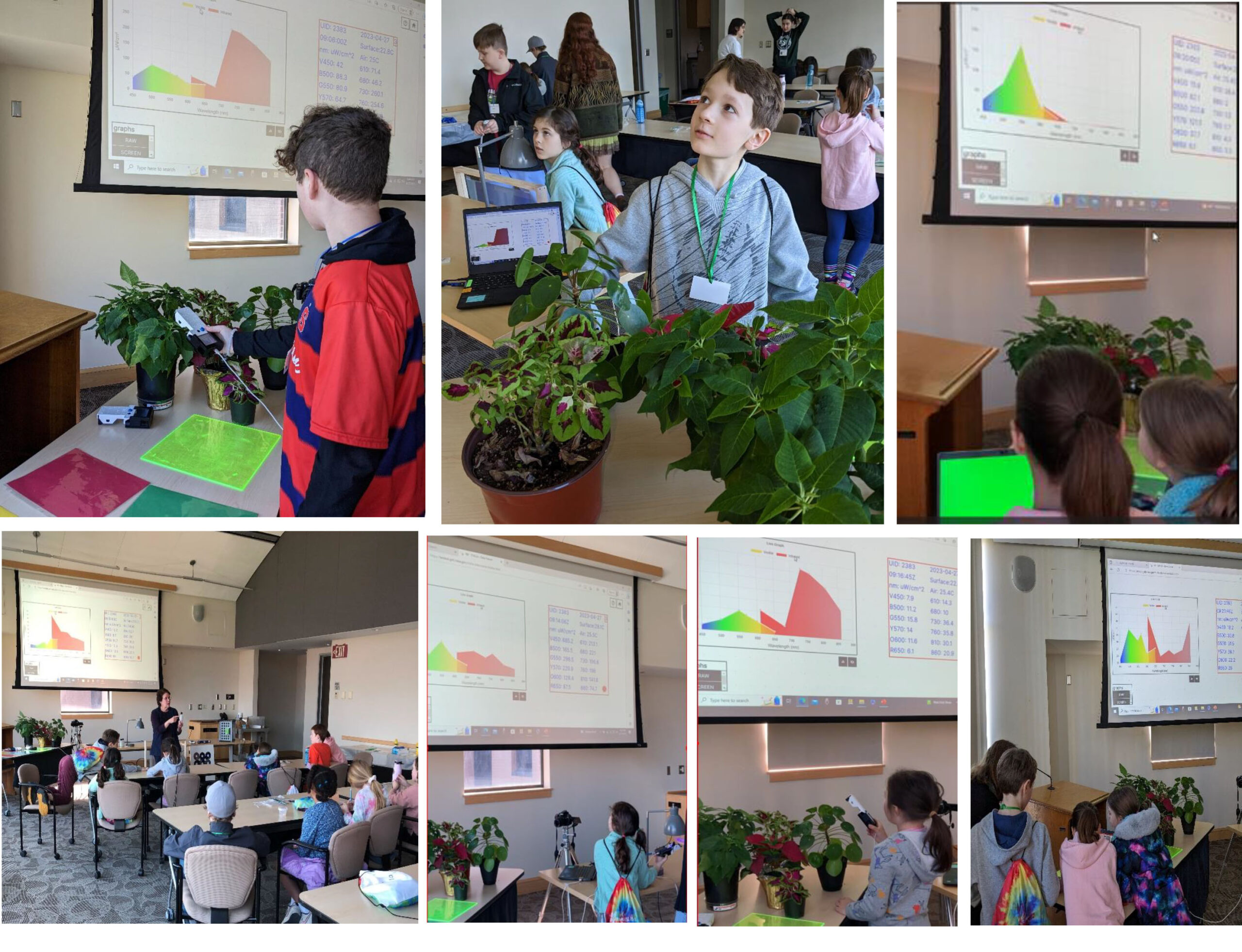
STELLA Spring Webinar: April 15, 2024
STELLA users will talk about their experiences using the DIY spectrometer during this webinar. Panelists include Bianca Cilento (RIT), Karen Karker (SUNY), and Peder Nelson (OSU and NASA GLOBE Observer).

Landsat 9’s Operational Land Imager 2: A Well-Known Instrument
Landsat 9’s OLI-2 instrument was characterized in unprecedented detail using a new laser-based method of in-band spectral response testing. A continuous relative spectral response dataset and pre-launch testing details have been published in a recent paper.
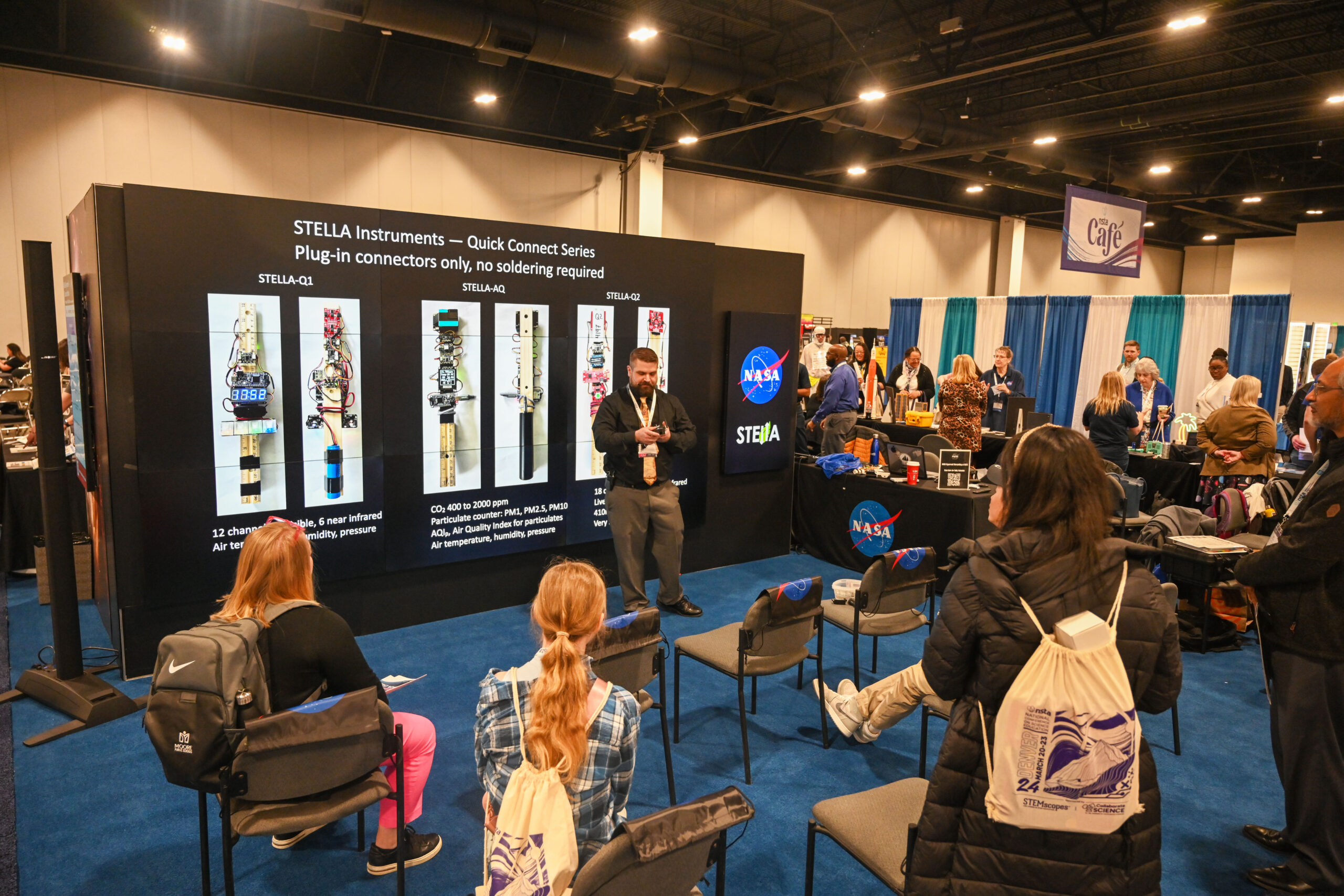
Bringing Earth Observations into Science Classrooms
Landsat outreach supported the NASA booth at the National Science Teacher’s Association annual meeting in Denver.
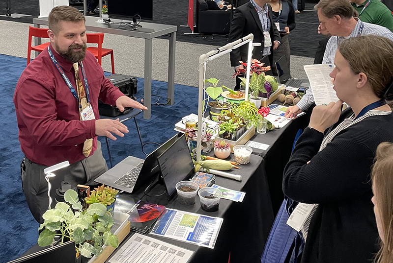
Commodity Classic: Landsat Supports Farmers and Food Production
Landsat was part of the NASA Earth Science presence at the 2024 Commodity Classic in Houston this year.
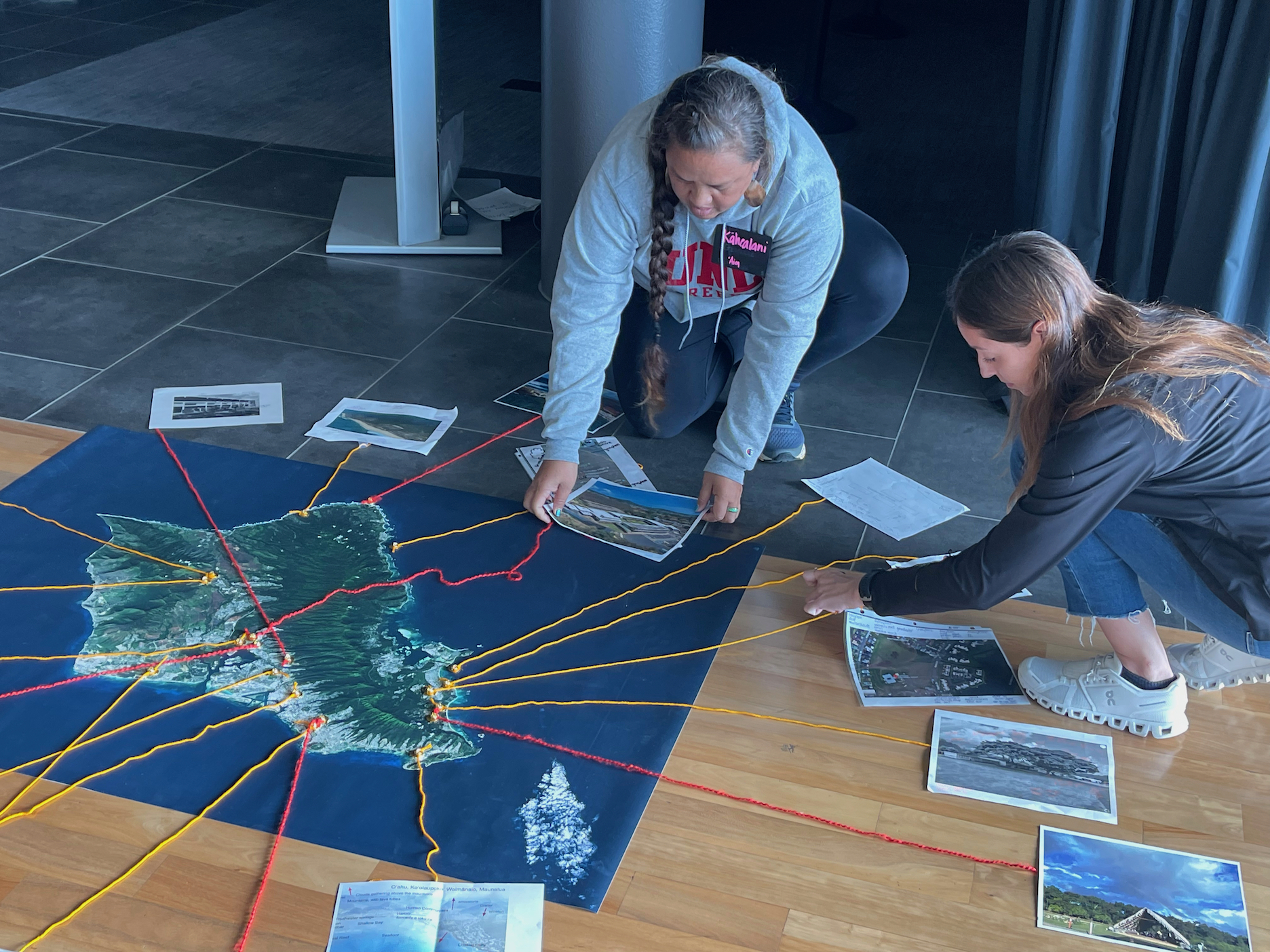
Landsat Goes to Hawaiʻi to Help Inspire Climate Change Connections
During two recent Earth to Sky Climate Science Education workshops, participants learned how Landsat imagery helps us assess changes in land cover and land use.
Landsat & LCLUC: Science Meeting Highlights
Outreach specialists from the Landsat Communications and Public Engagement team participated in community engagement efforts at the joint NASA and University of Maryland Land Cover Land Use Change (LCLUC) meeting.
Data in Harmony: NASA’s Harmonized Landsat and Sentinel-2 Project
NASA’s Harmonized Landsat and Sentinel-2 (HLS) project is a groundbreaking initiative that combines data from Landsats 8 & 9 with the European Space Agency’s Sentinel-2A & 2B satellites.
Scenes from the Polar Night
Landsat satellites have begun regularly acquiring images of ice at the poles during the winter, with enlightening results.
STELLA Spring Webinar: April 15, 2024
STELLA users will talk about their experiences using the DIY spectrometer during this webinar. Panelists include Bianca Cilento (RIT), Karen Karker (SUNY), and Peder Nelson (OSU and NASA GLOBE Observer).
Landsat 9’s Operational Land Imager 2: A Well-Known Instrument
Landsat 9’s OLI-2 instrument was characterized in unprecedented detail using a new laser-based method of in-band spectral response testing. A continuous relative spectral response dataset and pre-launch testing details have been published in a recent paper.
Bringing Earth Observations into Science Classrooms
Landsat outreach supported the NASA booth at the National Science Teacher’s Association annual meeting in Denver.
Commodity Classic: Landsat Supports Farmers and Food Production
Landsat was part of the NASA Earth Science presence at the 2024 Commodity Classic in Houston this year.
Landsat Goes to Hawaiʻi to Help Inspire Climate Change Connections
During two recent Earth to Sky Climate Science Education workshops, participants learned how Landsat imagery helps us assess changes in land cover and land use.
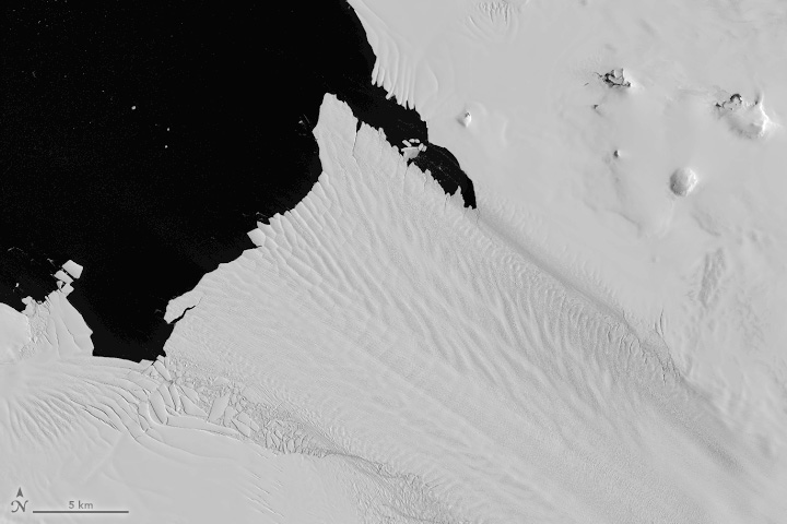
Antarctic History Revealed by Landsat
New research shows that while some Antarctic ice shelves have been thinning since at least the 1970s, widespread thinning accelerated in the 1990s.
Landsat & LCLUC: Science Meeting Highlights
Outreach specialists from the Landsat Communications and Public Engagement team participated in community engagement efforts at the joint NASA and University of Maryland Land Cover Land Use Change (LCLUC) meeting.
Data in Harmony: NASA’s Harmonized Landsat and Sentinel-2 Project
NASA’s Harmonized Landsat and Sentinel-2 (HLS) project is a groundbreaking initiative that combines data from Landsats 8 & 9 with the European Space Agency’s Sentinel-2A & 2B satellites.
Scenes from the Polar Night
Landsat satellites have begun regularly acquiring images of ice at the poles during the winter, with enlightening results.
STELLA Spring Webinar: April 15, 2024
STELLA users will talk about their experiences using the DIY spectrometer during this webinar. Panelists include Bianca Cilento (RIT), Karen Karker (SUNY), and Peder Nelson (OSU and NASA GLOBE Observer).
Landsat 9’s Operational Land Imager 2: A Well-Known Instrument
Landsat 9’s OLI-2 instrument was characterized in unprecedented detail using a new laser-based method of in-band spectral response testing. A continuous relative spectral response dataset and pre-launch testing details have been published in a recent paper.
Bringing Earth Observations into Science Classrooms
Landsat outreach supported the NASA booth at the National Science Teacher’s Association annual meeting in Denver.
Commodity Classic: Landsat Supports Farmers and Food Production
Landsat was part of the NASA Earth Science presence at the 2024 Commodity Classic in Houston this year.
Landsat Goes to Hawaiʻi to Help Inspire Climate Change Connections
During two recent Earth to Sky Climate Science Education workshops, participants learned how Landsat imagery helps us assess changes in land cover and land use.
Antarctic History Revealed by Landsat
New research shows that while some Antarctic ice shelves have been thinning since at least the 1970s, widespread thinning accelerated in the 1990s.
