Search
Close this search box.
Then and Now banner

Project Scientists

Landsat Project Scientists from NASA and USGS have played an important role in advancing the scientific achievements of the Landsat Program. Freden oversaw the work of over 100 Landsat 1 scientists (principal investigators) studying topics ranging from fault-mapping to urban sprawl.
Arrow-1972

Landsat 1 NASA Project Scientist Stan Freden stands next to a model of the Landsat 1 satellite (originally known as the Earth Resources Technology Satellite-1).

Arrow-2021

Landsat 9 Project Scientists Jeff Masek (NASA) and Chris Crawfold (USGS) stand next to the Landsat 9 rocket at the Vandenberg Space Force Base in September 2021, just before launch.

Masek and Crawford, led Landsat Science Teams that conducted cutting-edge Landsat-based research and helped define the sensor specifications needed for future Landsat satellites. Bruce Cook (Landsat Next) and Chris Neigh (Landsat 9) from NASA have recently joined Crawford as the latest Landsat Project Scientists.

Landsat Spacecraft

In the last 50 years, there have been four different types of Landsat spacecraft, better and better science instruments were carried on each new spacecraft generation.
1974 arrow
The Landsat 2 satellite in the clean room at General Electric’s former Space Division facility, Valley Forge, PA in 1974, a year before its launch. Photo credit: NASA/GE
2021 arrow
Removing a protective cover off of the Landsat 9 spacecraft at the Integrated Processing Facility at Vandenberg Space Force Base near Lompoc, CA. Photo credit: NASA/Randy Beaudoin
4 generations landsat usgs
Learn more about Landsat’s history and the four different types of Landsat spacecrafts in this video from our partners at USGS.

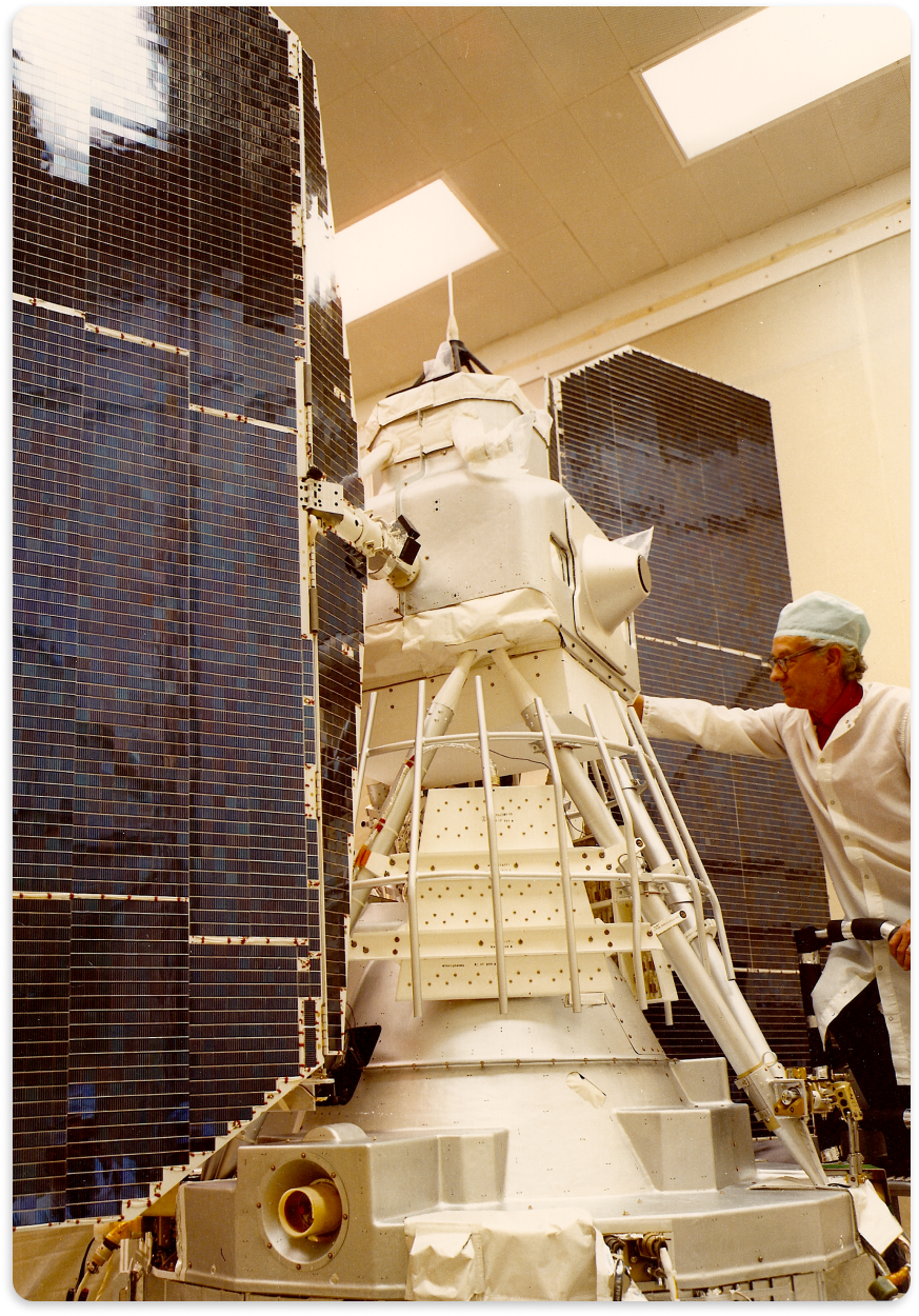
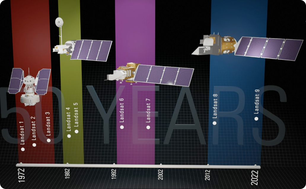
Landsat 1, 2, and 3 all flew on a borrowed spacecraft design from the Nimbus weather satellites. Described as “butterfly-shaped,” this was the only generation of Landsat spacecraft to have two solar panel arrays. Landsat 9, along with Landsat 8, flies on a fourth-generation Landsat spacecraft with a single solar wing.

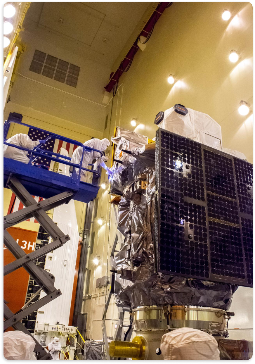
While Landsat spacecraft designs have evolved over the last five decades, they have all carried science-grade instruments and relied on solar panels to provide power on orbit.

Data in the Field

Collecting data in the field is an important part of the Landsat program. To ensure accurate and consistent Landsat measurements, scientists use a calibration process that includes comparing information collected on the ground with data collected by Landsat satellites.
arrow 2015

Landsat calibration scientist Joel McCorkel (right) and analyst Amit Angal take a calibration panel measurement with the SOLARIS (Solar, Lunar for Absolute Reflectance Imaging Spectroradiometer) instrument in California’s Algodones Dunes. Photo credit: NASA

arrow 1975

Taking a calibration panel measurement with a tripod-mounted Exotech 100 spectral instrument near Willison, North Dakota during a field campaign for the Landsat-based Large Area Crop Inventory Experiment (LACIE). Photo credit: LARS/Purdue University

Field work, calibration measurements, and government-academia teamwork are essential elements of the Landsat program.

LARS LACIE van
A boom-mounted Exotech 100 takes measurements over a field during a LACIE field campaign. Photo credit: LARS/Purdue University.

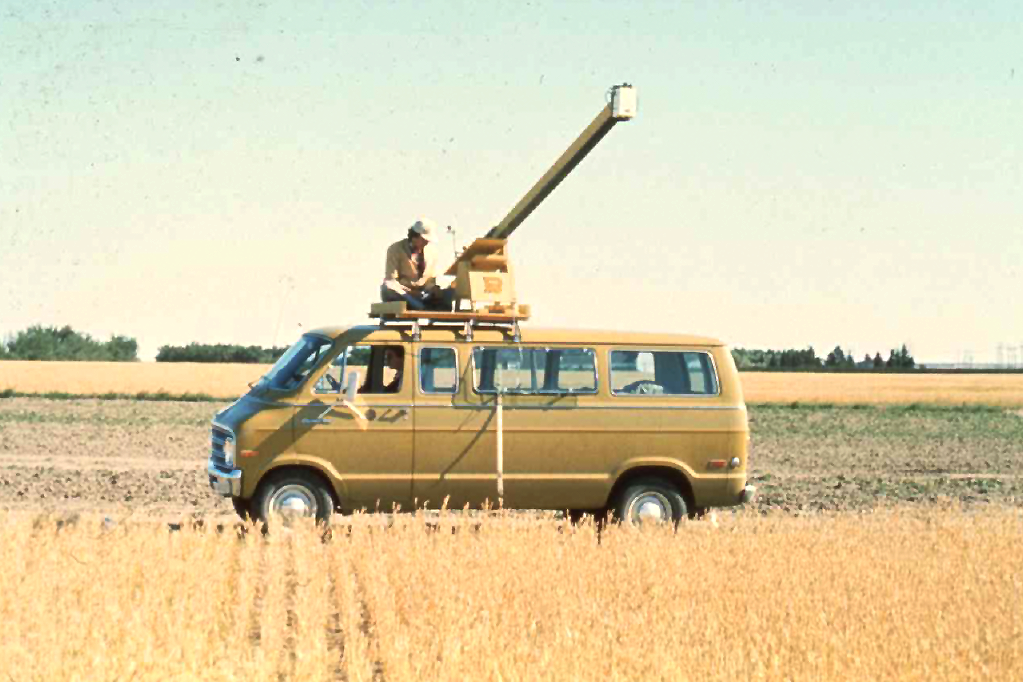
During the LACIE field campaigns of 1974-77, scientists from NASA, the U.S. Department of Agriculture, the Laboratory for Applications of Remote Sensing at Purdue University, the Environmental Research Institute of Michigan, Texas A & M University, and Colorado State University worked together to collect and analyze field measurement in three Midwest field locations in Kansas, North Dakota, and South Dakota. Field spectrometers were relatively new, as the field project plan explained, “The development in recent years of sensor systems capable of collecting high quality spectral measurements under field conditions now makes it possible to pursue investigations which would not have been possible a few years ago.”

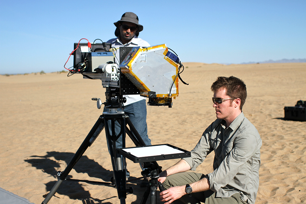
During the 2015 Algodones Dunes field campaign, scientists from NASA’s Goddard Space Flight Center, South Dakota University, the Rochester Institute of Technology, the University of Lethbridge, and the University of Arizona participated in a joint intercalibration study for missions including Landsat, MODIS, and CLARREO.

Mapping Reefs

Knowing near-shore ocean depth is important for ship navigation. Scientists have used Landsat data to help make seafloor measurements in clear, shallow waters since the mid-1970s.
1975

Jacques Cousteau and the NASA/Cousteau Bathymetry Experiment team aboard the Calypso. The team included astronaut Rusty Schweickart (second from left) and lead scientist Fabian Polycyn (in collared shirt). The experiment showed for the first time that ocean depths up to 72 feet could be measured by Landsat in clear waters. Photo credit: David Lychenheim

2022

NASA scientists Lola Fatoyinbo (foreground) and Nathan Thomas (in kayak) in Annapolis, Maryland. Thomas and Fatoyinbo are co-authors on a recent paper that shares an open source workflow for mapping ocean depth in shallow, clear waters using a combination of ICESat-2 lidar and Landsat 8 data. Photo credit: Lola Fatoyinbo/NASA

The science of satellite-derived bathymetry was born with the Landsat 1 and 2 missions. The same clear waters brought the NASA/Cousteau expedition to the Bahamas in 1975, are where bathymetry innovation continues with Thomas, his team, and ICESat-2.

Extreme Environments

Space can be a harsh environment, so Landsat satellites and instruments go through lots of testing before being launched.

On June 28, 1971, a little over a year before Landsat 1 launched, a mock-up of the Earth Resources Technology Satellite (ERTS-1)—Landsat 1’s original name—was tested in a spin test chamber at General Electric’s Space Division in Valley Forge, PA. Photo credit: NASA/General Electric

The Landsat 9 satellite coming out of thermal vacuum testing at Northrop Grumman’s facility in Gilbert, Arizona on April 5, 2021. For 42 days, the satellite was sealed in the chamber exposed to the hard conditions found in space including the extreme shifts in temperature that occur as the satellite goes between sunlit and shadowed portions of its orbit. Photo credit: Northrop Grumman

Landsat satellites carry science-grade instruments onboard. Exposing a science-grade instrument to the harshness of space and the extreme shaking of blast-off takes lots of forethought and planning. Landsat satellites are subjected to acoustic, vibration, and electromagnetic interference tests to ensure the spacecrafts can survive the rocket ride into space and their instruments can return meaningful science measurements to the ground.