
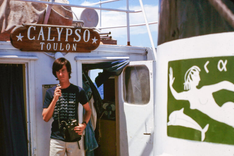
Leaving from Nassau on a Tuesday night in late August 1975, Jacques Cousteau, his divers, and a team of scientists set out on the Calypso for a three-week expedition to determine if the young Landsat satellite mission could measure the depth of shallow ocean waters.
For days, the Calypso played leap frog with the Landsat 1 and 2 satellites in the waters between the Bahamas and Florida, sailing 90 nautical miles each night to be in position for the morning overpass of the satellite.
Ultimately, research done on the trip determined that in clear waters, with a bright seafloor, depths up to 22 meters (72 feet) could be measured by Landsat.
This revelation gave birth to the field of satellite-derived bathymetry and enabled charts in clear water areas around the world to be revised, helping sailing vessels and deep-drafted supertankers avoid running aground on hazardous shoals or seamounts.
The joint NASA–Cousteau expedition that sparked these actions was a highly coordinated endeavor.
Participants included an Apollo 9 astronaut, a president’s son, scientists from NASA, three universities, the Defense Mapping Agency, and the U.S. Coast Guard. The experiment involved the coordination of two research vessels, a T-38 jet, and 13 different satellites for weather, communications, and imagery.
“It was a tremendous example of how modern tools of scientists can be put together to get a better understanding of this globe we live on,” the Deputy NASA Administrator, George Low, said of the expedition in a 1976 interview.
But it couldn’t have happened without the world’s most famous aquanaut, Jacques Cousteau, his team of expert divers, and the Calypso.
Astronauts and Aquanauts Together
The ocean’s vastness made Cousteau an early supporter of satellite remote sensing.
Cousteau, a decades-long oceanographer, was keenly aware that ocean monitoring from above would be necessary to understand the ocean as part of the interconnected Earth system and to raise the awareness requisite for protecting the sea. There was a growing recognition in the 1970s that helping the planet required understanding the planet.
“Everything that happens is demonstrating the need for space technology applied to the ocean,” Cousteau said during a 1976 interview at NASA Headquarters.
George Low, the Deputy NASA Administrator, himself a recreational diver, connected Jacques Cousteau with former Apollo 9 and Skylab astronaut Russell Schweickart. Schweickart was heading up NASA’s User Services division and both he and Cousteau were looking for ways to advance Earth science.
At the time, it was theorized that the new Landsat satellites might be useful for measuring shallow ocean waters. New deep-drafted supertankers were carrying crude oil around the globe and to avoid environmental catastrophes it had become important to know where waters in shipping lanes were less than 20 meters (65 feet).
To establish if Landsat could accurately measure ocean depth from space, simultaneous measurements from ships, divers and the satellite were needed.
Schweickart knew a coordinated bathymetry expedition was an essential step. He had honed his diving expertise while training for his Skylab mission in NASA’s water immersion facility and was enthusiastic about scuba work. Teaming with Cousteau was a natural fit.
Chasing Satellites
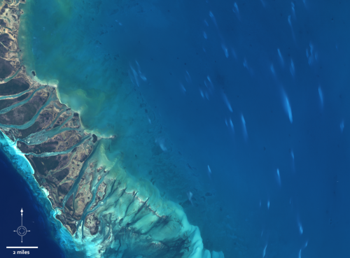
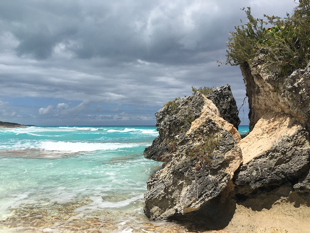
An elaborate experiment was designed to determine definitively if multispectral data from the Landsat satellites could be used to calculate water depth. The clear waters of the Bahamas and coastal Florida were selected as the test site.
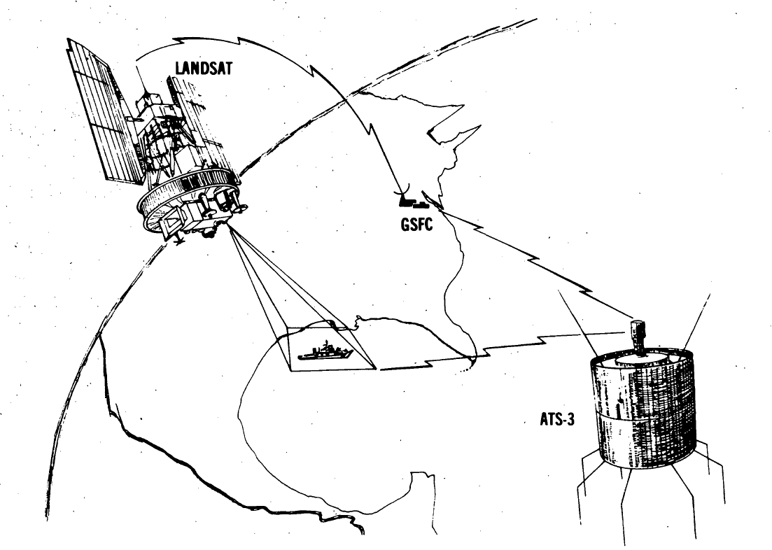
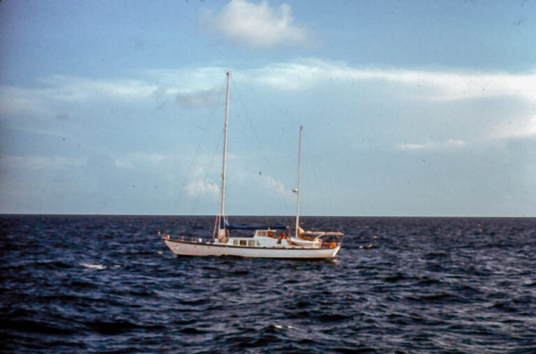
The experiment design involved two research vessels, the Calypso and Johns Hopkins University Applied Physics Lab’s Beadonyan, being in position, or “on station,” when the Landsat 1 and 2 satellites went overhead on eight different days (four consecutive days on each of two weeks).
The overall concept was simple: the research ships would use their fathometers to measure water depth at the exact same time that the satellite flew overhead and then
those measurements would be compared (the simultaneous measurements eliminated any environmental or atmospheric differences that could have complicated comparisons), but realizing that plan took extraordinary coordination.
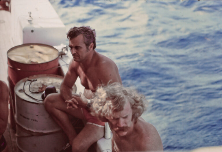
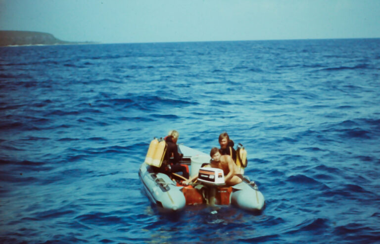
As the Landsat satellite flew overhead, Cousteau and his team of divers made a series of carefully timed measurements of water clarity, light transmission through the water column, and bottom reflectivity. This was done both near the Calypso and at two sites 60 meters from the Calypso using small motorized Zodiac rigid inflatable boats.
To make the light transmission measurements, two teams of divers had to use a submarine photometer to measure light at the water’s surface, one meter under the water and in 5-meter increments to the bottom (down to 20 meters).
The divers had to hold the photometer in a fixed position looking up and cycle through four different measurements. They also used specially filtered underwater cameras to measure bottom reflectivity (assisted by gray cards for reference). Everything was carefully timed and Schweickart and President Gerald Ford’s son Jack helped with these underwater measurements.
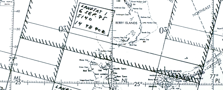
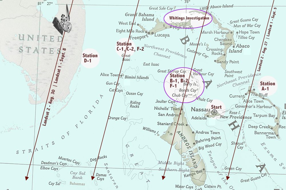
After a day of trial measurements in the waters around Nassau on August 26, 1975, the Calypso set sail for the first “rendezvous spot” with Landsat 2, just north of Eleuthera Island, traveling 90 nautical miles (nm) to be “on station” for the 10:30 a.m. overpass.
The 90 nm journey was repeated again Wednesday night so that the Calypso was “on station” at the prime test site, on the northernmost Great Bahama Bank just west of the Berry Islands on Thursday, August 28. Measurements were again repeated 90 nm away the next day near Little & Great Isaac Cays and the coast off of Hollywood, Florida the following day. Similar measurements were repeated two weeks later as Landsat 1 flew over.
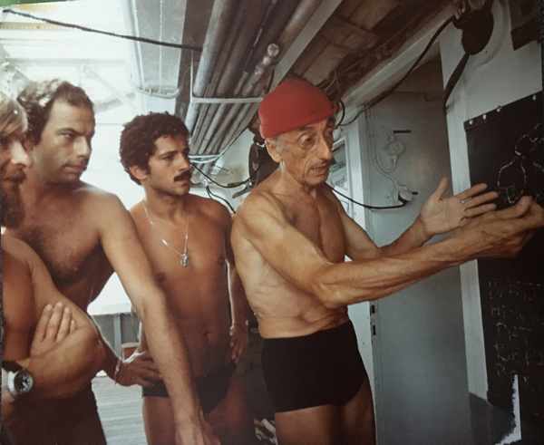
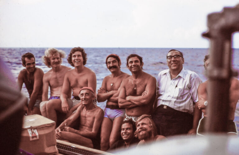
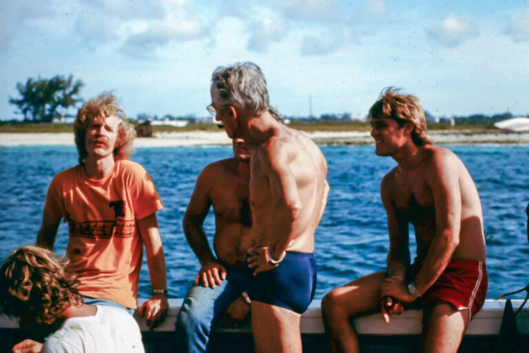
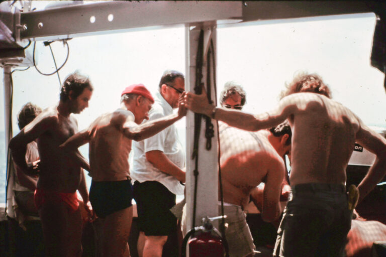
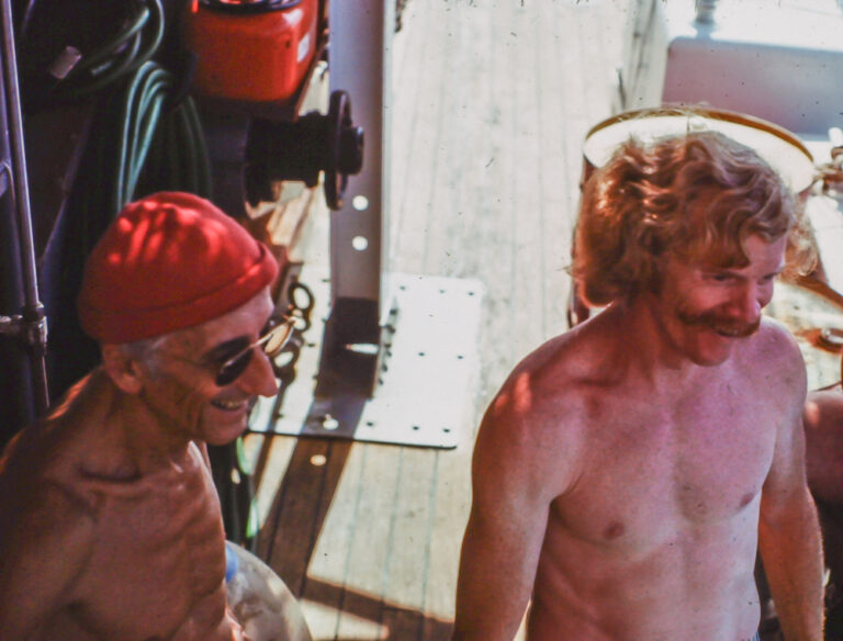
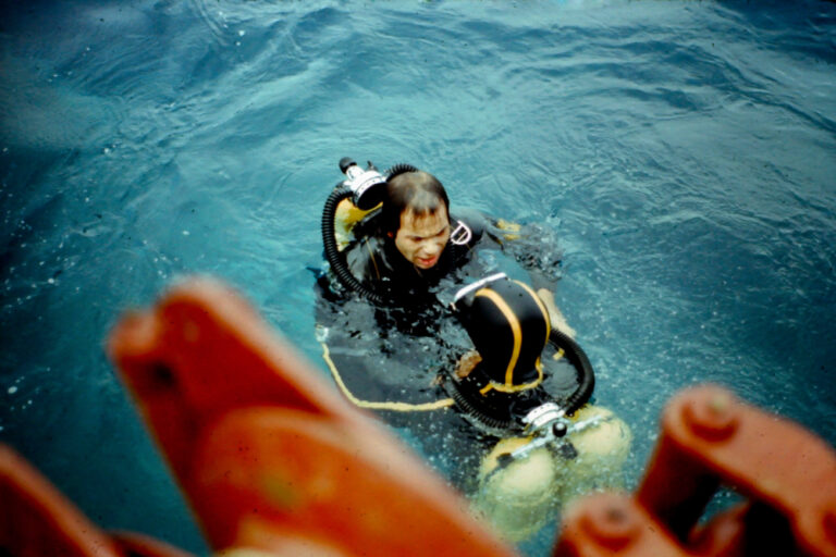
To make the precision measurements, the skill of the divers was essential. A photograph taken onboard the Calypso during the expedition shows Cousteau explaining the experiment protocols to his team of divers.
His chief diver, Bernard Delemotte (right, and on left edge of the top photo) shared his memories of the expedition.
“I was in charge of the divers,” Delemotte explains. “We were very convinced that we could do serious work together [with NASA].”
Before the satellite overpass, the Calypso and Beayondan were in position, anchored side-by-side, and ready to make all specified measurements.
“Two small Zodiacs left from the Calypso just before the satellite passage,” Delemotte recalls.
The Zodiacs stationed themselves 60 meters (200 feet) from the Calypso and at the moment that the satellite was overhead someone on the Calypso would call to the divers through the portable VHF radio: “Go now!”
The divers would then start the series of prescribed measurements.
Using these measurements, scientists developed mathematical models describing the relationship between the satellite data (signal voltage) and water depth, accounting for how far the light could travel through water (its clarity) and how reflective the ocean floor was (how much of the light that made it to the seafloor would bounce back for the satellite to “see”). In shallow waters around the world where water clarity and seafloor reflectance conditions were sufficient, these models were used to calculate water depth and correct outdated nautical charts.
“Particular thanks” was given to Cousteau’s team of divers in the experiment’s final report “for their dedication and expertise in the underwater phases of the experiment, without which, measurements of key experimental parameters could not have been made.”
The Whiting Investigation
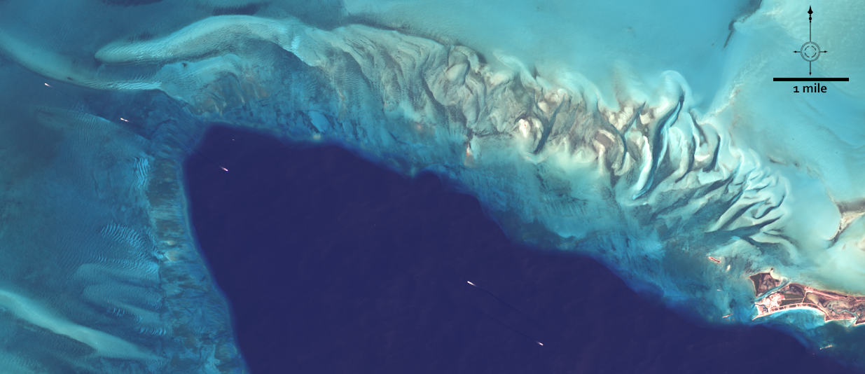
Mysterious white patches sometimes showed up on Landsat images. Researchers wanted to know more about these transient bright features since they could be mistaken for shoals if a single Landsat image was being used to measure sea depth.
These ephemeral patches of light-colored water recorded by Landsat were captured “whiting” events.
Sailors who have encountered whitings up-close have long described them as the sea seemingly turning into milk.
Whitings happen when fine-grained calcium-carbonate becomes suspended in the water. They’ve been recorded in lakes, the Persian Gulf, and coastal waters of southern Florida, but they are found nowhere more frequently than the Bahamas.
The milky stretches of water can be kilometers long and take days or weeks to dissipate.
Since the 1930s, scientists have been trying to determine their origin. Nearly a hundred years later, it’s still being debated.
Despite the heavy research emphasis on the bathymetry measurements during the 1975 expedition, a one-day side investigation into these whiting events was by far most memorable for Delemotte.
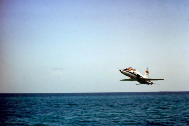
On Friday, September 5, 1975, Delemotte and his divers were part of an experiment led by Texas AMU researcher John Hill to try and track the origin of two whitings north of Grand Bahama Island on the Little Bahama Bank.
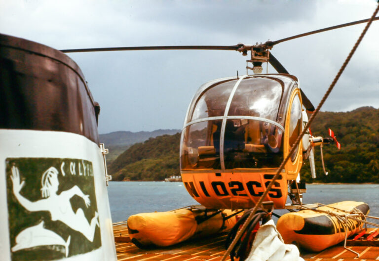
To initially find the whitings, a T-38 jet was deployed to scan the area. After finding an area with telltale elongated white patches, the location was relayed to the Calypso and its helicopter was then used to direct the vessel there.
“I remember we were really intrigued at the time, during our observations, suddenly there appeared folds of suspended sand at the surface,” Delemotte recalled about sailing into the whitings. The whitings reminded him of river sediments plumes, but there was no river.
With the Calypso anchored in the midst of a whiting, its helicopter would help find the source and direct divers to that location.
At the first whiting the Calypso helicopter witnessed billowing-like clouds of white-colored water rising towards the surface. “Quite possibly the first actual observation of the evolution of a non-man-induced whiting in the middle of a shallow bank,” according to the expedition report.
Zodiacs, each carrying three people, would make measurements at the whiting source, tail, and in adjacent clear waters. The small boats were used because of their speed, maneuverability, and they were less disruptive to any sea life below.
At each site, water samples were taken and series of measurements—water clarity (using a secchi disk), water temperature, and salinity—was made by the Zodiac teams.
One diver would dive-in to make horizontal visibility observations below the surface and to take a bottom sample if the depth was less than 20 meters. They also made observations of what was found on the seafloor.
Delemotte was one of those divers.
At the source area of the first whiting the water was clear for the top two meters, but below that the water was turbid all the way to the bottom.
Delemotte recalls the visibility changing rapidly as he dove down. Suddenly there would be “nothing—no visibility at all,” he describes.
But he wasn’t alone.
Several sharks were swimming in the area and it was recorded in the report that “one shark even took a swipe at a diver’s flipper.” Delemotte explained that one of the sharks bit at his scuba diving fins. He said encountering sharks was always a little startling, but for Cousteau’s divers it wasn’t uncommon.
Previous investigators were known to not enter other whitings for just such a reason, the report described.
Delemotte also observed a large school of bone fish swimming near the bottom. It was reported that the large sharks or fish could have created turbulence causing the whiting and it was hypothesized that perhaps the bonefish presence had attracted the sharks.
Delemotte also noted Callianassa mounds (burrows created by mud shrimp) six to ten centimeters-tall on the seafloor at the source.
In the middle of that first whiting, close to where the Calypso was anchored, another diver observed sediments spewing a meter high from Callianassa mounds. The mounds, resembling mini-volcanos, were also present at the source of the second whiting, but nothing was observed emanating from those mounds and nothing else out of the ordinary was found—no sharks, no schools of fish, no shrimp.
In the end, no singular source mechanism could be definitively established. While the quest to find the cause for whitings wasn’t ultimately realized, Hill could report that “The excellent naturalistic instincts and experience of Captain Cousteau’s divers made it possible for several new and interesting observations.”
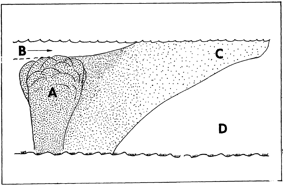
Because of their diving expertise, Delemotte and his team were able to the make necessary observations in the disorienting no- and low-visibility conditions. Thanks to the measurements made, a diagram showing the vertical profile of the whitings was created.
The expedition added to the body of knowledge about the mysterious phenomena. But, debate about the origins of whitings goes on to this day.
References:
Barker, John, Charles Bohn, Locke Stuart, and John Hill. 1976. Landsat Digital Data Processing: A Near Real-Time Application. NASA Report.
Broecker, W.S., A. Sanyal, and T. Takahashi. 2000. “The origin of Bahamian whitings revisited.” Geophysical Research Letters 27 (22):3759-3760.
Brun, Nancy L., and Eleanor H. Ritchie. 1979. Astronautics and Aeronautics, 1975: A Chronology. Washington, D.C.: NASA.
Cousteau, Jacques, Russel Schwelckart, George Low. 1976. Jacques Cousteau at NASA Headquarters: The Space Colonies Idea 1967-1977. Edited by Stewart Brand.
Delemotte, Bernard. 2019. Cousteau Article Bernard Delemotte Interview. Edited by Valerie Casasanto.
Department of the Interior. 1976. “Remote Sensing and Advanced Techniques.” In Geological Survey Research 1976, edited by Thomas S. Kleppe and V.E. McKelvey, 276-283. Washington, D.C.: U.S. Government Printing Office.
Jurek, Richard. 2019. The Ultimate Engineer: The Remarkable Life of NASA’s Visionary Leader George M. Low. Lincoln, Nebraska: University of Nebraska Press.
Lloyd, Ryan Allen, Remote Sensing of Whitings in the Bahamas. University of South
Florida Graduate Theses and Dissertations.
Long, Jacqueline S., Chuanmin Hu, and Mengqiu Wang. 2018. “Long-term spatiotemporal variability of southwest Florida whiting events from MODIS observations.” International Journal of Remote Sensing 39 (3):906-923. doi: 10.1080/01431161.2017.1392637.
Long, Jacqueline S., Chuanmin Hu, Lisa L. Robbins, Robert H. Byrne, John H. Paul, and Jennifer L. Wolny. 2017. “Optical and biochemical properties of a southwest Florida whiting event.” Estuarine, Coastal and Shelf Science196:258-268. doi: https://doi.org/10.1016/j.ecss.2017.07.017.
Martinez, Andrew B., Richard T. Joy, Maria K. Kalcic, Greg Terrie, and Sephen P. Haimbach. 1988. “Adaptative estimation of water depth using multispectral remote sensing.” Ocean Optics IX.
Polcyn, Fabian C. 1976. NASA/Cousteau Ocean Bathymetry Experiment: Remote Bathymetry Using High Gain Landsat Data. Greenbelt, MD: NASA.
Purkis, Sam, Amanda Oehlert, Peter Swart, Thomas Dobbelaere, Emmanuel Hanert, and Paul Harris. 2019. “Ocean Chemistry and Hydrodynamics as Controls of Mud Production on Great Bahama Bank.” 2019 AAPG Annual Convention and Exhibition, San Antonio, Texas, May 19-22, 2019.


