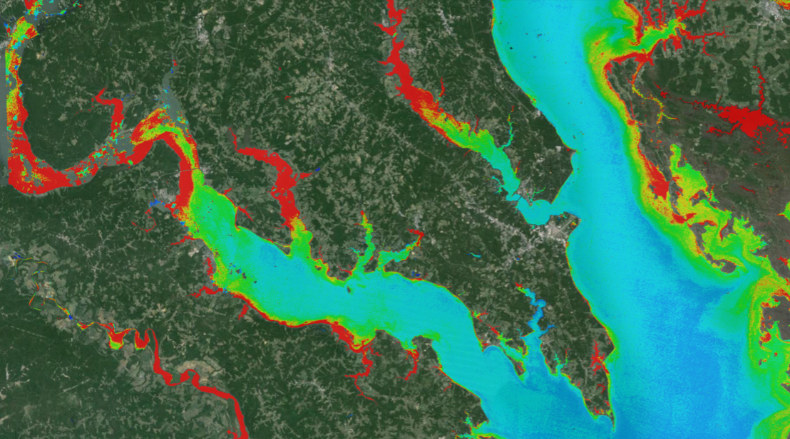
New Tool Provides Rapid Evaluation of Water Quality
A combination of Landsat and Sentinel-2 imagery, NASA near real-time data, and machine learning provides near real-time access to high-resolution water quality maps.

A combination of Landsat and Sentinel-2 imagery, NASA near real-time data, and machine learning provides near real-time access to high-resolution water quality maps.

In the FY23 Aeronautics and Space Report released on May 23, 2024, a multitude of Federal agencies report work informed by Landsat data.
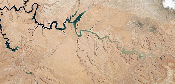
More water is taken from the Colorado River than it has to give. Better water use accounting made possible by Landsat provides needed guidance for difficult water use decisions.
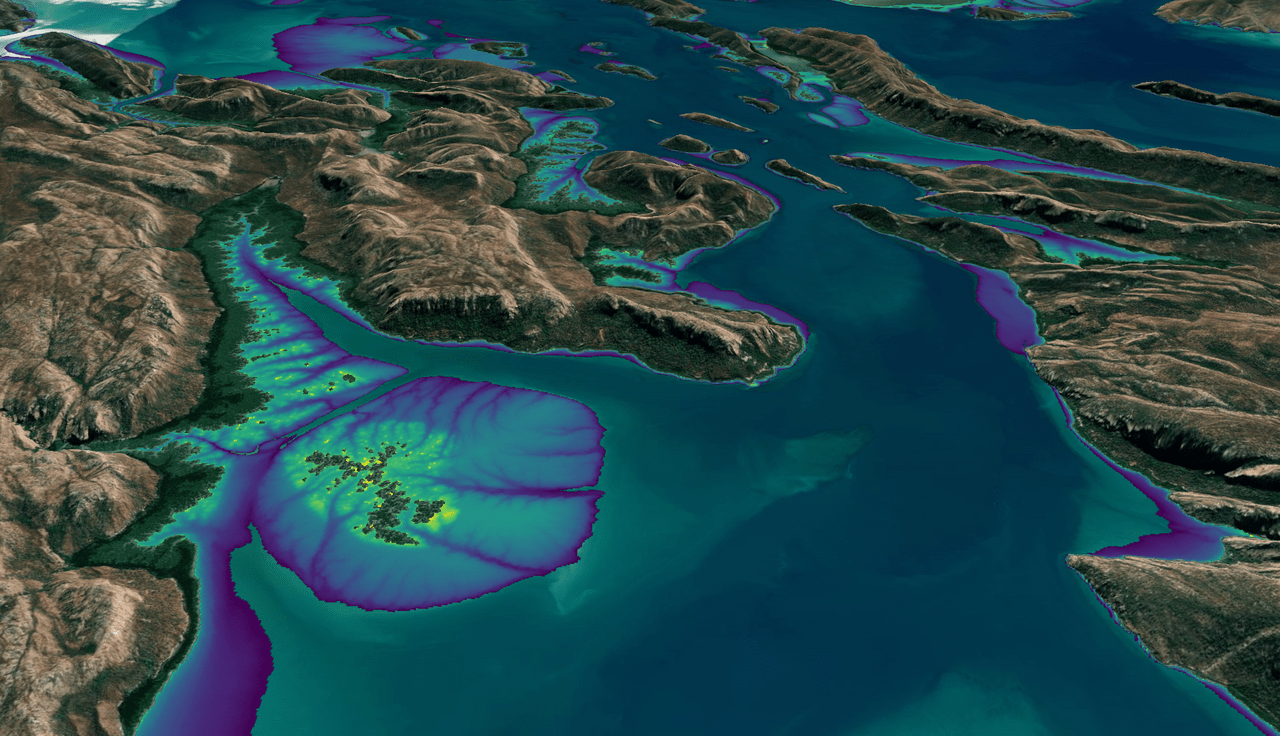
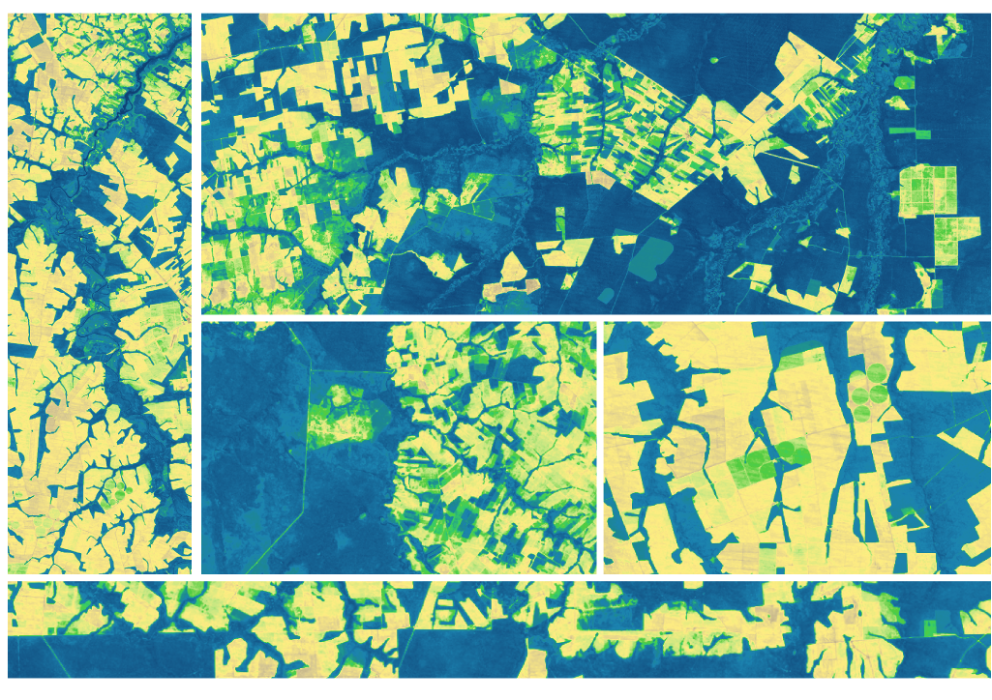
This month, the Digital Earth Australia (DEA) team released a new Landsat and Sentinel-2 based intertidal data product. The new data set characterizes the tidal shoreline zone of Australia in more detail than ever before.
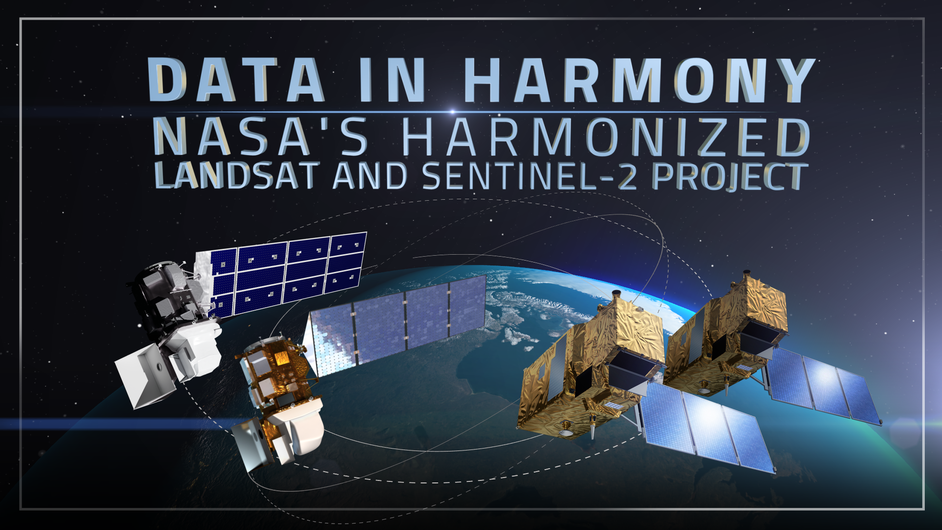
NASA’s Harmonized Landsat and Sentinel-2 (HLS) project is a groundbreaking initiative that combines data from Landsats 8 & 9 with the European Space Agency’s Sentinel-2A & 2B satellites.
The research teams who help sustain the largest freshwater reserve in the world are developing a new tool to promote more resilient farming systems in Brazil. The goal is to help farmers better handle changes in the water cycle, deal with droughts, and adapt to a changing climate.
A delve into Landsat-based studies revealing the environmental impact of river mining, the decline in global lake water levels, and the risks of rising sea levels on coastal habitats. Plus, a sneak peek at what the future of the Landsat program holds with the introduction of Landsat Next.
As the world looks for sustainable solutions, a system tapping into Landsat data for water management has passed a critical test.
A new, comprehensive analysis of satellite data finds that majority of glaciers on the landmass have retreated significantly.

The Pale Blue Dot Visualization Challenge—aimed at making Earth observation data accessible to everyone—has officially kicked off.
While floating algae, emergent aquatic vegetation, and historic surface scum can be tracked throughout the Landsat record, researchers warn data users that older Landsat sensors lack the precision needed to be used for water-column studies.
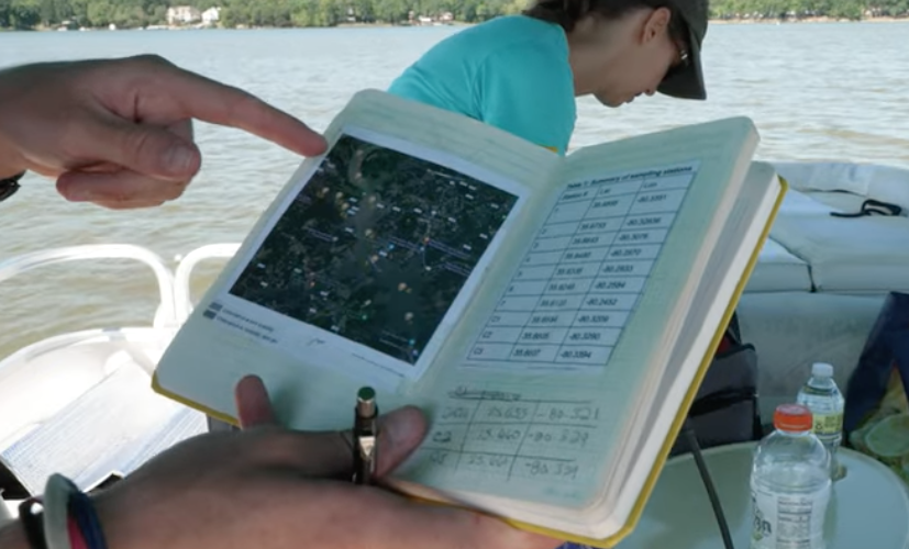
Safeguarding freshwater resources is crucial, and while scientists use a variety of ground-based techniques to gauge water quality, the Landsat program has provided water quality data from orbit for decades.
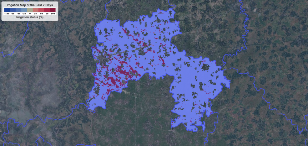
Satellite data are providing information to Bangladeshi farmers about how much water they are using, how much they have, and how much their crops need.
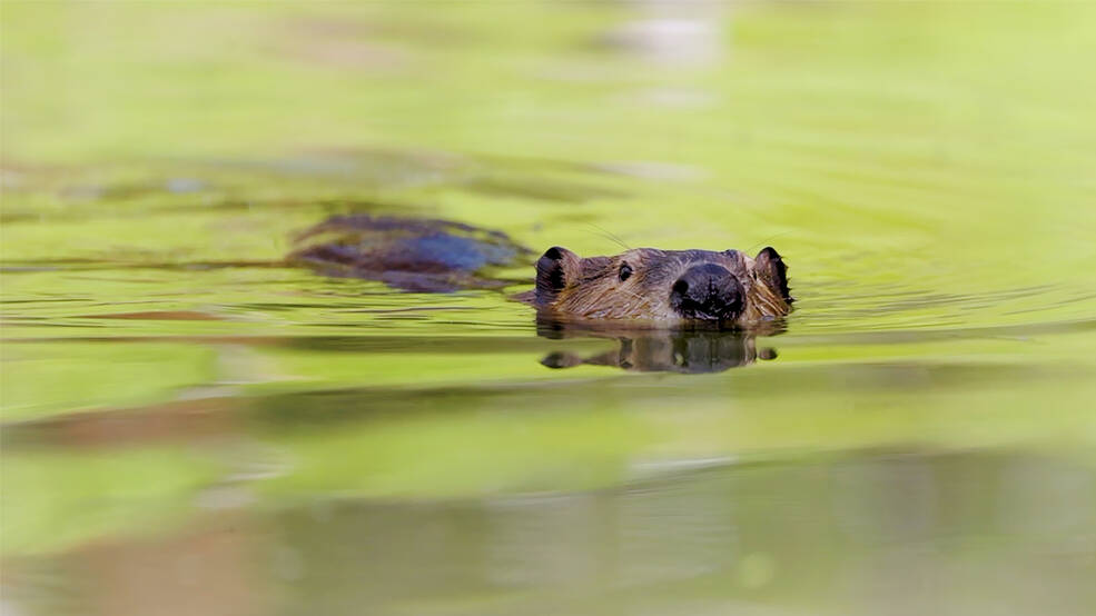
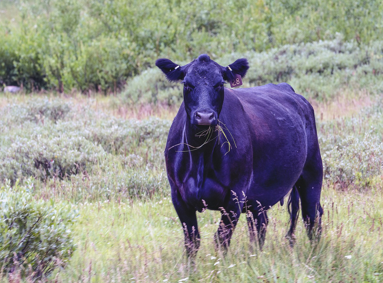
Satellites like Landsat are quantifying how beavers can have an outsized and positive impact on local ecosystems.
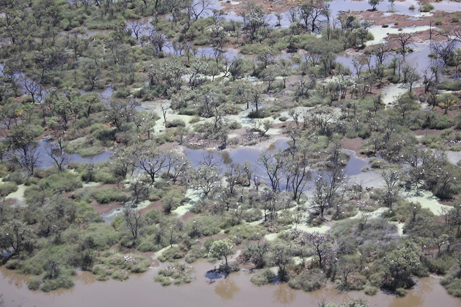
Practitioners managing the wellbeing of wetlands have a new tool at their disposal. The Wetland Insight Tool, developed by Geoscience Australia, provides a visual summary of 35+ years of wetland dynamics.
Landsat 8 very nearly flew without a thermal infrared sensor. This is the backstory of how TIRS made it onto Landsat 8.
Merging data from multiple satellites, OPERA can help government agencies, disaster responders, and the public access data about natural and human impacts to the land.
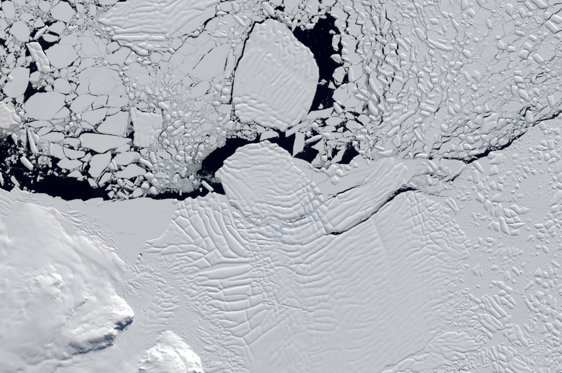
An international team of researchers has combined satellite imagery and climate and ocean records to obtain the most detailed understanding yet of how the West Antarctic Ice Sheet – which contains enough ice to raise global sea level by 3.3 metres – is responding to climate change.
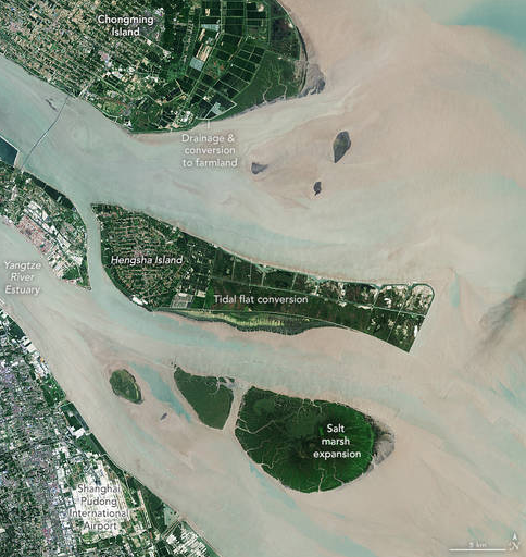
The world has lost 561 square miles (1,453 square kilometers) of salt marshes over the past 20 years.
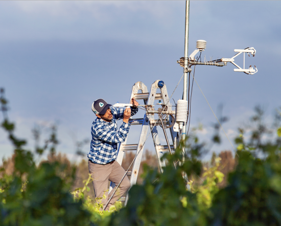
Satellites offer a wealth of information pertinent for water and food security. Landsat has long been a foundational piece of the “Space for Ag” initiative.
New research uses Landsat observations and advanced computing to chronicle wetlands lost (and found) around the globe.
Nestled in the science-based information that park rangers share with visitors to Glacier Bay National Park and Preserve are insights from Landsat satellites and NASA climate scientists.

Airborne Snow Observatories, Inc. uses higher-resolution snow cover data from Landsat to update their model snow cover.
More frequent satellite observations, such as those of the Harmonized Landsat Sentinel-2 (HLS) dataset, are needed to fully capture flood dynamics in regions experiencing short-lived, ephemeral flooding.
After 50 years of Landsat, discovery of new commercial and scientific uses is only accelerating.
An analysis of over a million Landsat images has revealed that 4,000 square kilometres of tidal wetlands have been lost globally over twenty years.
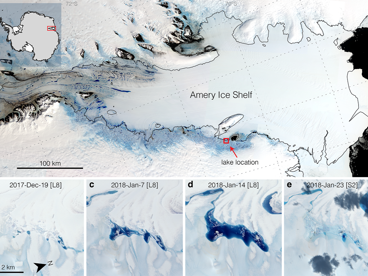
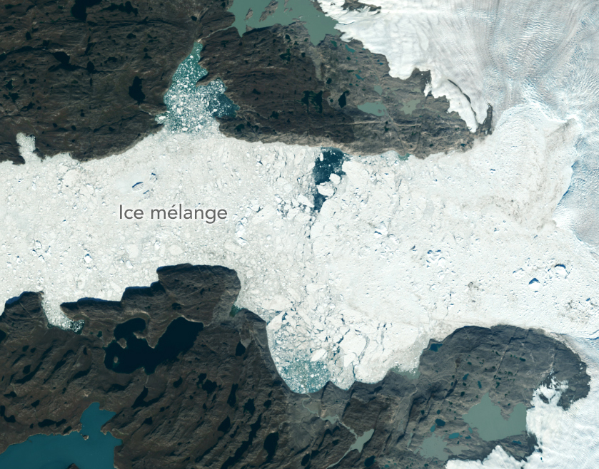
Satellites have helped show that strong tidal activity may facilitate water-induced fracturing, or hydrofracturing, where land ice transitions to floating ice shelf and cause the meltwater lake to drain quickly, often in as little as several days.
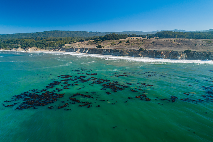
The Landsat-informed kelpwatch.org hosts the world’s largest open-source dynamic map of kelp forest canopy.
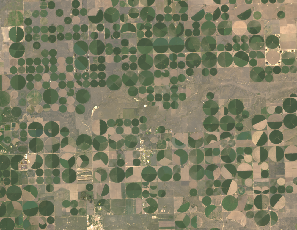
BBC’s Follow the Food documentary series has reported on Earth observations supporting food production, market stability and on-farm decisions.
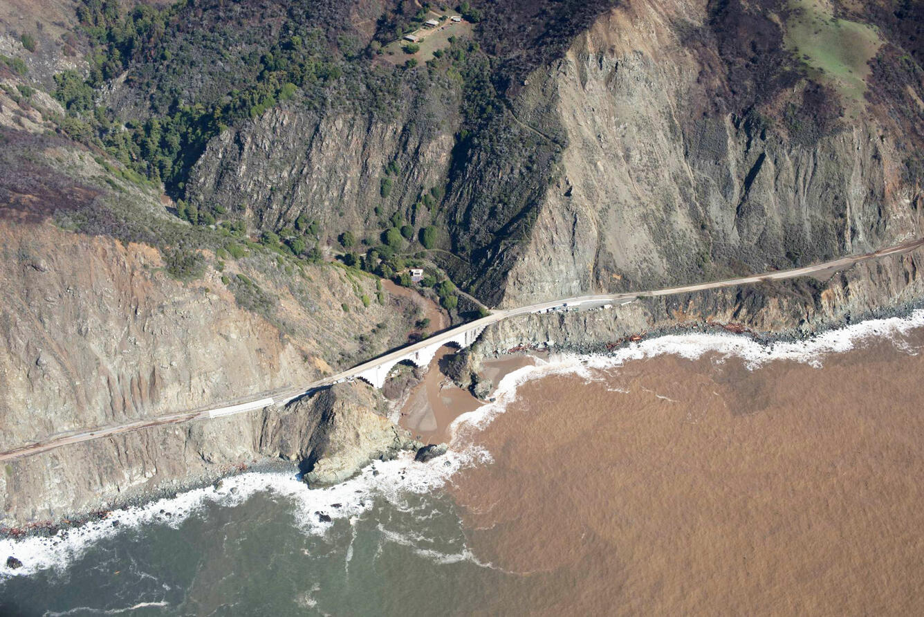
A new study combines decades of Landsat and Sentinel-2 imagery with hydrologic and oceanographic data to look at how changes on land affect coastlines in Big Sur, California.
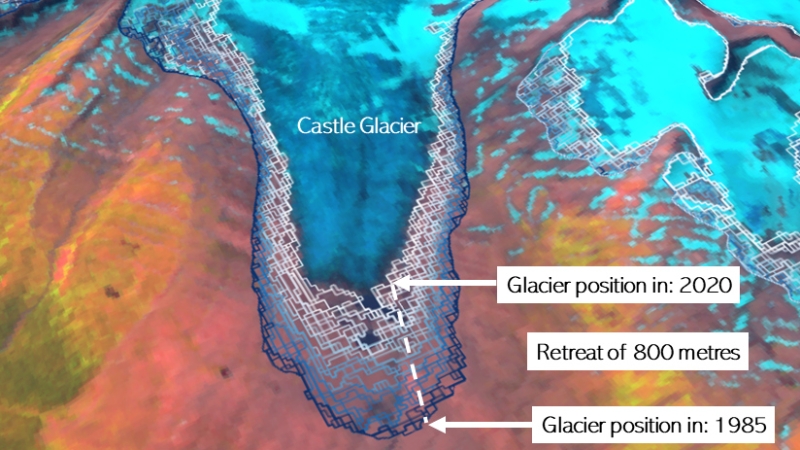
A new mapping tool developed by UNBC researchers shows that western Canadian glaciers are shrinking at an increasing rate.
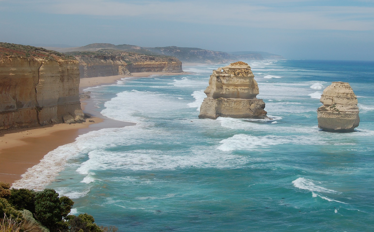
Using decades of Landsat satellite imagery, scientists at Geoscience Australia have mapped annual shoreline locations for the entirety of Australia going back more than thirty years.
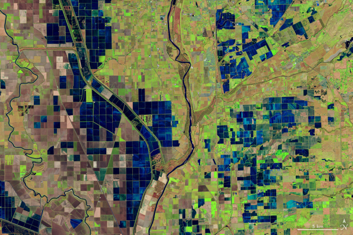
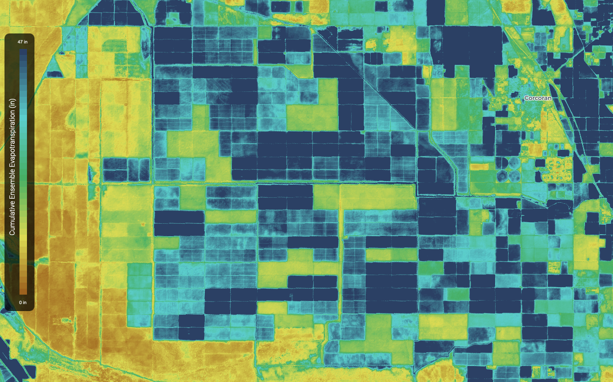
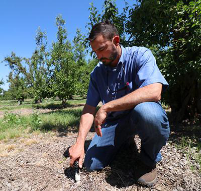
Data from Landsat powers OpenET, a new web-based platform that puts water use information for 17 western United States into the hands of farmers, water managers and conservation groups.
