
August 02, 2021 • For over 30 years, Dr. Beach, aka Dr. Stephen Leatherman, a professor and coast geomorphologist at Florida International University, has created a Top 10 Beach list based on criteria including water and sand quality, safety, and management. You can find his 2021 picks here and see how Landsat views them as well.
What’s your favorite beach?
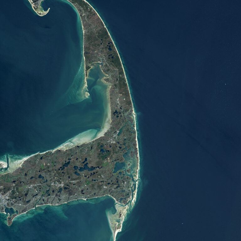
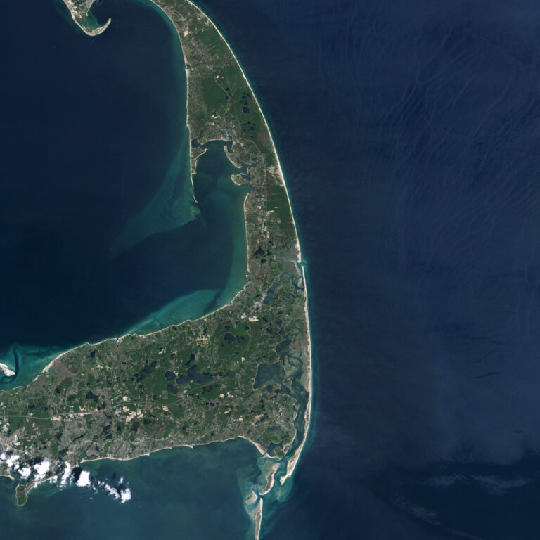
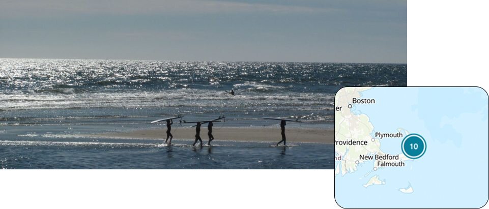
10. Coast Guard Beach
Coast Guard Beach is located just north of Nauset Inlet on Outer Cape Cod, Massachusetts. This inlet was first mapped by Champlain in 1605 as inlets were vitally important in terms of off-loading ships and setting the flag of the country of origin.This beach is located at the point where the glacial sea cliffs transcend into a barrier beach (e.g., sand spit) that provides protection for the lagoon and development of lush salt marshes. The inlet is not navigable except with small boats and changes it orientation and even position over time as clearly shown on Landsat imagery.
“In my early days as a Professor at Boston University and later at the University of Massachusetts at Amherst, I spent many summer and some winter-time days conducting scientific studies along this barrier beach.”
– Dr. Beach
Landsat 5 image acquired June 15, 1985 (left); Landsat 8 image acquired May 1, 2021 (right).
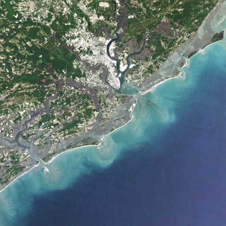
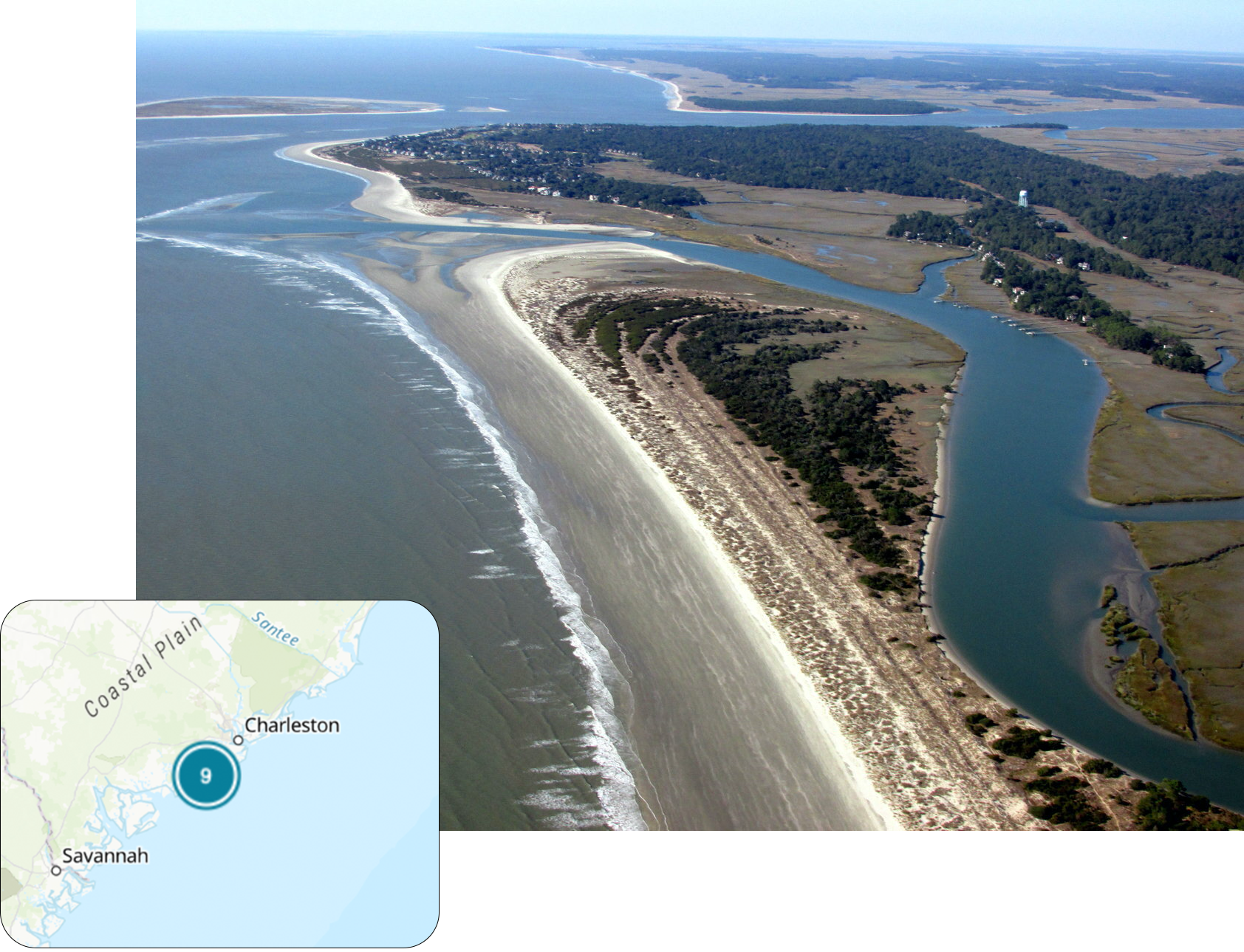
9. Beachwalker Park
Beachwalker Park is a public beach located on the southern part of Kiawah Island, South Carolina. This barrier island in the Charleston area is 10-miles long and features a fine grained, hard-packed beach that can be traversed easily by bicycle.
The island is bounded by two major inlets with Folly Beach to the north and Seabrook Island to the south. The strong ebbing (outgoing) tidal currents through the two permanent inlets result in the large sandy shoals in the Atlantic Ocean. These large sandy shoals at the inlets control the sand supply along this series of barrier islands and are continuously changing as well demonstrated on time-lapse Landsat imagery.
This Landsat image also shows that the bay is completely filled with salt marshes, making the area highly productive for seafood.
“In the early 2000s, I served as the beach consultant to the Town of Kiawah Island because their world-famous golf course on the north end was being threatened by severe erosion. It was necessary to artificially bypass some sand on the north end of the island so that the normal flow of sand along the island was reinstated, saving the outermost link of this PGA golf course.”
– Dr. Beach
Landsat 5 image acquired May 4, 1986 (left); Landsat 8 image acquired May 12, 2018 (right).
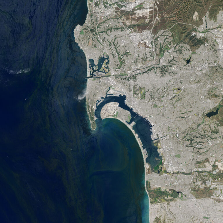
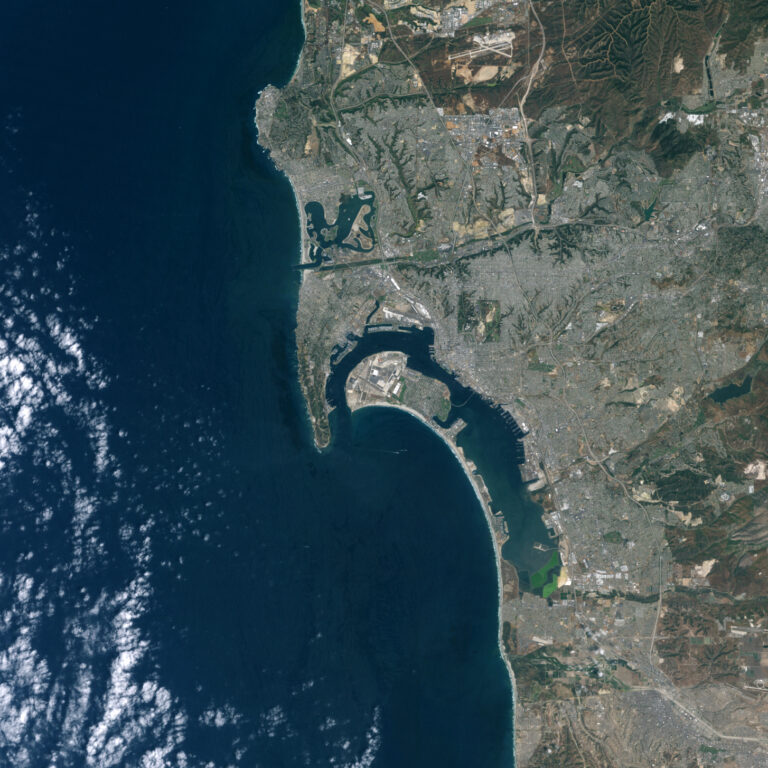
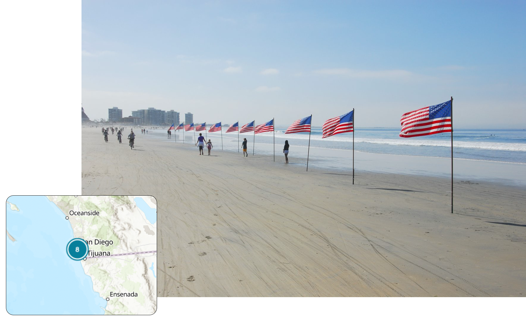
8. Coronado Beach
Coronado Beach in San Diego is the toast of Southern California with some of the warmest and safest water on the Pacific coast. The large rocky headland that points southward, provides shelter from the large plunging breakers generated by winter storms, which provide the little rainfall that this area with a Mediterranean climate receives. Coronado Beach is more than a hundred meters wide and sparkles because it contains mica, which is very unique.
The Hotel del Coronado is a world-famous landmark built over a hundred years ago; it has hosted kings, sheiks, presidents and actors/actresses in this iconic seaside hotel. Coronado is a very expensive place to live, and beachfront real estate anywhere along the California coast is unaffordable for most everyone.
The harbor serves as a major port for the Navy’s Pacific fleet, being the home port for several aircraft carriers. The docks and the crossing airplane runways for the Naval base are evident on this Landsat image.
“I do enjoy visiting this beautiful beach as well as enjoying lunch and drinks, taking advantage of the hotel’s beachside service.”
– Dr. Beach
Landsat 5 image acquired April 23, 1985 (left); Landsat 8 image acquired April 23, 2020 (right).
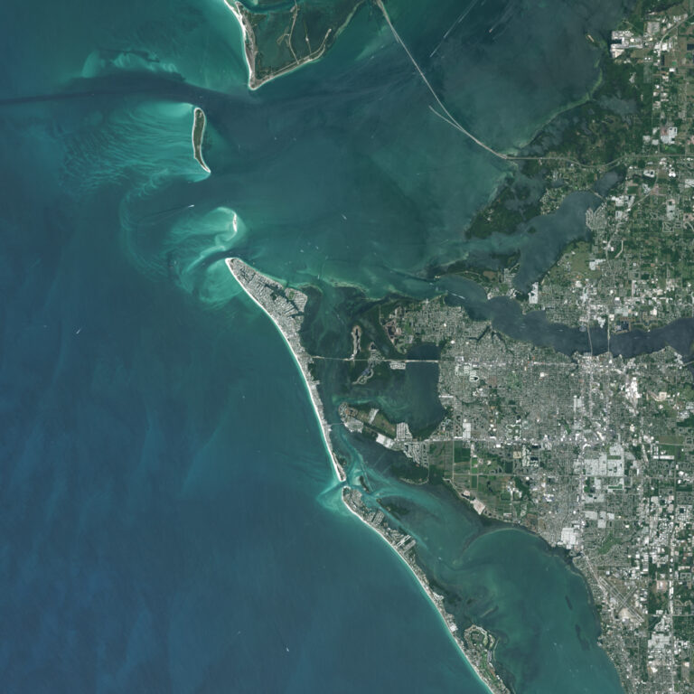
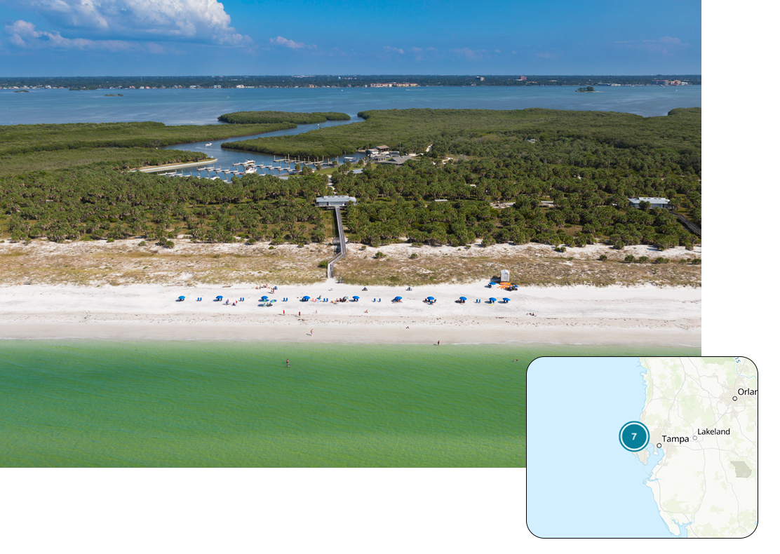
7. Caladesi Island State Park
Caladesi Island State Park is located in the small town of Dunedin on the Southwest Florida coast. This state park is easily reached by pedestrian ferry boats from the nearby Honeymoon Island. The stark white undeveloped beach is composed of crystalline quartz sand, which is soft and cushy at the water’s edge.
The normally calm, clean and clear Gulf waters are very inviting for a swim but shuffle your feet to scare away any stingrays that might be lying under a thin coat of sand in the shallow warm waters.
Caladesi is no longer a true island as shown on the Landsat image–it is now connected to the developed Clearwater Beach.
“Caladesi is located in the Tampa area, but it seems like a world away on this getaway island.”
– Dr. Beach
Landsat 5 image acquired April 25, 1986 (left); Landsat 8 image acquired April 9, 2021 (right).
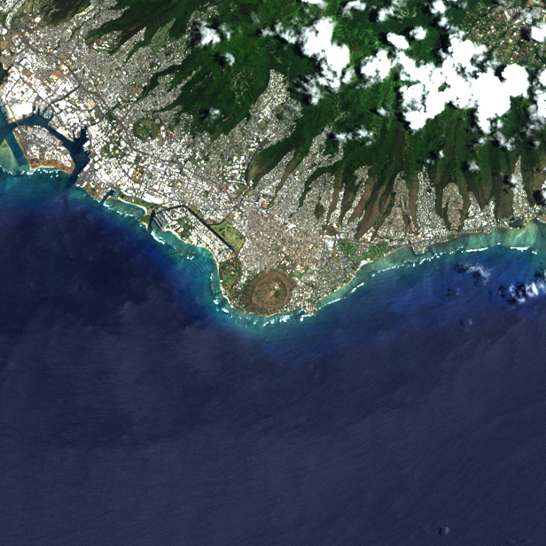
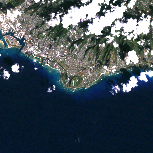
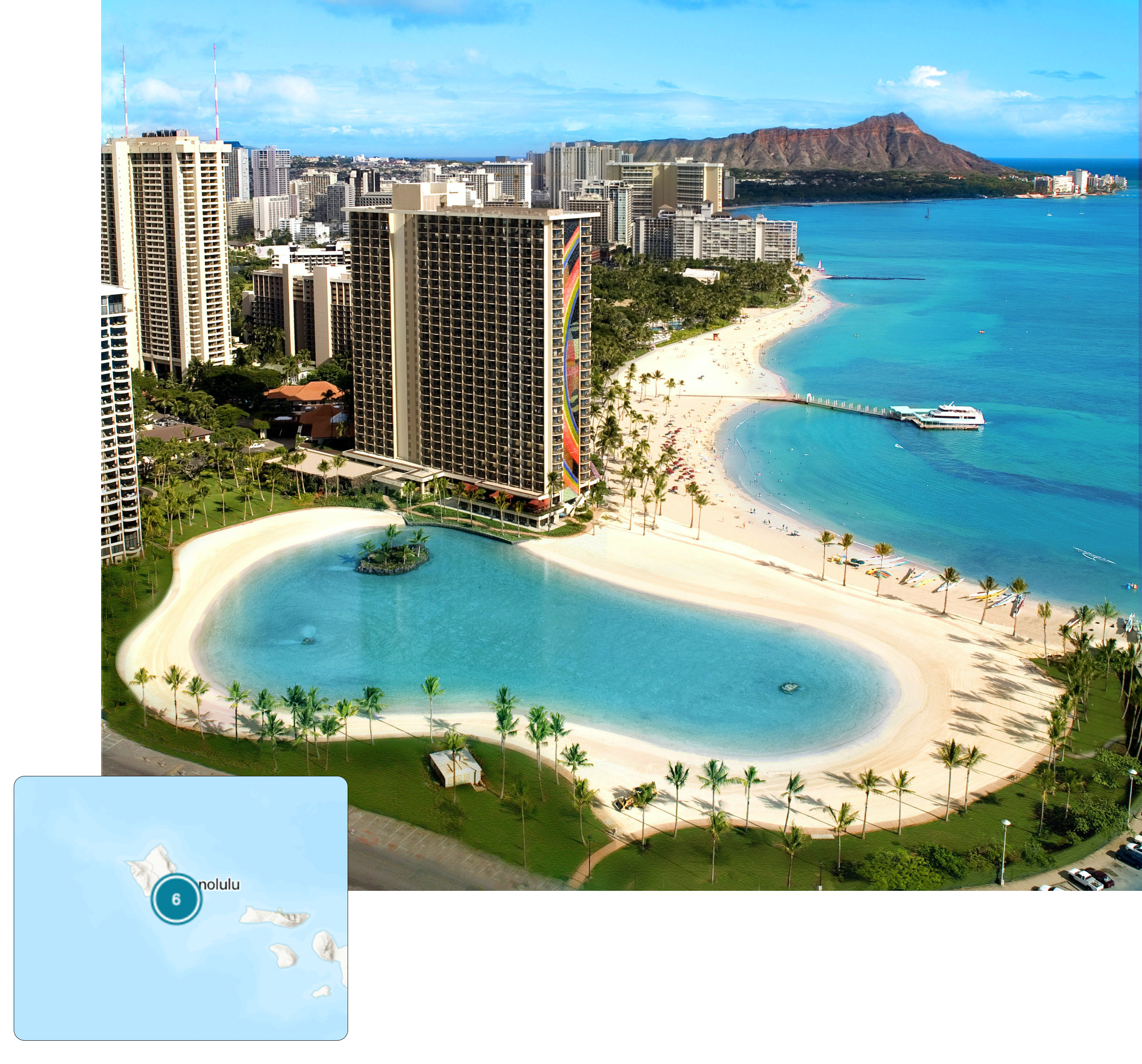
6. Duke Kahanamoku Beach
Duke Kahanamoku Beach is named for the famous native Hawaiian who was a big-board surfer and introduced surfing as a sport to mainland Americans and indeed the world. One of the prominent features on this Landsat image is Diamondhead with its circular shape near the coast. Duke Kahanamoku Beach is located at the westernmost end of Waikiki where the waves are diminished by offshore coral reefs, making for a great family beach. The city of Honolulu occupies the developable landscape shown in a gray tone with white highlights, while the mountain peaks are well vegetated with no development.
This large cone of an extinct volcano provides the iconic backdrop for photos of Waikiki Beach, one of the ten most famous beaches in the world—it is indicated on the Landsat image as a white sliver of coral sand along the shore.
“This is my favorite spot at the world-famous Waikiki Beach where you can both play in the surf and swim in the calm lagoonal waters.”
– Dr. Beach
Landsat 4 image acquired February 16, 1990 (left); Landsat 8 image acquired May 17, 2021 (right).
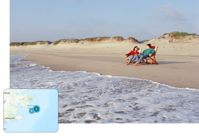
5. Lighthouse Beach
Lighthouse Beach in the village of Buxton is located at Cape Hatteras, the most northern cape in the Outer Banks of North Carolina. The high rate of beach erosion on the east flank of the cape, averaging 15 feet per year during the past century, caused much consternation to the National Park Service managers as the most historic lighthouse on the U.S. was being drawn closer to the water’s edge.
Finally, the iconic spiral-striped Cape Hatteras Lighthouse was moved landward in 1999 to prevent its loss, which has happened to other lighthouses in the past. Sometimes a long spit develops off the tip of Cape Hatteras that can be hundreds of feet long. The Landsat image shows the seaward growth of south flank of Cape Hatteras as evidenced by the parallel lines of beach ridges. Lighthouse Beach, which is guarded, is the number one surfing spot on the US Atlantic Coast as the offshore sand banks, known as Diamond Shoals, cause wave refraction that focuses wave energy on this beach. The Landsat image shows some of the close-to-shore shoals with breaking waves indicating the tops of the massive sand shoals.
“It is fun to walk down the narrow sand spit, more exposed at low tide, as waves are approaching from both directions because of the bending of the waves. It is a surrealistic experience on big wave days, making one feel somewhat like Moses and the parting of the sea as you walk along this narrow string of sand in the ocean.”
– Dr. Beach
Landsat 5 image acquired April 1, 1985 (left); Landsat 8 image acquired May 3, 2020 (right).
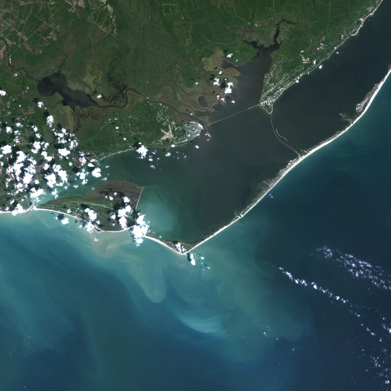
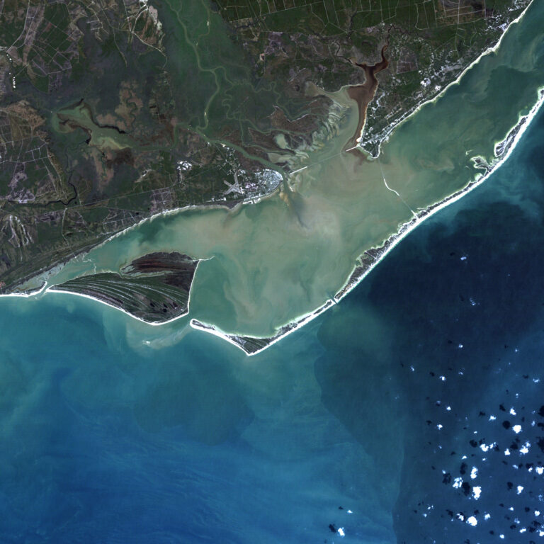
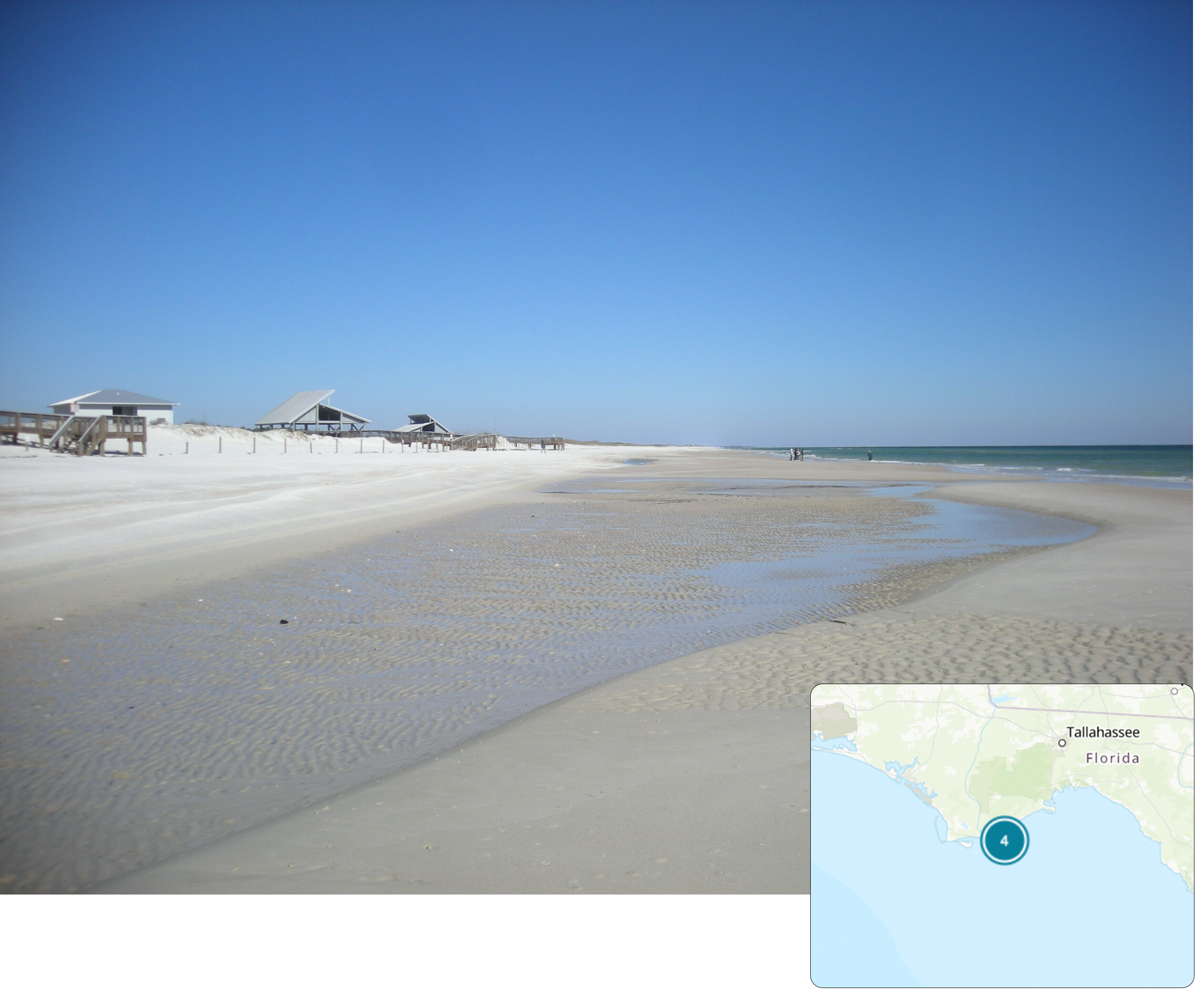
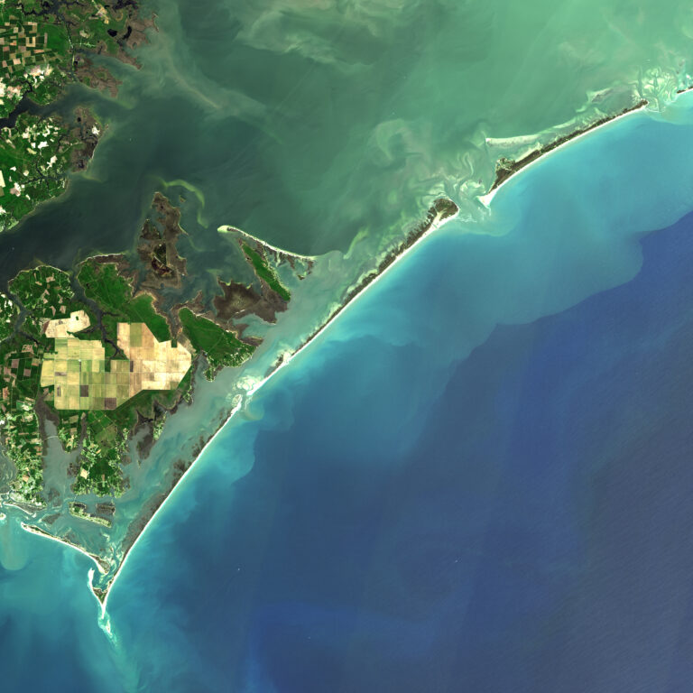
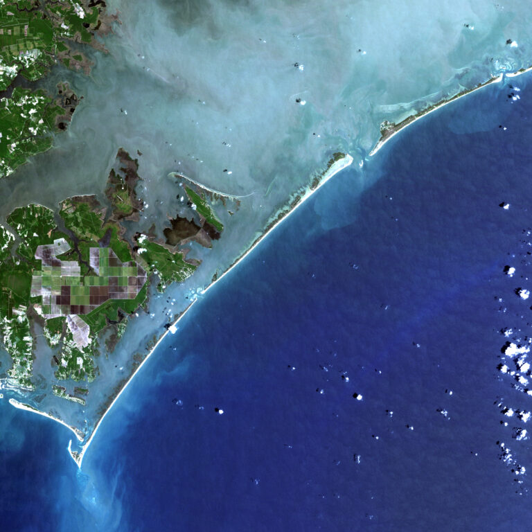
4. St. George Island State Park
St. George Island State Park is located north of the bridge that links this barrier island to the mainland as shown on the Landsat image. The Florida panhandle beaches are known for their super fine, white sand. St. George is far from urban areas and is a favorite destination for beachgoers, anglers and bird watchers as nature abounds.
The enclosed bay behind St. George Island is fairly shallow and the water much less clear as shown on the Landsat image, but it is not polluted.
“Besides swimming in the crystal-clear Gulf of Mexico waters, I enjoy beachcombing and shelling. While this island was hit hard in 2018 by Hurricane Michael, it has substantially recovered as there was little development to be impacted. Don’t bother bringing a surfboard or even boogie board because the Gulf waves here are generally measured in inches.”
– Dr. Beach
Landsat 5 image acquired October 3, 1984 (left); Landsat 8 image acquired October 13, 2020 (right).
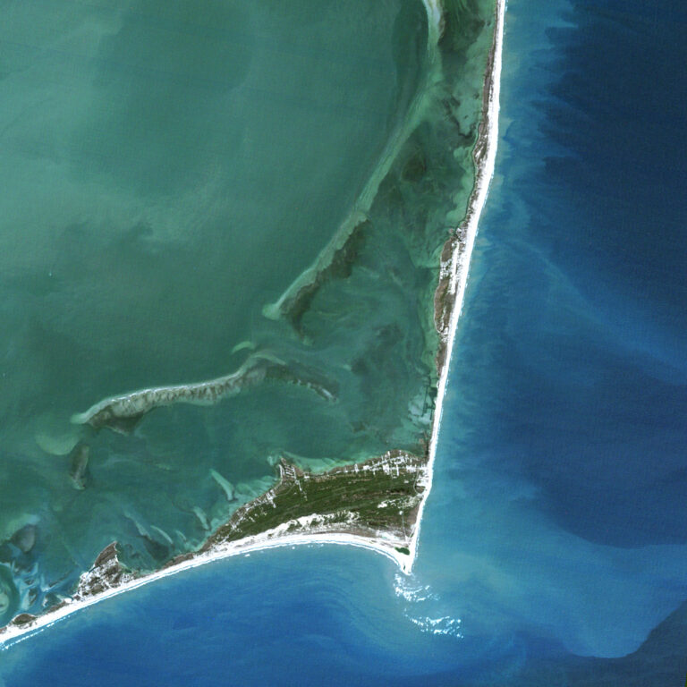
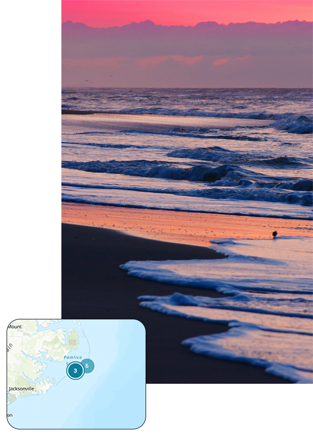
3. Ocracoke Lifeguarded Beach
Ocracoke Lifeguarded Beach at the southern end of Cape Hatteras National Seashore was the first seashore to be incorporated into the National Park Service system. A section of this long, narrow barrier island has lifeguards, which is the designated swimming area.
The Landsat image shows Ocracoke to the north as separated by an inlet from Portsmouth Island. The village of Ocracoke was built at the wide area of the island where it was protected from oceanic waves during coastal storms which include both winter nor’easters and hurricanes.
“Ocracoke Island is a small village with quaint inns and B&Bs—don’t expect to stay at a signature hotel or play golf here; the rest of the island is totally undeveloped. I have been encouraging the island to go carless, which is being realized with the recent advent of pedestrian ferry boats. Ocracoke was once the home of the most infamous pirate Blackbeard and is still a very special place—my favorite getaway beach.”
- Dr. Beach
Landsat 5 image acquired May 16, 1984 (left); Landsat 8 image acquired May 3, 2020 (right).
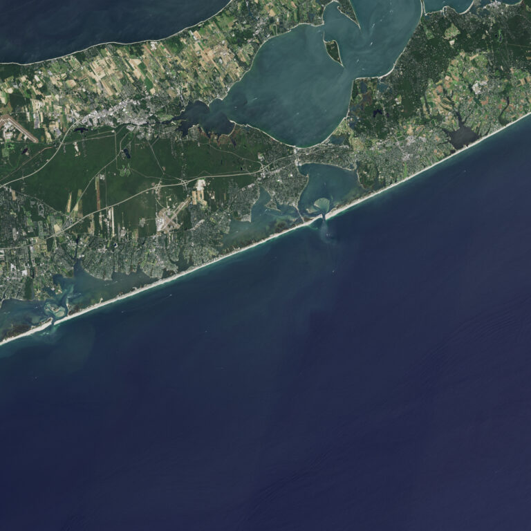
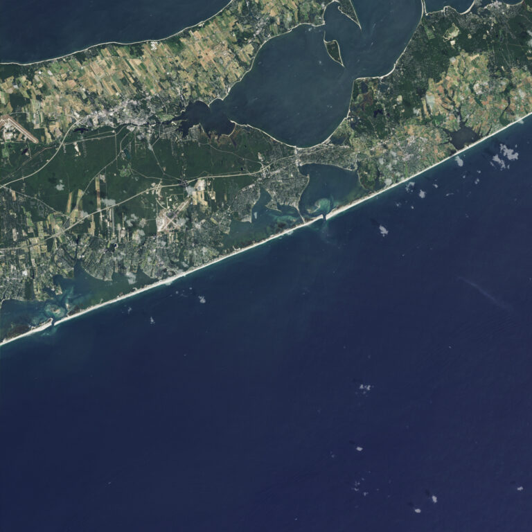
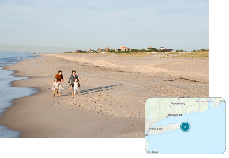
2. Coopers Beach
Cooper’s Beach in the tony town of Southampton on the south shore of Long Island, New York is shielded from the cold Labrador current, making for a fairly long summer swimming season. The white quartz sand is medium to coarse grained with some pebbles, making the beach slope fairly steeply into the water. Some of the most gorgeous and expensive residential houses in the United States are located in the world-famous Hamptons; presently a beachfront house/compound is being offered by Sotheby’s for $150 million at “Billionaire’s Row.
This Landsat image shows the fairly large coastal pond named Mecox Bay to the east with the eastern edge of Shinnecock Bay also displayed.
“I spent several decades conducting scientific studies of this very interest oceanic shoreline because it is so dynamic and the beachfront real estate so expensive.”
– Dr. Beach
Landsat 5 image acquired September 1, 1985 (left); Landsat 8 image acquired August 30, 2019 (right).
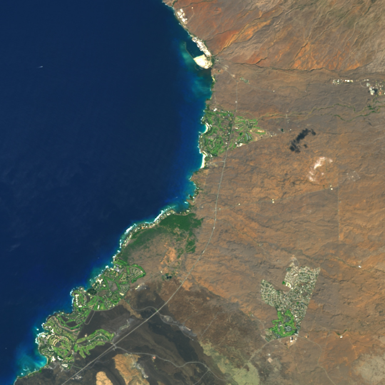
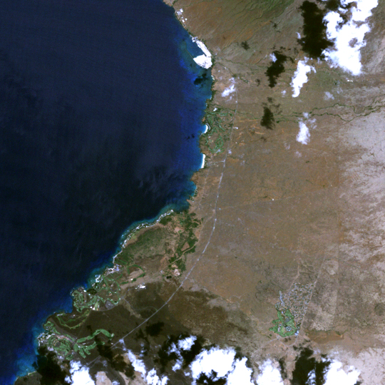
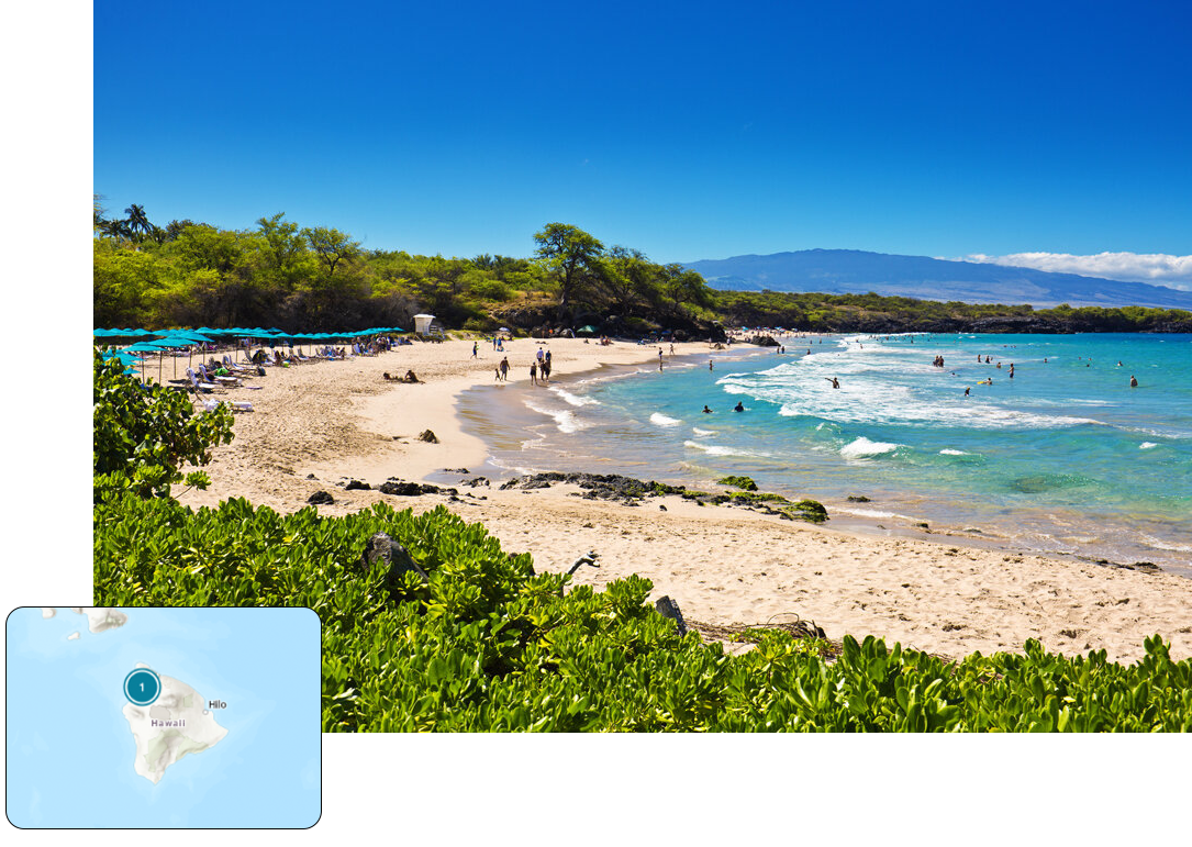
1. Hapuna Beach State Park
Hapuna Beach State Park is a white coral sand beach that resides in a landscape dominated by black lava flows on the Big Island of Hawaii.
This side of the island has not been influenced by volcanic eruptions for thousands of years, providing time for coral reefs to grow offshore, which supplies the sand to the small pocket beaches along this otherwise rocky shoreline. The crystal-clear water is perfect for swimming, snorkeling and scuba diving during the summer months in contrast to winter big-wave days when pounding shorebreaks and rip currents make swimming impossible.
Hapuna and the other pocket beaches appear as an oasis in this otherwise fairly bleak landscape except for the areas irrigated as prominently shown on the Landsat imagery by the green vegetation.
“This volcanically active island is the only place that I know where you can snow ski at the high mountain tops and water ski in the warm ocean water on the same day.”
– Dr. Beach
Landsat 5 image acquired September 13, 1990 (left); Landsat 8 image acquired January 5, 2021 (right).
View Dr. Beach’s 2021 picks and find out more about his criteria for his annual beach rankings.
Learn more about how Landsat data is used to study coastal waters at Camp Landsat!


