
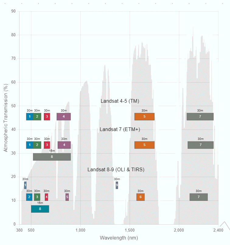
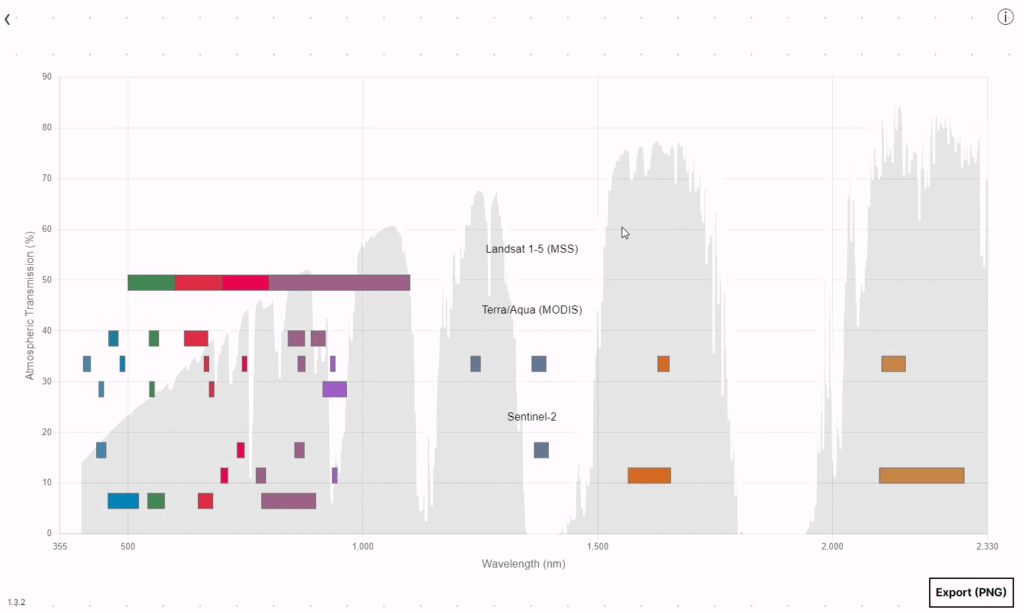
Our Spectral Band Comparison Tool empowers users to quickly visualize and compare spectral bands from multiple Earth-observing satellites. This tool provides customizable visualizations for creating accurate graphics.
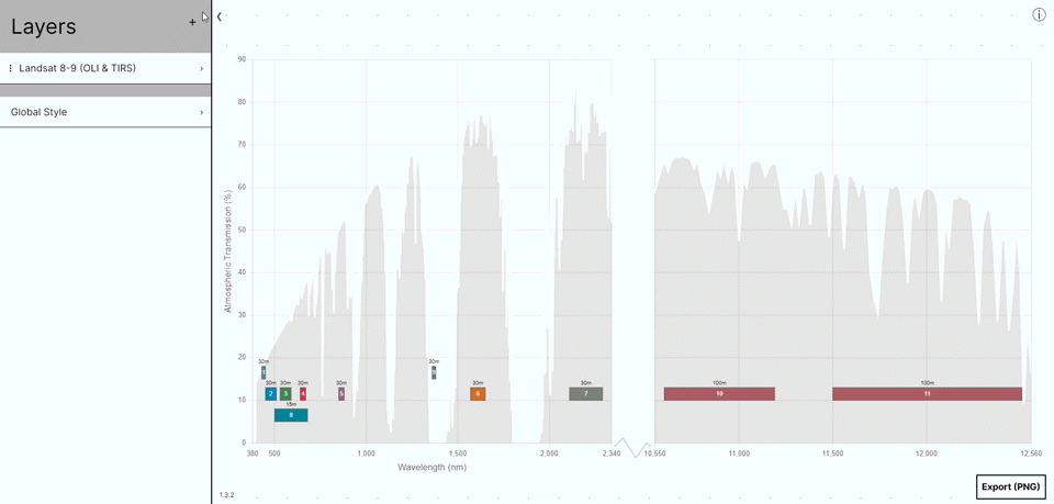
This tool expands upon the successful Landsat Spectral Bands graphic with atmospheric transmission data. Given the challenges of creating this graphic using traditional methods, we developed this tool to generate accurate diagrams.
Compare Instruments
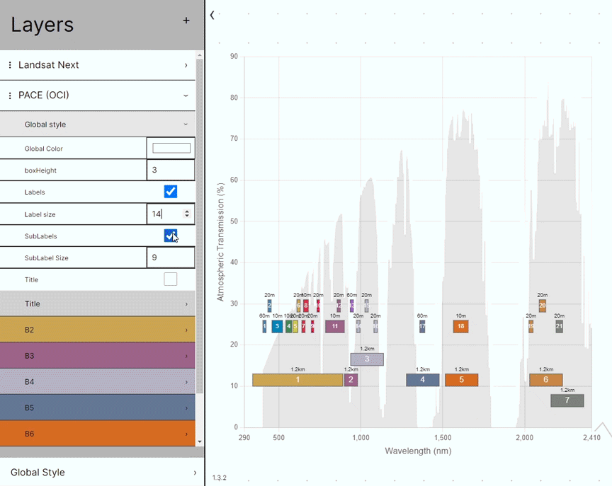
Custom Styling
Enhance your graphic’s visual appeal by tailoring the appearance of each instrument. You can customize labels, adjust box and text sizes, and modify band colors to create a unique and informative visualization.
Users also have the option to toggle the atmospheric transmission curve on and off. The Spectral Band Comparison Tool currently uses the same MODTRAN4 summertime, mid-latitude hazy atmosphere (~5 km visibility) atmospheric transmission data that the original 2008 graphic featured.
Export Graphics
Once you’ve perfected your graphic, you can export and download it as a high-quality PNG file. Use it in your presentations or talks, or as a starting point for other designs.
Explore Further
For data users trying to decide which instruments are best suited for their applications and research, our USGS partners offer an interactive Spectral Characteristics Viewer built for this purpose.
The USGS Spectral Characteristics Viewer is a sophisticated analysis tool that allows users to compare the relative spectral response information from all Landsat satellites, EO-1 ALI, Terra ASTER, and Terra MODIS; as well as select international civil satellites, and domestic and international commercial sensors.
Users can simultaneously plot the target spectra of an array of targets (man-made, minerals, vegetation, water, rocks, etc.) from the USGS Spectroscopy Laboratory and the ECOSTRESS Spectral Library.
By overlaying sensor spectral response curves with target spectra, users can visually analyze which sensors and spectral bands are best suited for their work, additionally, users can compute and plot sensors’ responses to target spectra.
