
Some interesting details of the report:
• “Fire has many other effects on ecosystems. Plant species richness, diversity, and functional types can change in response to fire (Peterson and Reich, 2008). All properties of the surface soils (such as bulk density, particle size distribution, pH, and organic carbon and nitrogen content) can be altered by the frequency and severity of fire (Boerner and others, 2009). Faunal communities will respond to fire, with some species increasing (Fuhlendorf and others, 2006) and other species decreasing, after the fire (Vasconcelos and others, 2009).”
• “Fire also has been used to manage wetland ecosystems for more than 50 years (Lynch, 1941; Frost, 1995). Uses have included returning marshes to early successional states, increasing forage for wildlife (Lynch, 1941). In all fire-influenced ecosystems, prescribed burns are routinely used to reduce fuel loads, reducing the possibility of catastrophic fires.”
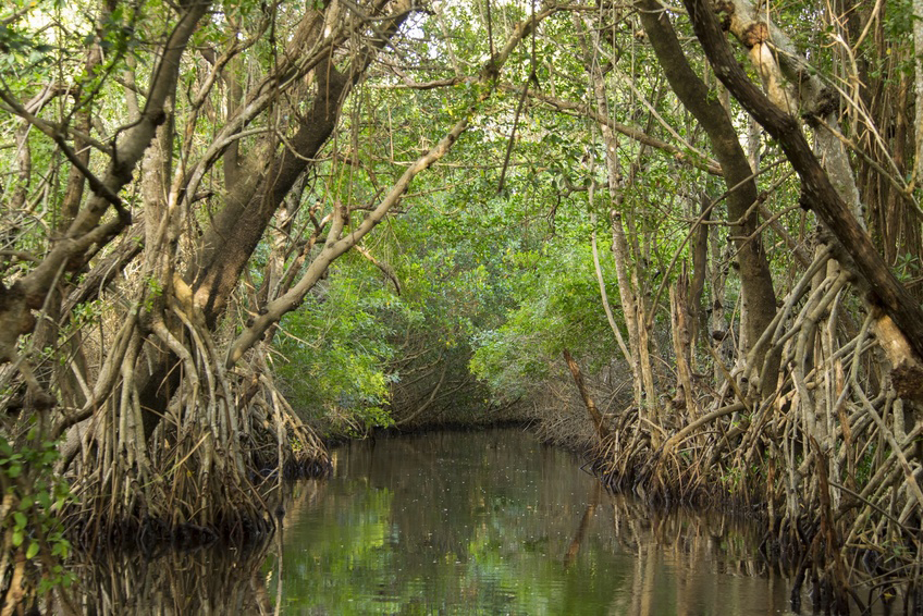
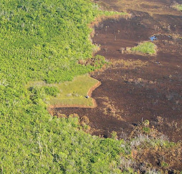
• “Fire has always been an integral part of the ecosystems of southern Florida, especially in the Everglades (Robertson, 1962; Wade and others, 1980; Cohen, 1984) (fig. 1). Botanists and ornithologists who explored the area in the early 1900s commented on fires. Small (1916) reported what he considered to be catastrophic fires burning from Madiera Hammock all the way to Cape Sable, a distance almost 25 miles. He stated: ‘… we saw miles of hammock and rolling clouds of black smoke skyward. This calamity was not confined to the neighborhood of Madiera Bay but in the Cape Sable region three or four vast forest fires were seen.’ Following a subsequent trip to southwestern Florida near Everglades City Small (1923) reported: ‘The long drought had turned a large part of the vegetation into tinder, and prairies, pinelands, hammocks and cypress strands were food for terrific conflagrations.’ Holt and Sutton (1926) reported extensive fires burning in the Cape Sable marshes during their ornithological explorations of the winter of 1924. A fire is clearly visible burning in the Cape Sables marshes in a 1928 aerial photograph (fig. 2). Beard (1938) conducted wildlife surveys during the mid-1930s in the region that would become Everglades National Park. He reported: ‘The Everglades park area was badly burned during the winter of 1937–8, and there was no time during the drier part of the year that one could not see smoke somewhere on the horizon.'”
• “Early ecologists of the region thought that man, both aboriginal and immigrant, was the primary cause for fires in the Everglades (Small, 1924, 1930; Beard, 1938; Egler, 1952). Many of the fires reported from 1900 to 1945 were related to man, owing to the extensive drainage of the northern Everglades coupled with drought, especially in the 1930s (Beard, 1938; Phillips, 1940; Dovell, 1942). Robertson (1953), in the first review of fire in Everglades National Park, showed that lightning was a causative factor for many fires. He noted that, during 18 months in 1951–52, about 53 percent of all fires in Everglades National Park were caused by lightning. A 2007 study using the fire history database of Everglades National Park showed that lightning fires are a common occurrence in the park (Slocum and others, 2007).”
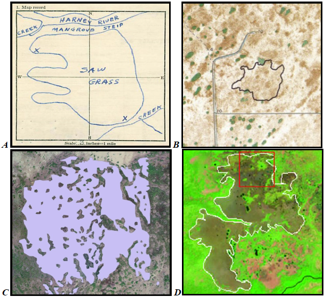
• “Over the past several decades, the staffs of Everglades National Park (EVER) and Big Cypress National Preserve (BICY) have acquired a substantial amount of wildfire history data in the form of paper records and tabular data (Klukas, 1973; Bancroft, 1976; Taylor 1980, 1981). Over the years, multiple methods were used to delineate fire perimeters: (1) hand drawn on U.S. Department of the Interior fire reporting forms, (2) hand drawn on 1:24,000 scale U.S. Geological Survey (USGS) topographic quadrangle (quad) sheets, (3) demarcated using Global Positioning System (GPS) technology (DeVries and others, 1992), or (4) digitized from remotely sensed images.”
• “Fire perimeters from 1994–2004 were visually compared against Landsat archive satellite imagery as part of research on the use of satellite data to map Everglades fire history. Cloud-free satellite images following the occurrence of each fire were inspected, noting fire scars large enough to be visible in Landsat imagery (that is, 3 or more acres in size) that were in the wrong location. Only a small percentage of polygons were misplaced, verifying that the reporting-form polygons were accurate (table 1). The placement of the polygons then was corrected in the geodatabase. Fires for which no scar was apparent in the imagery also were documented (table 2). All locational errors were noted in the database.”
+ Full USGS Open-fire Report: Fire history of Everglades National Park and Big Cypress National Preserve, southern Florida


