Presentation Title:
Impact of Climate Variability on the Hydrogeochemistry of Ecologically Important Prairie Wetlands and Lakes
Background:
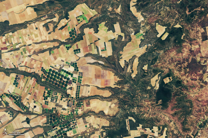
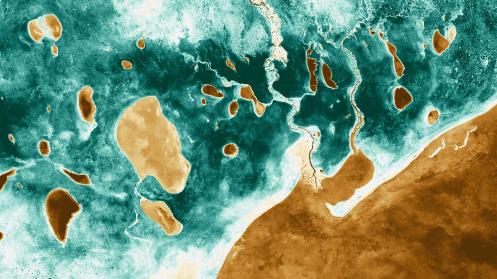
The Prairie Pothole Region of the north-central U.S. and south central Canada, which occupies 750,000 square kilometers, is one of the most important ecosystem complexes on the continent. It’s millions of ponds and lakes support the majority of the continent’s waterfowl. Water chemistry here is 1) highly variable, and 2) unusually rich in sulfate.
Approach:
To characterize how climate variability impacts wetland chemistry in time and space, we chemically analyzed 167 water bodies in a 10,000 square kilometer during 2012-2013, following a time of extreme precipitation. These same water bodies had been studied in the 1960’s and 70’s during a time of mild drought
Results:
Using a geochemical modeling approach, we determined that for most water bodies, their chemical evolution was due to addition of rainwater and overland flow. However, for a significant minority (~40%), their chemical evolution was more complex and required inputs of saline groundwater. The first group was larger and their surface area changed less over time than the second group. The first group also was associated with more permeable underlying sediments (sand) than the second group (clay).
Landsat data was used to evaluate both the surface area change over time (1973- 2011) and to derive a statistical measure of water permanence both of which could be tied to the chemical evolution of the water bodies.
These results will help establish which portions of the Prairie Pothole Region are most susceptible to climate variability and change and guide management decisions as to where conservation efforts should be placed.
Co-authors:
Christopher Mills
USGS Central Region Office
David Mushet
USGS
Craig Stricker
USGS-Denver Federal Center
Jennifer Rover
USGS
Anyone can freely download Landsat data from the USGS EarthExplorer or LandsatLook.
Further Reading:
+ Martin Goldhaber’s USGS Profile
+ Landsat at #AGU15
NASA Study Finds Potential Carbon Sink in Boreal Forest Growth
New research led by Landsat 8/9 Project Scientist Chris Neigh used Landsat and ICESat-2 data to investigate how boreal forests growth could sequester carbon.