
Landsat Observations Key Resource for Many Federal Agencies
In the FY23 Aeronautics and Space Report released on May 23, 2024, a multitude of Federal agencies report work informed by Landsat data.

In the FY23 Aeronautics and Space Report released on May 23, 2024, a multitude of Federal agencies report work informed by Landsat data.
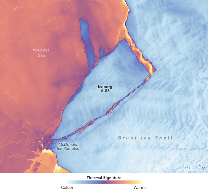
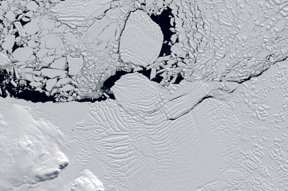
The Brunt Ice Shelf lost a large wedge of floating ice, the third sizeable iceberg to calve from the shelf in recent years. The TIRS instrument on Landsat 9 captured false-color images of the calving.
The Australian company Indji Systems uses a variety of satellite data to provide real-time hazard monitoring and alerts to utility and renewable energy companies across Australia, North America and Europe.
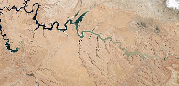
More water is taken from the Colorado River than it has to give. Better water use accounting made possible by Landsat provides needed guidance for difficult water use decisions.

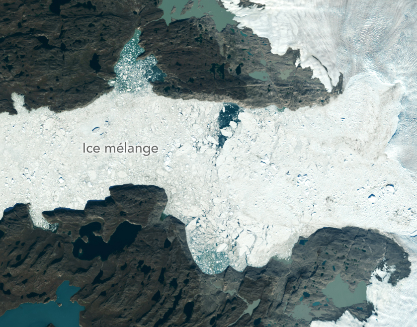
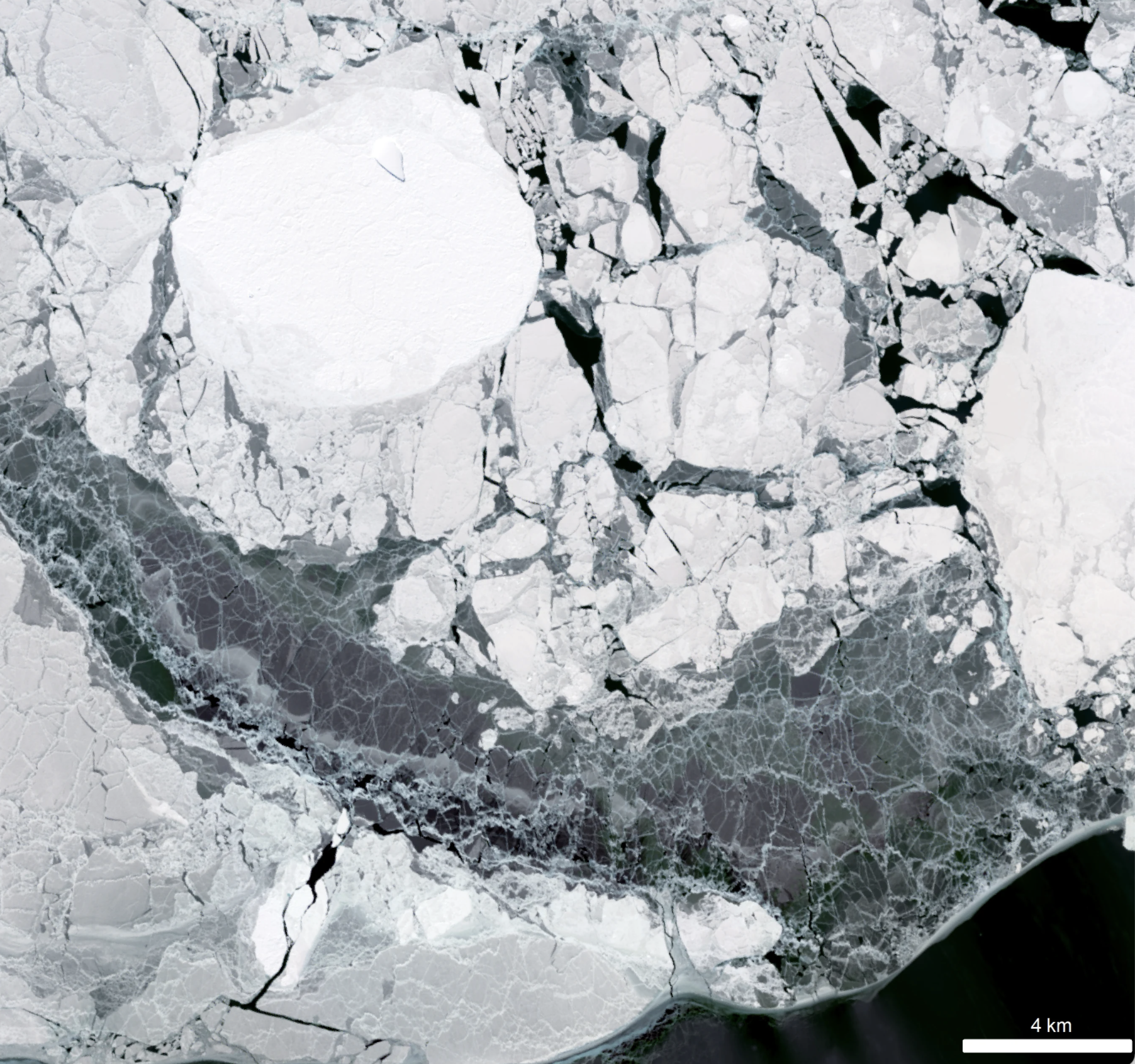
Landsat satellites have begun regularly acquiring images of ice at the poles during the winter, with enlightening results.
New research shows that while some Antarctic ice shelves have been thinning since at least the 1970s, widespread thinning accelerated in the 1990s.
A new, comprehensive analysis of satellite data finds that majority of glaciers on the landmass have retreated significantly.
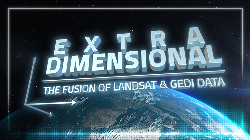
When Landsat’s vast decades-long archive is combined with data from other instruments it can provide amazing insight into how our world is evolving with us and around us. Here are some of the ways Landsat and GEDI data are being harnessed to help us better understand the complex relationship between humanity and nature.

The Pale Blue Dot Visualization Challenge—aimed at making Earth observation data accessible to everyone—has officially kicked off.
Safeguarding freshwater resources is crucial, and while scientists use a variety of ground-based techniques to gauge water quality, the Landsat program has provided water quality data from orbit for decades.

The Jane Goodall Institute has been working with NASA and using Earth science satellite imagery and data—including Landsat (NASA/USGS)—in its chimpanzee and forest conservation efforts in Africa, particularly the Gombe region.
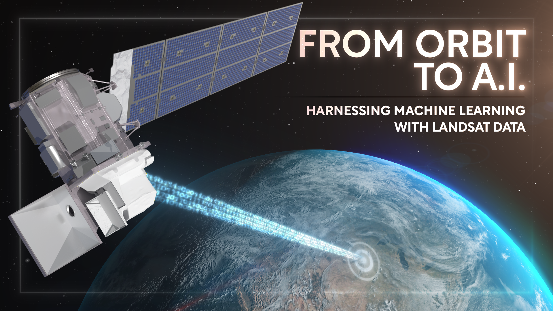
Over the past few years, machine learning techniques have been increasingly used to analyze the vast amount of data collected by the Landsat mission, which has been circling the globe for over 50 years.
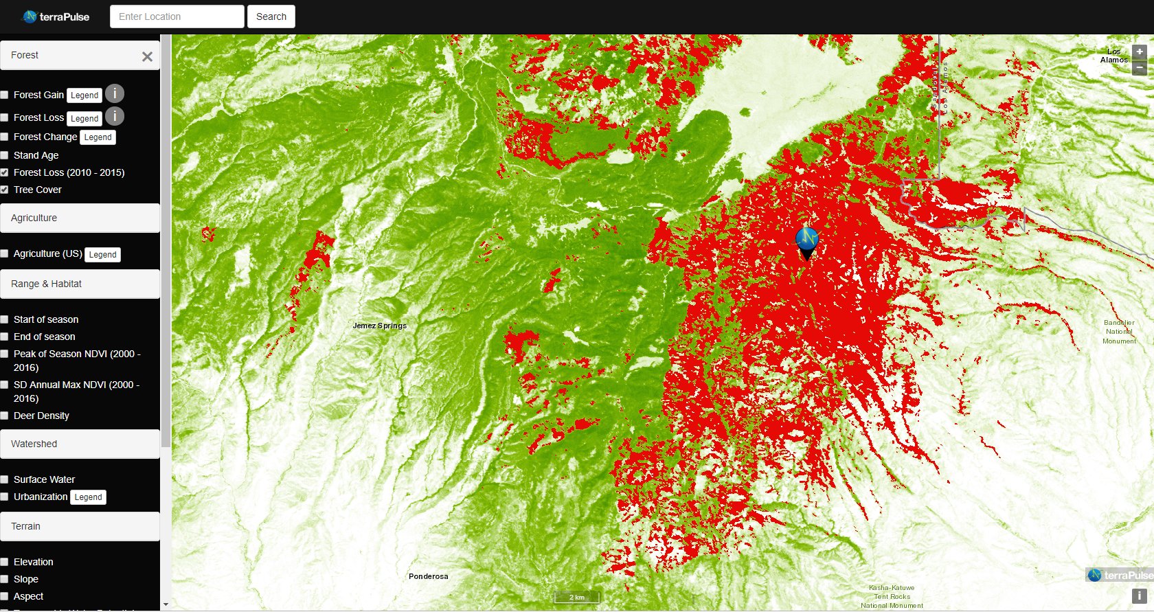
Applying AI to Earth data—including Landsat—helps terraPulse reveal sustainable options for farming, reforestation, and land management.
Merging data from multiple satellites, OPERA can help government agencies, disaster responders, and the public access data about natural and human impacts to the land.
Washington-Allen is a longtime Landsat data user working towards drylands restoration and sustainability solutions.
The collaboration between NASA and IBM is a unique application of artificial intelligence (AI) foundation model technology to NASA Earth observation data.
An international team of researchers has combined satellite imagery and climate and ocean records to obtain the most detailed understanding yet of how the West Antarctic Ice Sheet – which contains enough ice to raise global sea level by 3.3 metres – is responding to climate change.
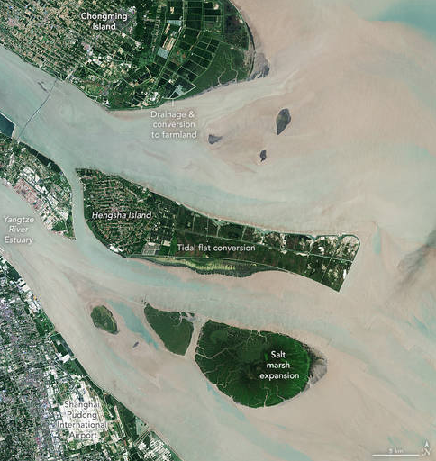
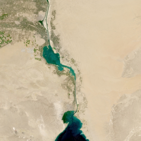
The world has lost 561 square miles (1,453 square kilometers) of salt marshes over the past 20 years.
New research uses Landsat observations and advanced computing to chronicle wetlands lost (and found) around the globe.

Nestled in the science-based information that park rangers share with visitors to Glacier Bay National Park and Preserve are insights from Landsat satellites and NASA climate scientists.
Landsat has shown that wildfires and climbing temperatures have caused a 6.7 percent decline in California tree cover since 1985.
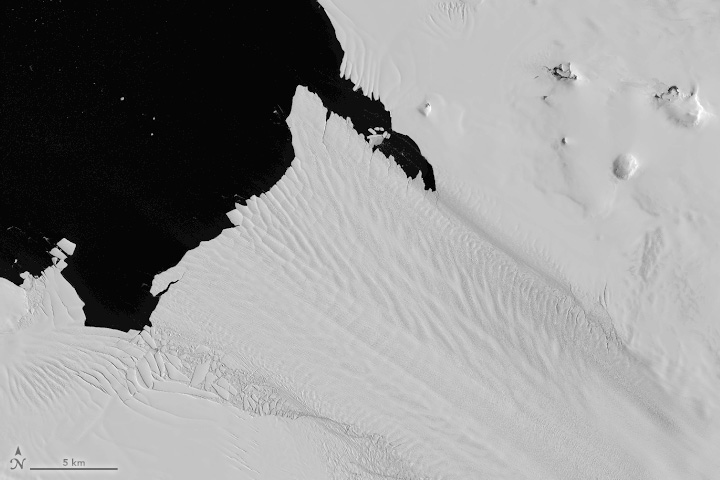
Despite the rapid melting of ice in many parts of Antarctica during the second half of the 20th century, researchers have found that the floating ice shelves which skirt the eastern Antarctic Peninsula have undergone sustained advance over the past 20 years.
An analysis of over a million Landsat images has revealed that 4,000 square kilometres of tidal wetlands have been lost globally over twenty years.
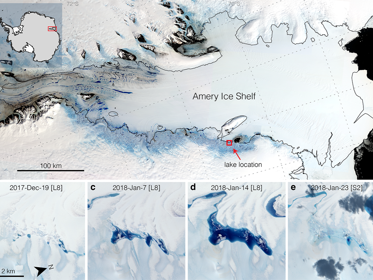
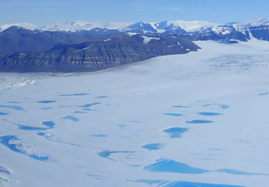
Satellites have helped show that strong tidal activity may facilitate water-induced fracturing, or hydrofracturing, where land ice transitions to floating ice shelf and cause the meltwater lake to drain quickly, often in as little as several days.
Rooftop gardens and greenery can help ease some of the severe heat in cities, according to research from climate scientists at NASA’s Goddard Institute for Space Studies (GISS) in New York.
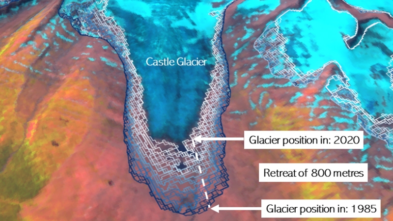
A new mapping tool developed by UNBC researchers shows that western Canadian glaciers are shrinking at an increasing rate.
Using Landsat, scientists have discovered for the first time that large scale solar parks have a cooling effect on the land surrounding them.
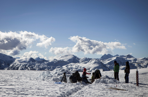
Field work conducted in northern Alaska is being used in concert with the Landsat satellite data record in an effort to better understand the impacts of climate change on the Arctic.
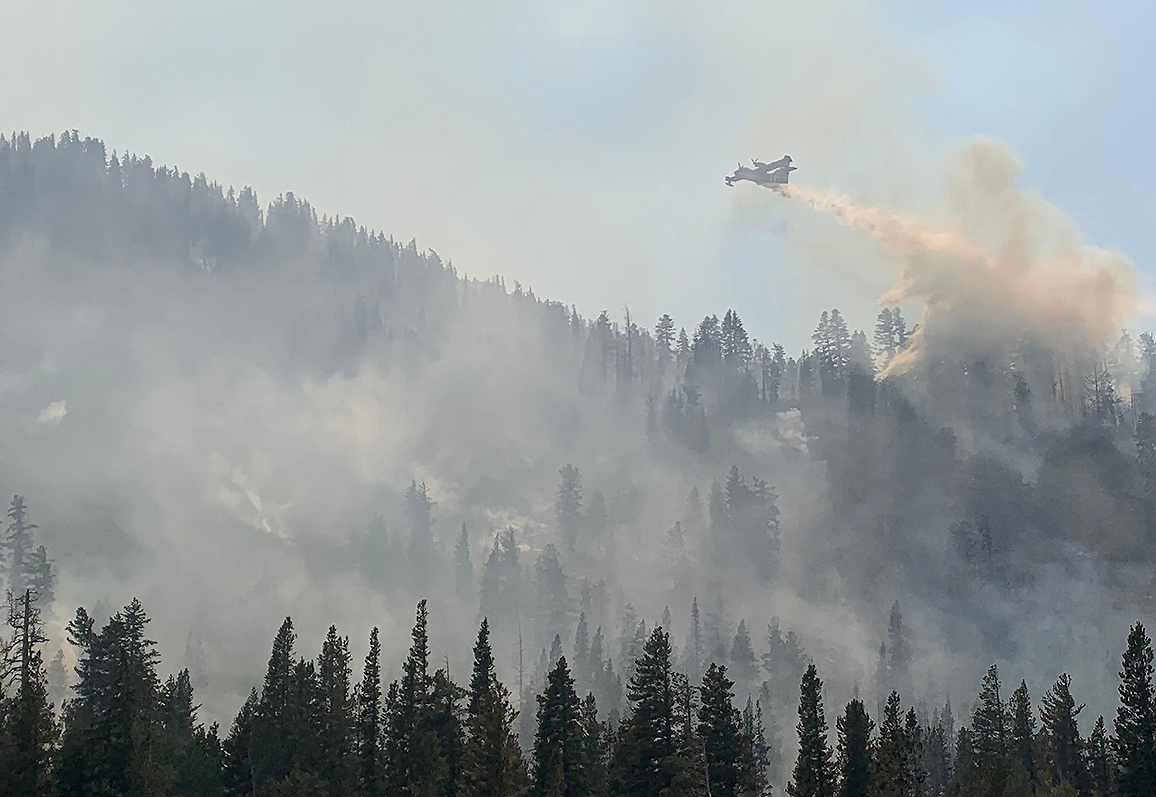
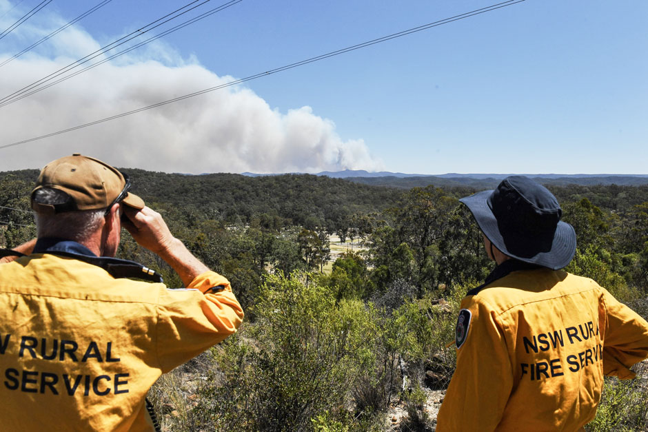
Wildfires in the western United States have been spreading to higher elevations over the past few decades due to warmer and drier conditions that are clearly linked to climate change.
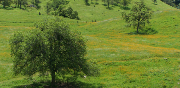
California’s blue oak woodlands have decreased by more than 1,200 square kilometers.
Mountaintop glacier ice in the tropics of all four hemispheres covers significantly less area than it did just 50 years ago.
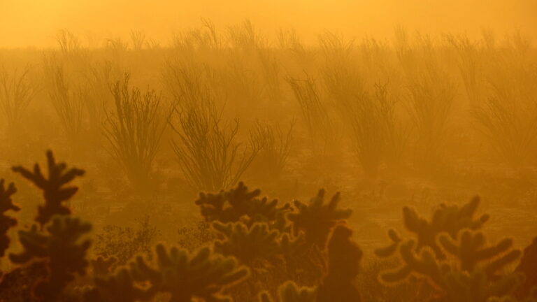
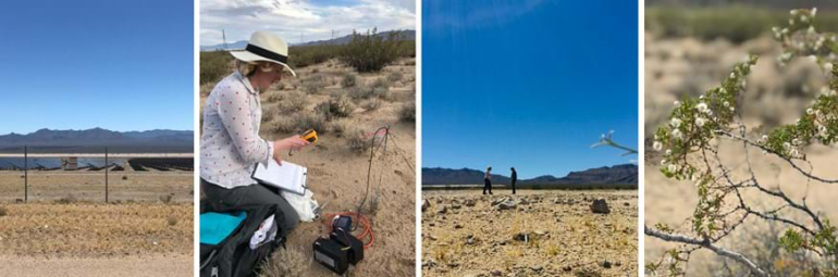
Landsat data stretching back 40 years show that vegetation loss is most stark in desert ecosystems already on edge of habitability.
Antarctica’s George VI Ice Shelf experienced record melting during the 2019-2020 summer season.
