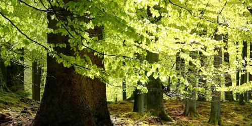
Quantifying Forests’ Impacts on Global Carbon Budget with Satellites
A new method, fusing data from many sources, has been developed for quantifying forests’ role as both carbon sink and carbon source.

A new method, fusing data from many sources, has been developed for quantifying forests’ role as both carbon sink and carbon source.
Landsat 9 Project Scientist Jeff Masek joined astronaut Jessica Meir and other researchers to discuss the role of space and aviation technologies in studying our changing world as part of the Smithsonian Conservation Commons’ Earth Optimism initiative.
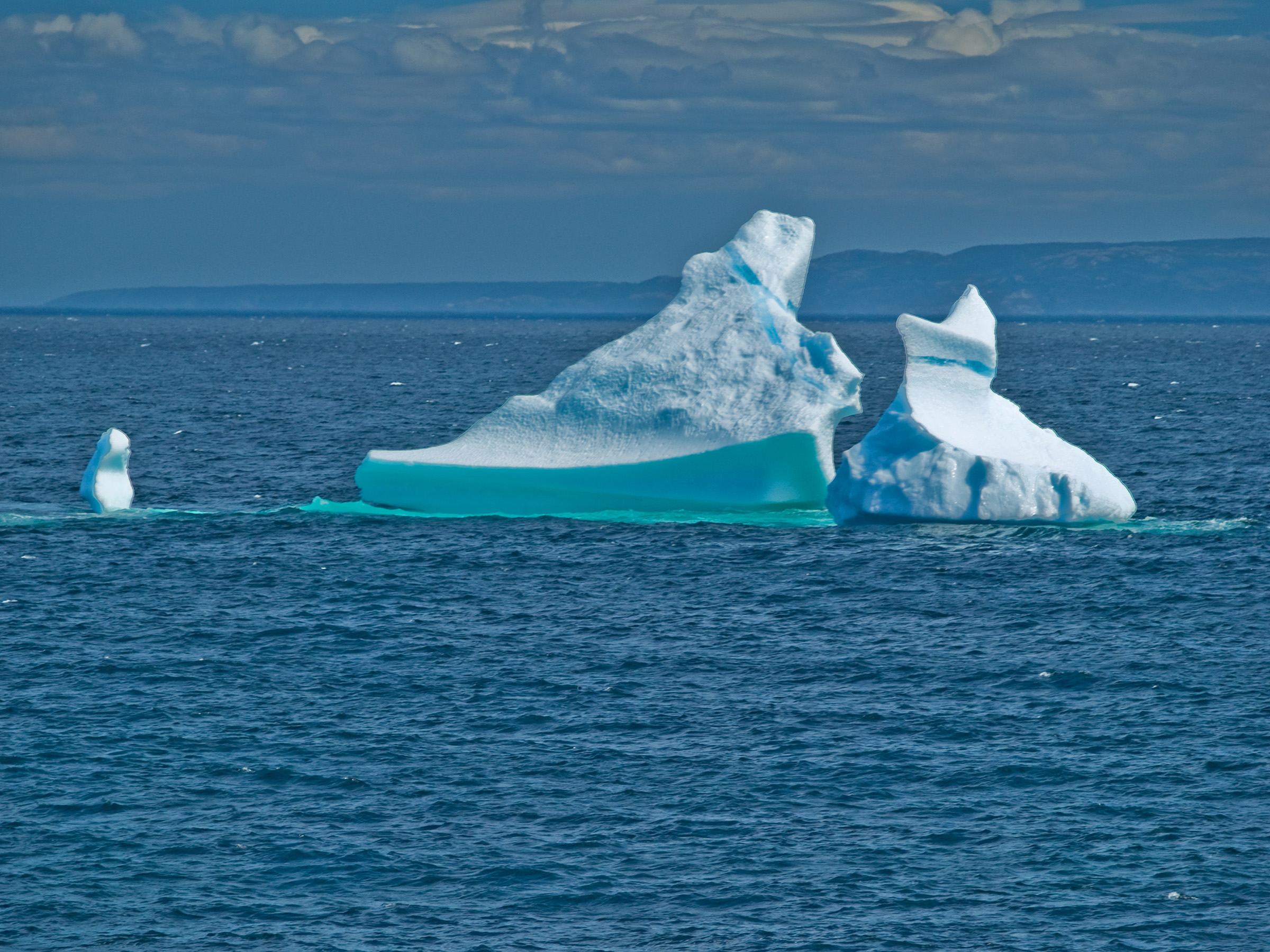
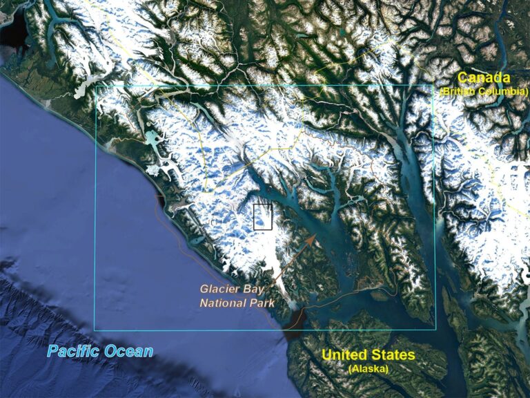
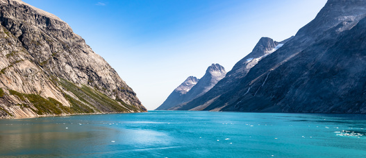
Many of the Greenland’s glaciers are retreating while also undergoing other physical changes.
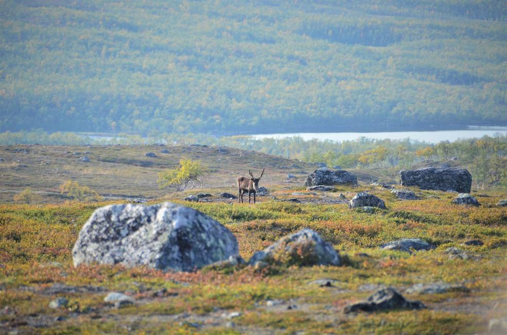
Using satellite images to track global tundra ecosystems over decades, a new study found the region has become greener, as warmer air and soil temperatures lead to increased plant growth.
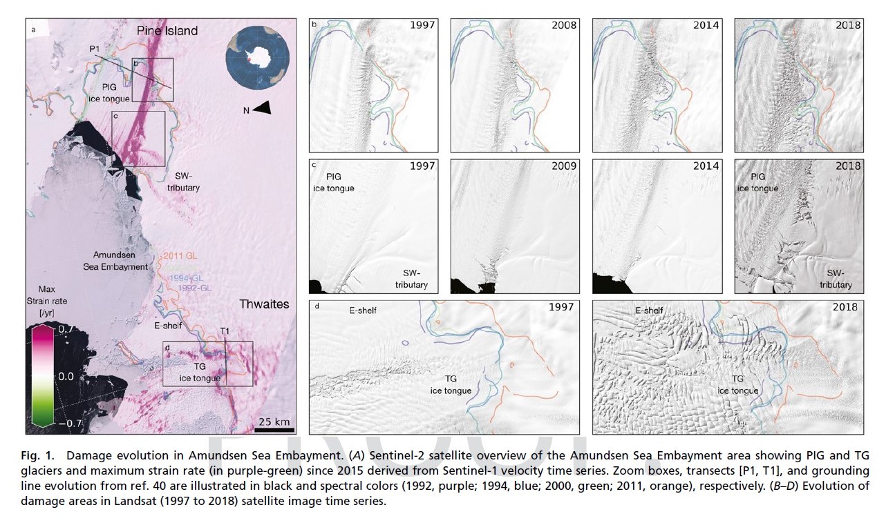
Combined satellite imagery have afforded researchers a new, accurate picture of the rapid development of damage in the shear zones on the ice shelves of Pine Island and Thwaites.

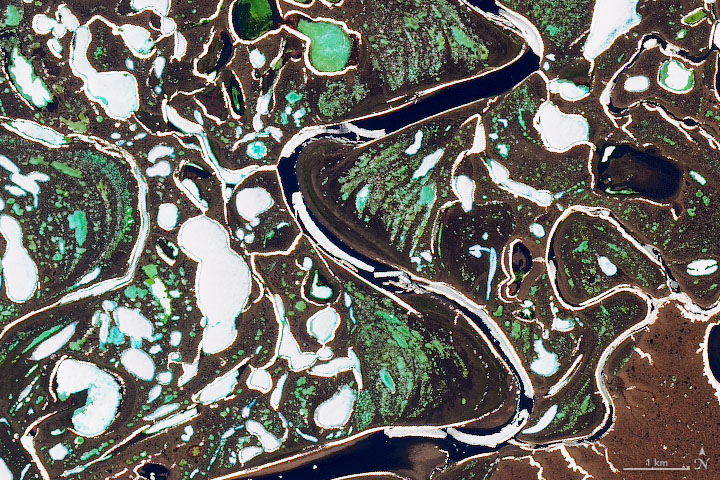
Using 30 years of Landsat data, researchers have found that the volume of glacial lakes worldwide has increased by about 50% since 1990.
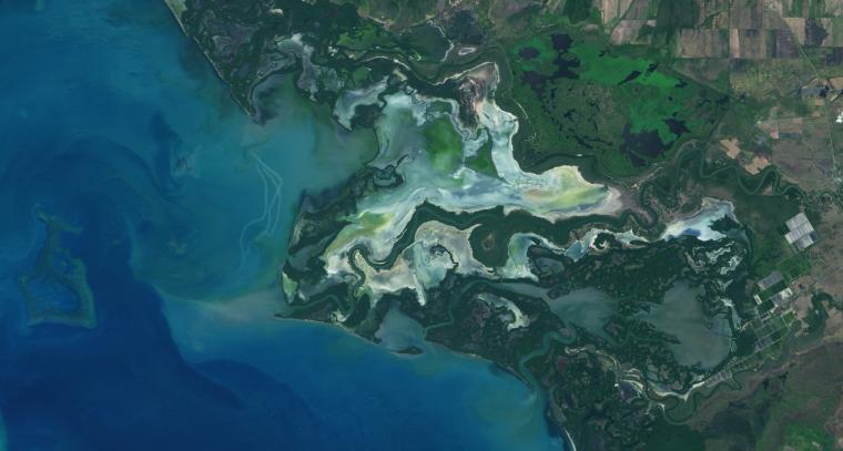
Using Landsat, researchers have created the first map of the causes of change in global mangrove habitats between 2000 and 2016—a valuable tool to aid conservation efforts for these vital coastline defenders.

Goldberg will launch Cloud to Classroom, an innovative project that uses satellite imagery to help K-12 classrooms understand global environmental change through remote sensing.
A team of Boise State researchers is helping forecast tropical forest recovery from deforestation using Landsat satellite data.

Landsat imagery shows that bull kelp canopy area can vary dramatically from year to year, and that long-term population trends vary from reef to reef.
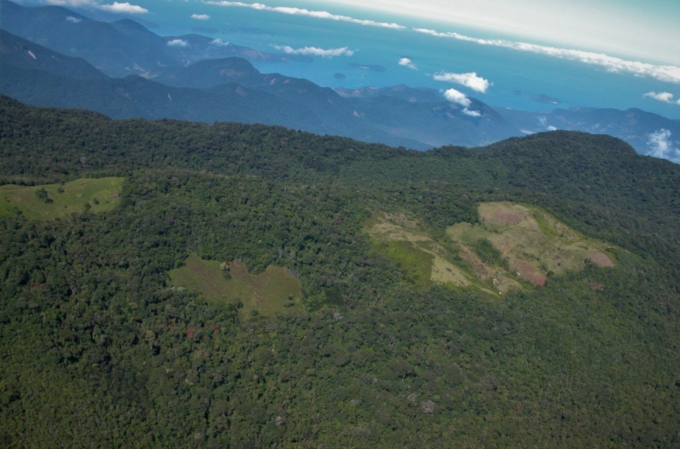
Considered one of the world’s richest and most endangered forests, the Atlantic rainforest occupies 15% of Brazil’s landmass in an area that is home to 72% of the population.
The extent of wintertime river ice has declined by 2.5 percentage points globally over the past three decades.
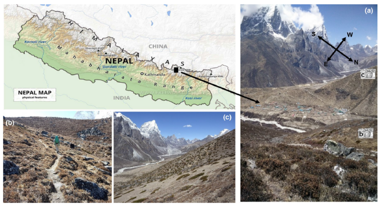
Plant life is expanding in the area around Mount Everest, and across the Himalayan region, new research shows.
IndigoAg is using HLS data to help fulfill its mission of making farms more profitable and sustainable.
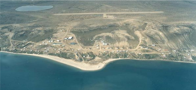
Southwest Banks Island has experienced the deleterious effects of climate change.
December 11, 2019 • Dr. Christopher Shuman is a glaciologist with NASA Goddard Space Flight Center and the University of Maryland at Baltimore County. Here is
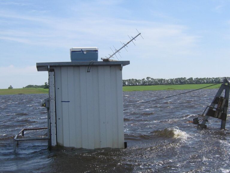
Landsat has enabled a more thorough understanding of how the Central Valley landscape is impacted by floods.
New time-lapse videos of Earth’s glaciers and ice sheets as seen from space are providing scientists with new insights into how the planet’s frozen regions are changing.
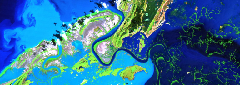
A new longitudinal study from Australia has harnessed thirty years of NASA/USGS Landsat data to map the nationwide movement and migration of mangrove forests.
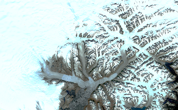
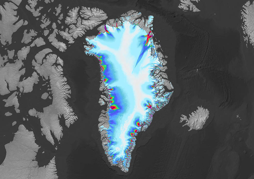
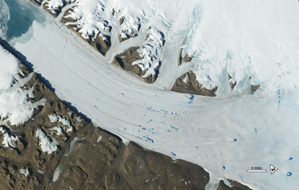
The branching network of glaciers that empty into Greenland’s Sermilik Fjord has changed significantly in the last half century.
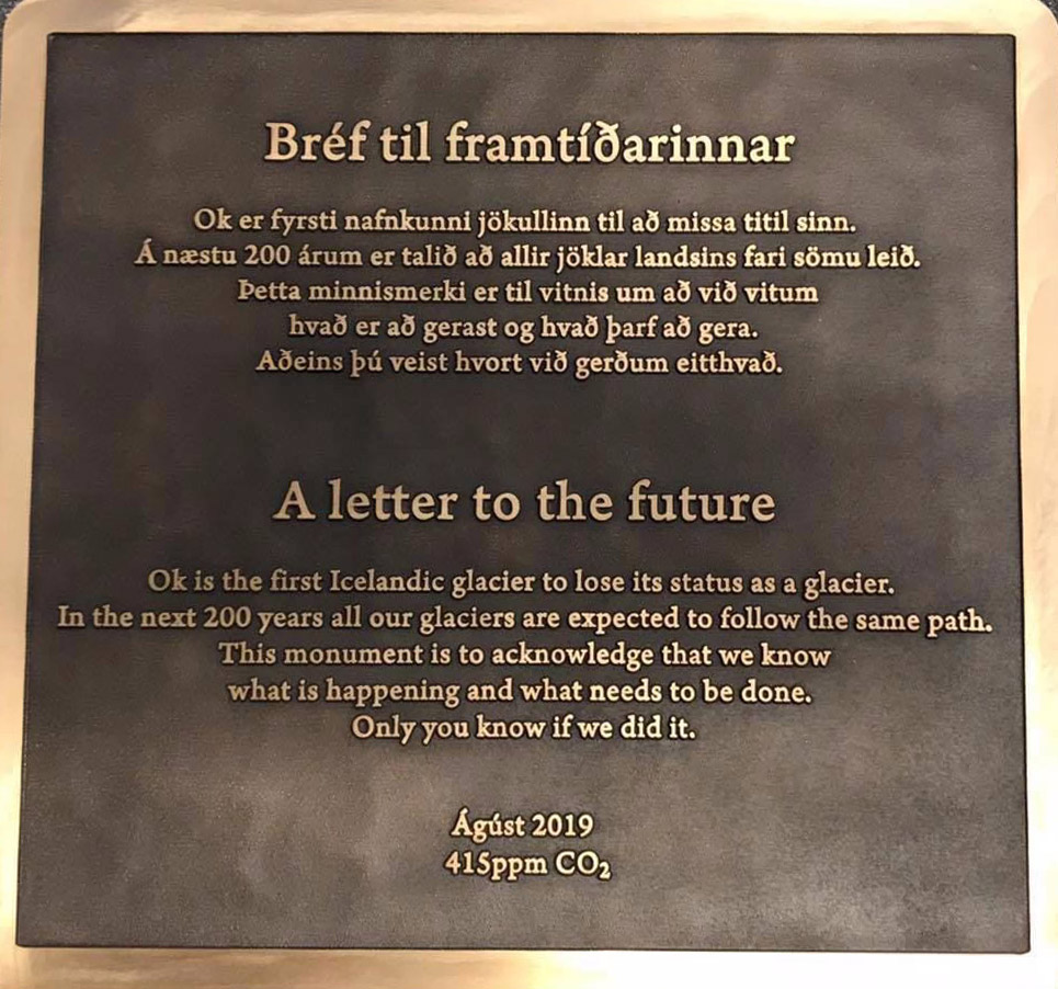
A memorial was placed on top of the volcano where Okjökull Glacier’s ice once flowed.
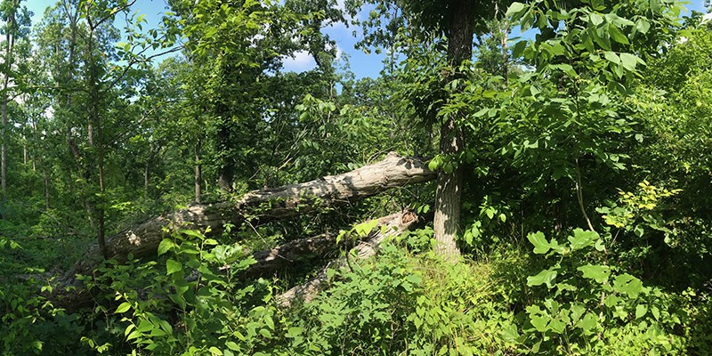
Landsat shows that large blowdown areas in southern Illinois forests are more heavily invaded by invasive species and slower to recover than smaller areas after a tornado.
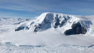
Seven ice features in western Antarctica have been named for Earth-observation satellites, including one named for Landsat.
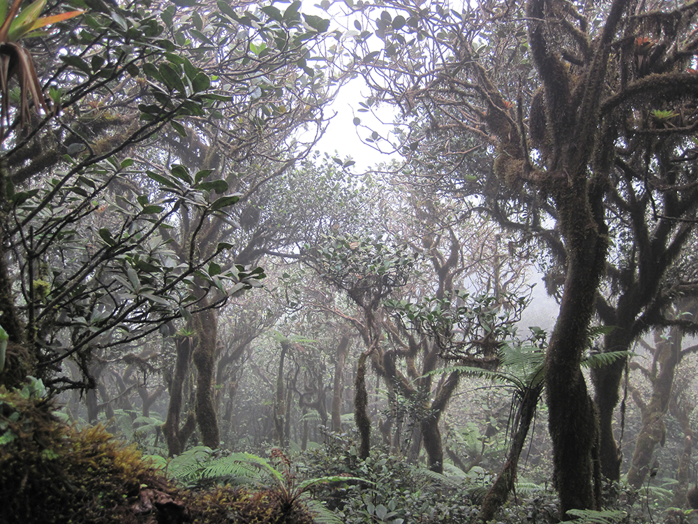
If greenhouse gas emissions continue increasing as they have been, 90% of Western Hemisphere cloud forests would be affected as early as 2060.
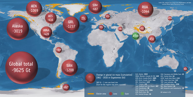
An international team used classical glaciological field observations combined with a wealth of information from various satellite missions to painstakingly calculate how much ice has been lost or gained by 19 different glacierized regions around the world.
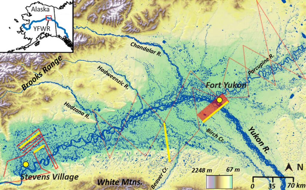
Remarkably little is known about the subsurface connections between the thousands of lakes scattered across ecoregions like Yukon Flats; this study sheds light on those lakes.
The first comprehensive assessment of glacier mass loss for all regions in western North America (excluding Alaskan glaciers) suggests that ice masses throughout western North America are in significant decline.
Antarctica experienced a sixfold increase in yearly ice mass loss between 1979 and 2017.
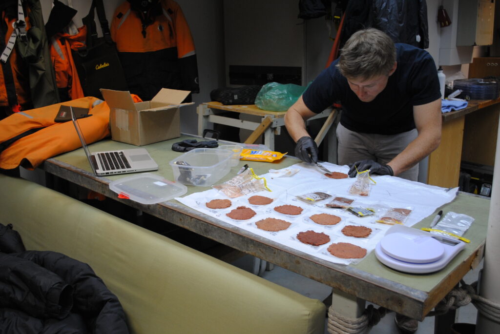
Scientists are now able to determine what penguins are eating from space.
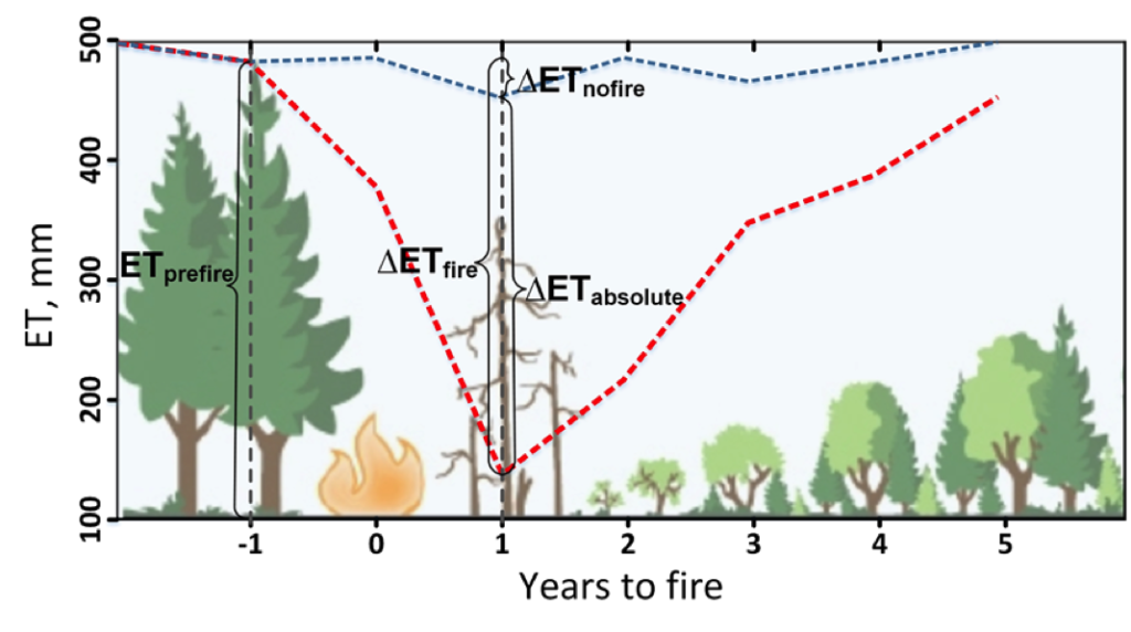
Fires play an important role in regulating forest density, vegetation water use, and runoff.
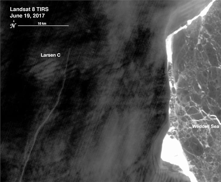
Iceberg A-68 calved from the Larsen C during a period of larger then average tidal cycles.
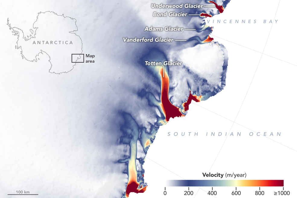
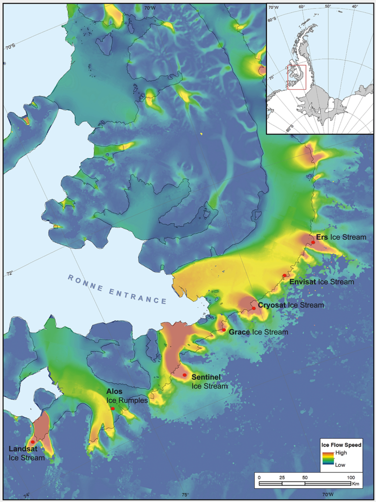
New detailed NASA maps of ice velocity and elevation show that a group of glaciers spanning one-eighth of East Antarctica’s coast have begun to lose ice over the past decade, hinting at widespread changes in the ocean.
“Great insight comes from thinking in multi-sensor and using several constellations together.”
