
Dr. Bas Altena is a postdoc at the University of Oslo and a Living Planet Fellow (ESA). Here is what Bas shared with us about the work he is presenting today at #AGU18:
High-resolution surface and upper fjord circulation of Greenland fjords from optical remote sensing
What are the major findings of this research?
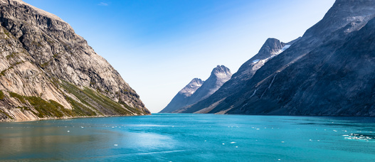
We have developed a method to map surface and subsurface circulation in ice-covered fjords from satellite images, and applied this method to estimate circulation patterns in a fjord in Greenland. We know that half of the annual mass loss from the Greenland ice sheet comes from ice loss at the interface between the glacier front and the ocean. You can observe this—icebergs falling from the cliff into the fjord—but this only provides part of the picture. A similar amount of ice, or possibly more, is melted away by warm ocean water. Because this happens below the surface, it is much more difficult to see or measure. The circulation in these fjords can also be quite complicated due to layering brought on by differences in temperature and salinity. With more observations of circulation patterns, we should be able to better understand what’s going on in these fjords, and improve our projections of the impacts that warming ocean water has on the ice sheets.
What are the implications of your findings?
Information about fjord circulation is typically obtained from moorings, which are submerged from a vessel, and need to be recovered in order to read the data they gather. However, not many are in place in Greenland, as these fjords are often choked with icebergs which makes maneuvering a boat very difficult. And we all know from the Titanic that these can be dangerous. Furthermore, these moorings can get destroyed as large icebergs pass by and damage their sensor strings.
If mooring data can be recovered, they will show recordings of the velocities and temperatures throughout the water column over time at one specific point. On the other hand, our method can estimate the circulation pattern over a whole fjord of more than 100 kilometers. We can thus combine both datasets and advance our knowledge of fjord circulation and ice-ocean interaction, especially for the many fjords in Greenland that have no in-situ data available.
Were there any technical challenges combining the Planet, Sentinel-2 and Landsat data? If so, how were they overcome?
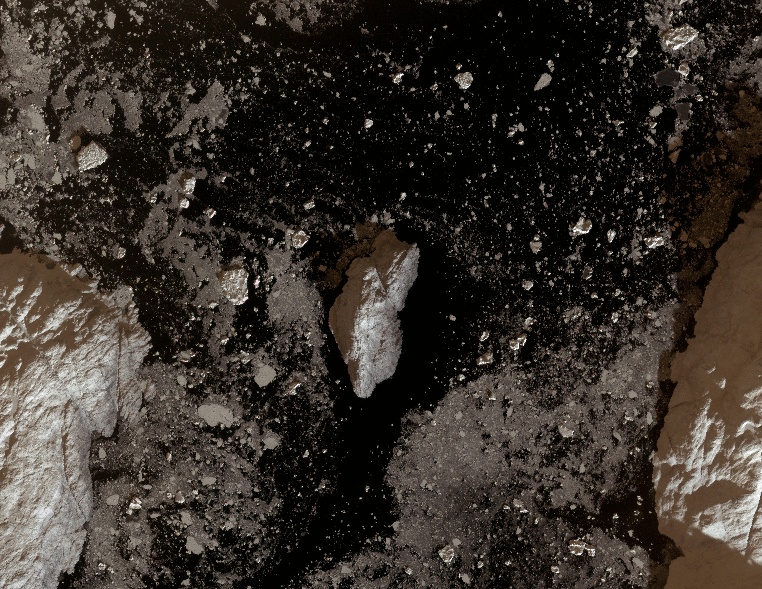
With any optical satellite system, clouds are an obstruction, but an additional limitation is caused by the polar night, which makes acquisitions at high latitudes troublesome in wintertime. More specifically for our method, we had to distinguish between fjord ice and icebergs, which is a difficult task. But through analyzing the spectral and spatial properties, it is possible to separate between both ice types.
What insight did the Landsat 8 data add?
Instead of only one satellite, we use multiple satellite systems. Because we use several satellites, like Landsat 8, Sentinel-2 and the Planet Doves we are able to observe different circulation patterns. Thus the great insight comes from thinking in multi-sensor and using several constellations together.
It is possible to observe patterns in sea-ice circulation with two satellites in delayed orbit, such as with EO-1 and Landsat 7. With more satellites, it becomes possible to extract even more complicated flows, as we increase the number of observations (and decrease the time between subsequent observations). Furthermore, the increased satellite data from Landsat and Sentinel make it possible to establish time series, where we can look at fjord circulation throughout the season, or even shorter intervals. So for us it means: the more satellites the merrier!
Co-authors:
Andreas Kääb
University of Oslo
This research was made possible by European Research Council (ERC) funding (project ICEMASS) as well as funding from the European Space Agency through the Living Planet Fellowship (project ICEFLOW).
Anyone can freely download Landsat or Sentinel-2 data from the USGS EarthExplorer or LandsatLook, while researchers can get access to Planet data through the science and education program.
Related reference:
+ Kääb & Leprince. 2014: Motion detection using near-simultaneous satellite acquisitions. Remote Sensing of Environment.
Further Reading:
+ Landsat at #AGU18


