
By Chrysandra Medley, Earth System Science Interdisciplinary Center, University of Maryland
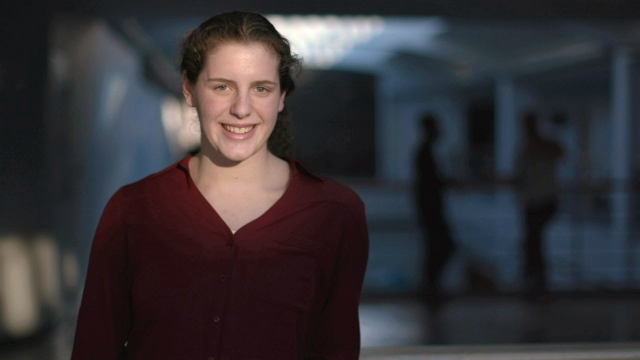
Last week, The National Geographic Society announced the 2020 recipients of the Young Explorers Grant, a prestigious grant awarded to young people, between the ages of 16 and 26, engaged in complex, impact-driven efforts to address global issues. Liza Goldberg, 18-year-old Earth System Science Interdisciplinary Center (ESSIC) scientist and NASA student research assistant, is one of the 22 recipients.
With this grant, Goldberg will launch Cloud to Classroom, an innovative project that uses satellite imagery to help K-12 classrooms understand global environmental change through remote sensing. Starting this Fall, Goldberg and the Google Earth Engine and Outreach team will travel to San Francisco, Mexico City, and Washington D.C. to complete several training programs. There, the team will teach students and teachers on how they can integrate these satellite-based tools into their Biology and Earth Sciences curriculum.
“Looking at news articles and statistics isn’t really enough when we’re trying to get kids to understand how severe the problems like deforestation, urbanization, and climate change are,” says Goldberg, “Through using satellite imagery and a series of apps that we’ll be building, we’ll be able to actually put the satellite imagery in their hands and let them visualize for themself what’s actually going on on the grounds.”
Goldberg is making these apps alongside the Google Earth Engine and Outreach team based in Mountain View, California. The team will be building these apps using Google Earth Engine tools and developer resources.
Goldberg has also been using Google Earth Engine tools in her research with NASA. For the past year, she’s been mapping the global drivers of mangrove loss with her lab group using the Google Earth engine and other forms of satellite imagery, [including over 1 million NASA/USGS Landsat images]. Just last week, Goldberg and her team were published on this research in Global Change Biology.
“Using satellite imagery, I’ve been able to see the climate change challenge and global environmental changes from a new perspective,” says Goldberg, “I want to see if I can give that same opportunity to other high school students who might not be as familiar with these sorts of global environmental changes that we’re seeing.”
Goldberg graduated from high school this past Spring, but her research started much earlier than that. She began working at NASA Goddard when she was 14, after a local science fair judge from NASA took interest in her project. Goldberg was presenting on her three-year study on the impact of climate change on the carbon dioxide exchange of red maple saplings. Ever since then, Goldberg has been immersed in climate change research.
In the Fall, Goldberg plans on joining her colleagues in California to begin training teachers and students as a part of Cloud to Classroom. She’ll also begin her undergraduate education at Stanford, where she will major in Earth Systems Science and minor in Computer Science. While attending school and beginning Cloud to Classroom, Goldberg will continue her work with NASA Goddard and plans to undertake new projects with several research groups at Stanford.
“With NASA and ESSIC, I’ve been able to have the wonderful opportunity to see the world from a new perspective,” she reflects.
Reference:
Goldberg, Liza, David Lagomasino, Nathan Thomas, and Temilola Fatoyinbo. “Global declines in human-driven mangrove loss.” Global Change Biology n/a (n/a). doi: 10.1111/gcb.15275.
=====
Editors note: In 2018, when Liza was a sixteen-year old intern working at NASA Goddard Space Flight Center, we had the opportunity to interview her about her work on mangroves. That Q&A follows here:
2018 Landsat Science Interview with Liza Goldberg
How long have you been interning at Goddard?
I have been interning at Goddard for two years. I began in Summer 2016, the summer after I finished middle school- I was 14 years old.
How did you first hear about the Goddard internship opportunity?
Throughout middle school, I worked on a science fair project that simulated climate change on red maple saplings that I planted in my backyard. I submitted the project to a science fair, and one of the judges there happened to work at Goddard. He suggested that I could potentially work with some of the scientists here, and after he contacted the Office of Education about me, I was introduced to Lola Fatoyinbo and David Lagomasino. I have been unofficially interning under them since, as I have been too young to officially join the internship program. I am now 16, so I can officially join the program this summer.
You have developed “what may be the world’s first satellite-based alert system showing where mangroves are threatened.” What are your hopes and aspirations for this alert system?
I hope to bring EcoMap (Electronic Coastal Monitoring and Assessment Program) to coastal communities, schools, and stakeholders around the world, beginning in the East Africa region. Users of the program would be trained in utilizing its maps and tools in identifying threats and predicting future loss drivers, allowing sustainable development and informed restoration/policy in regions under high vulnerability. There is a potential to work with several international institutions on making this global program a reality, and I ultimately hope that we work to establish a network of local communities who can actively use the program in monitoring their local ecosystems and benefiting their economies.
What are the next steps to making it publicly available?
The program is currently housed in the Google Earth Engine interface. We hope to use App Engine or another similar platform to convert the program to a web-based platform that would allow users around the world to access the data, and we aim to launch this program by August of this year.
What has your experience working with Landsat data been like? Was there a steep learning curve or was it pretty straightforward?
When I first started working at NASA, I barely knew what a satellite was. Though my lack of prior knowledge was daunting, working with Landsat data was always fairly straightforward for me, largely due to Google Earth Engine. I could easily import the data to my program, and complete the processing just in the Earth Engine coding interface. I never found that Landsat data was particularly difficult to understand or deal with.
What role does Landsat data play in the alert system you have developed?
Monitoring NDVI change plays a large part in the EcoMap system, and all NDVI data is provided by the Landsat 5, 7 and 8 8-day NDVI composites. We generated NDVI anomalies from 1984 to the present day, allowing users to identify
past regions of mangrove growth or loss. Monthly changes in NDVI over time can be also interactively charted for any point on the map. If mangroves have experienced declines in the past, or are currently experiencing degradation to mudflat or open water, Landsat helps us detect and map this disturbance.
What has been your biggest challenge while developing the alert system?
As of now, my biggest challenge has been designing EcoMap in a way that allows all users – not just remote sensing experts – to take advantage of its tools in mangrove monitoring. Generating the maps and loss statistics is almost easy; the challenge is making the program usable and interactive enough to allows users of all levels of expertise to understand all its predictive and analytical tools. Since we ultimately hope to train a wide range of users in the application of the program to serve local needs, the program’s usability is one of its most important aspects. After all, what is the point in creating decision-support tools if the targeted decision-makers cannot use the program?
What’s next for you? Do you think remote sensing and ecology will be part of your college studies?
I definitely look forward to studying remote sensing and ecology in college and graduate school. I hope to continue this project through college, and I am excited to see the progression of the field of remote sensing for sustainable development and ecological monitoring as I continue my work at university and beyond.
Related Reading:
+ At age 16, A Maryland student is working with NASA on a serious project, The Washington Post


