
Casey Youngflesh is a Postdoctoral Research Associate in the Department of Ecology and Evolutionary Biology at the University of Connecticut. Here is what he shared with us about the work he is presenting today at #AGU18:
A Continental Scale Assessment of Antarctic Food Web Dynamics Using Three Decades of Landsat Imagery
What are the major findings of this research?
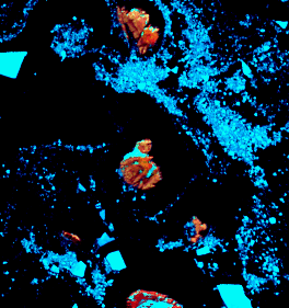
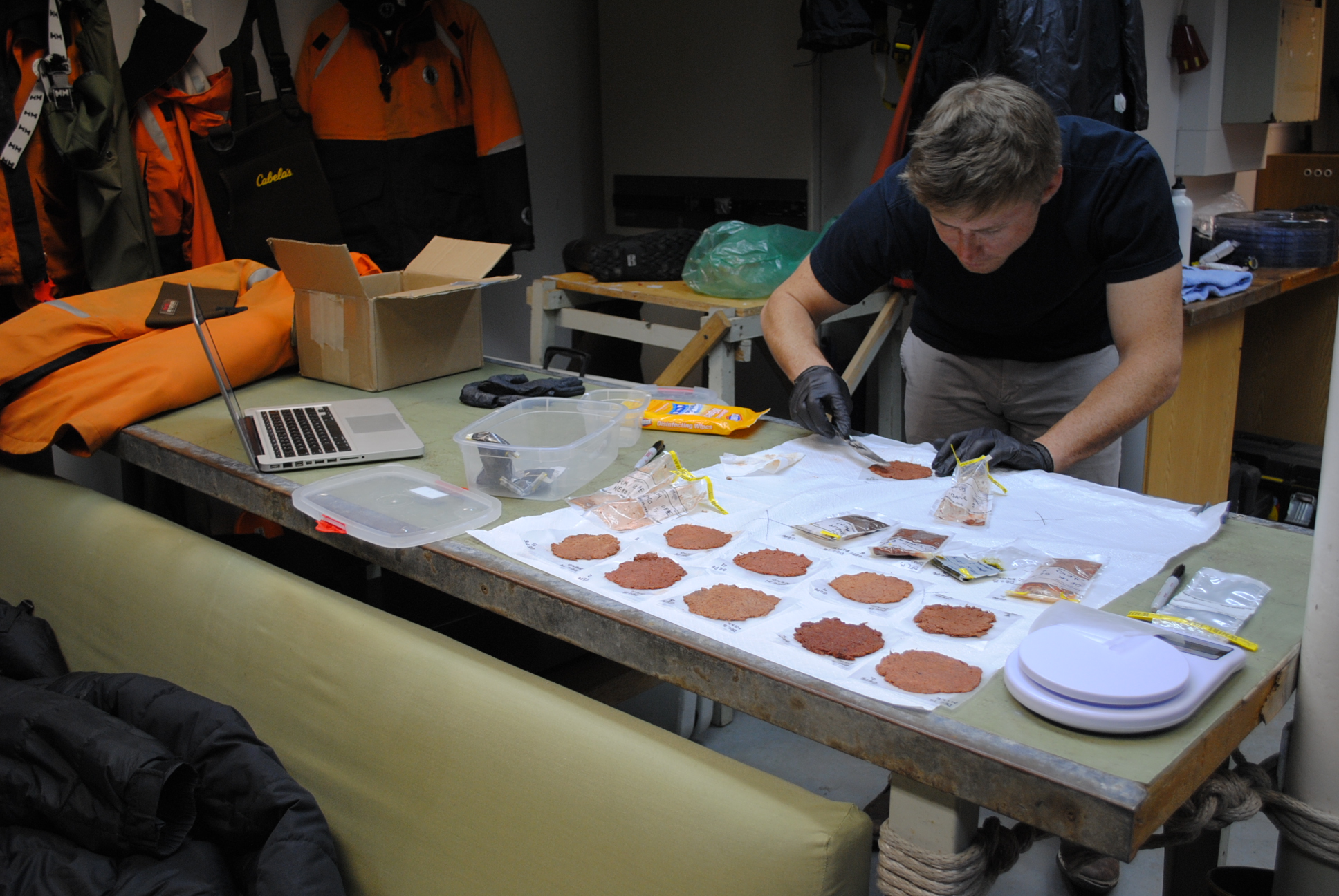
First and foremost, we show that we are now able to determine what penguins are eating from space. This is done by linking the spectral profile (essentially the color) of penguin guano to what these birds are eating. Large amounts of penguin guano build up at penguin colonies, which can be seen from space. The ability to derive this sort of important ecological information from satellite sensors means that we can study dietary patterns on scales that were previously intractable (continental, multidecadal).
Interestingly, we found no obvious trend in diet over time, despite changes in the physical environment. This is a surprise since the abundance and distribution of Adelie penguins has changed dramatically over the last 40 years and we had hypothesized that a shift in diet may have played a role. Spatial dietary patterns, however, suggest that in some areas experiencing population declines, penguins may have relatively few options for switching among prey resources. This is the subject of ongoing work.
What are the implications of your findings?
These findings are important for our understanding of how the Antarctic ecosystem functions and how this system might change in the future. Given continued changes in the physical environment and a growing krill fishery in the region, changes are likely to be seen both in the availability of penguin prey and penguin populations themselves.
Tools such as these will be important for the management of the Antarctic ecosystem which is often considered among the most pristine areas in the world. Understanding how ecosystems are responding to global change requires making inference at large spatial and temporal scales—satellite platforms are ideal for addressing these challenges of scale.
What insight did you gain from Landsat that would have been difficult to ascertain otherwise?
Landsat affords scientists the ability to look at ecological patterns on scales that would otherwise be impossible. We were able to obtain imagery for the all relevant areas of the Antarctic—a massive body of land with nearly 24,000km of coastline.
While dietary studies have been conducted at isolated sites around the Antarctic in the past, characterizing diet over nearly the entirety of the species range would be nearly impossible without the help of satellites. Landsat also provides a usable historic record dating back to the 1980s, allowing us to look at how ecological processes are changing through time, which is particularly relevant given the rate at which the physical environment is changing worldwide.
Co-authors:
Christian Che-Castaldo
Stony Brook University
Mathew Schwaller
Stony Brook University
Shawn Serbin
Brookhaven National Laboratory
Michael J Polito
Louisiana State University
Heather Lynch
Stony Brook University
This work was funded by a NASA Earth and Space Science Fellowship (NESSF graduate fellowship) – grant #NNX16AO27H. Casey conducted this work as a graduate student in Dr. Heather Lynch’s lab in the department of Ecology and Evolution at Stony Brook University.
Anyone can freely download Landsat data from the USGS EarthExplorer or LandsatLook.
Further Reading:
+ Space Views of Penguin ‘Poo’ Yield Insights
+ Satellites Probe Droppings for Clues About Penguin Populations, NASA Earth Observatory
+ How This Supercolony of 1.5 Million Penguins Stayed Hidden for Nearly 3,000 Years, LiveScience
+ Landsat at #AGU18


