Search
Close this search box.

Environmental Watch with Landsat Satellites

Environmental Watch with Landsat Satellites

[Source: Kasha Patel, NASA’s Goddard Space Flight Center] Landsat satellites have monitored Earth’s environment for more than four decades, providing detailed imagery of some of our planet’s most precious ecosystems such as forests, coastlines, glaciers, volcanoes and oceans. Scientists, researchers, foresters, emergency responders and educators use the data sets to understand natural and human-caused surface changes, identify the ecological impact of natural disasters, examine the effectiveness of environmental policies, and help preserve our planet for future generations.
This Earth Day, NASA and the U.S. Geological Survey celebrates the environment by looking back at some of the impressive data sets from Landsat, a joint mission of NASA and U.S. Geological Survey. Through these Earth images and others, scientists can monitor the place that over seven billion people call home. + more

EP near Modest, Calif.
Scientists use Landsat data to study plants’ water use by gauging evapotranspiration activity. The false color (left) and true color (right) images show croplands just south of Modesto, Calif. The dry grass and scrub slopes show very low evapotranspiration activity due to drought (tan in the false color image). The irrigated fields display high evapotranspiration (green in the false color image), and the flooded rice paddies (blue) exhibit very high levels of evapotranspiration.
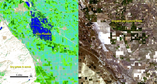
Image courtesy of Ayse Kilic, University of Nebraska-Lincoln. The image was acquired on Feb. 26, 2014 from the Landsat 8 satellite.


Further Reading:
+ Environmental Watch with Landsat satellites

On Key

Recent Posts

On Key

Related Posts