Q&A series conducted by Kate Ramsayer

Chris Neigh
Landsat 9 Project Scientist
NASA Goddard Space Flight Center
How do you use Landsat?
We’ve processed more than 224,000 Landsat images of the boreal forest, from 1984 through 2020, all to understand changes in tree-cover extent. We found that the northern hemisphere forests are shifting northward with climate warming. And that wouldn’t have been possible if we didn’t have the Landsat record. In another project—this is a land cover-land use-change program project–—we’re evaluating hotspots of change in Senegal where there’s been an expansion of irrigated agriculture to support the nutritional requirements of their population, which has nearly doubled in 20 years.
I came to NASA Goddard when I was working on my master’s degree at the University of Maryland, College Park. At the time I worked for a commercial company called EarthSat (now Maxar) and Dr. Compton Tucker, a NASA Senior Earth Scientist was the PI of a project called Geocover, which contracted EarthSat to collect a Landsat global land surface mosaic for 1975, 1990 and 2000 epochs for public scientific use. These data were used as the base imagery for Google Earth in 2005. Tucker was also an adjunct professor at the University of Maryland. I took his courses, and he offered me an internship position at Goddard to join his group evaluating the vegetation productivity data his group had been producing.
With its 50-year archive, Landsat can help explain complicated, intersecting relationships both within a year and across years to help us understand, locate, map, and monitor important ecosystems and give insight into how we can best protect them into the future.
What’s one Landsat image that is significant to you, and why?
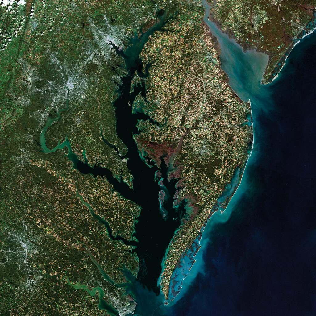
I always enjoy looking at the Landsat images over the Chesapeake Bay. I try to spend as much time as possible boating on it, discovering new coves, observing wildlife, and seeing new features and watching how its shifting sands are changing.
In the southern portion of the bay, you can see ghost forests, which is where the forest has been inundated multiple times to the point where the trees are dying back. There’s lots of areas that have had islands that are actually disappearing, and some portions that are being restored.
If you look at Smith Island and Tangier Island, which are in the southern portion of the bay, you can see through the Landsat record how they’ve become smaller. Alternatively, Poplar Island has grown after a 20-plus year restoration project.