
Image-based shoreline mapping (e.g. Landsat-based) has provided much of the current understanding of long-term barrier island shoreline morphology.
Lidar measurements are often used for precision elevation surveys of barrier islands, but the comparatively low-cost and high-repeat coverage of Landsat makes the satellites a valuable tool for more frequent shoreline mapping.
USGS just released an open-file report on their Landsat-based method for extracting sandy shorelines.
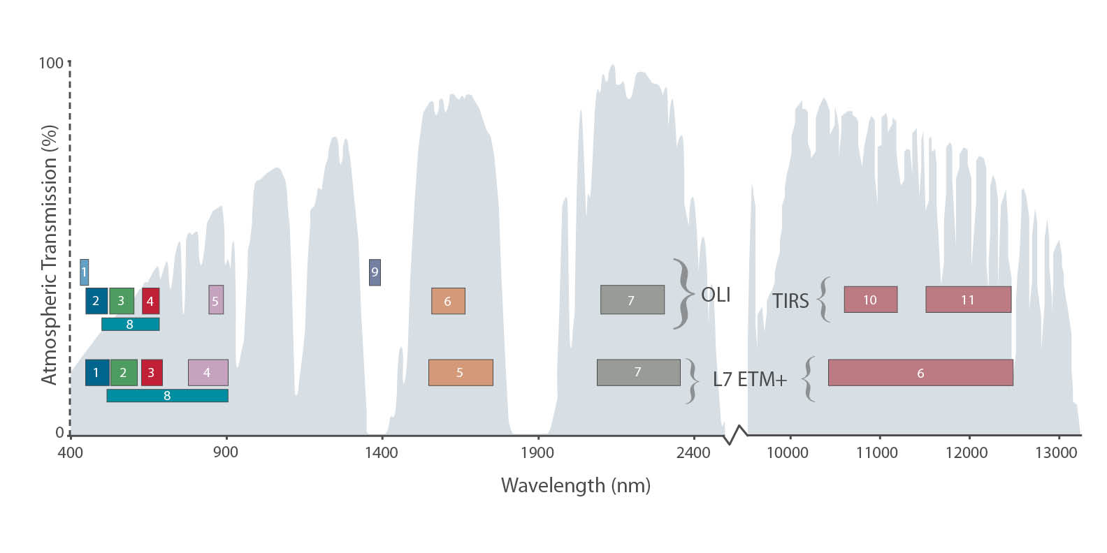
By taking advantage of Landsat’s second shortwave-infrared band, USGS can clearly distinguish land from water.
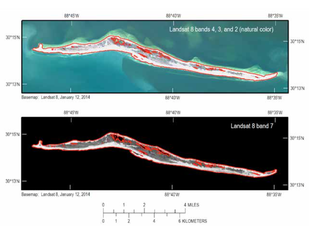
In the paper, a map showing Horn Island in Mississippi is shown as an example (see image to the right).
Because water absorbs shortwave infrared (SWIR) radiation, USGS scientists can use Landsat SWIR bands to generate island isolines (see the red lines on the Horn Island map, right), which are then converted to polygon shapefiles of shoreline and added to their shoreline database—allowing shoreline evolution to be monitored.
Further Reading:
+ Barrier Island shorelines extracted from Landsat imagery (Open-File Report 2015-1179), USGS
+ USGS St. Petersburg Coastal and Marine Science Center


