
USGS Invites Federal and International Partners to Join the Next Landsat Science Team
The USGS, in partnership with NASA, is calling for applications to staff the next Landsat Science Team to serve a 5-year term from 2025 to 2030.

The USGS, in partnership with NASA, is calling for applications to staff the next Landsat Science Team to serve a 5-year term from 2025 to 2030.
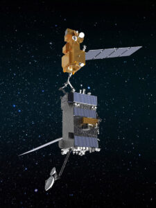
OSAM-1 Lead Systems Engineer Wendy Morgenstern discusses NASA’s On-orbit Servicing, Assembly, and Manufacturing 1 mission to robotically refuel Landsat 7, a satellite that wasn’t designed to be serviced.
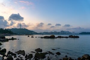
Intertidal wetlands significantly contribute to China’s environmental and ecological diversity, but are facing unprecedented pressures from anthropogenic development, as well as the threat of future sea level rise.
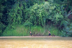
Researchers used Landsat satellites to track changes in surface water temperature for the Sekong, Sesan and Srepok rivers. Within one year of the opening of a major dam, downstream river temperatures during the dry season dropped by up to 3.6ºF.
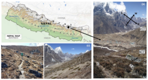
Plant life is expanding in the area around Mount Everest, and across the Himalayan region, new research shows.
Last spring, NASA researchers flew over the Everglades and Puerto Rico to measure how mangroves and rainforests grow and evolve over time, then hurricanes Irma and Maria struck.
Over 375 presentations at this year’s AGU Fall feature Landsat.
At this year’s AGU Fall meeting over 325 presentations feature research done using Landsat data. The Landsat-related papers and posters run the gamut of disciplines from cryosphere to biogeoscience to hydrology to global environmental change to natural hazards to informatics.
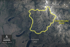
A NASA study of a basin in northwestern Wyoming revealed that the snowmelt season in the area is now ending on average about sixteen days earlier than it did from the 1970s through the 1990s.
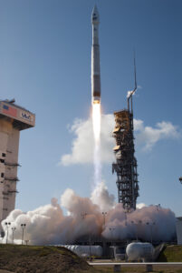
On the beautifully clear Monday morning of Feb. 11, 2013, the Landsat Data Continuity Mission made its way from California’s Vandenberg Air Force Base to
The great strength of Landsat data is its long record, the ability to look at our planet over the past 40 years and see what

Over dinner on R.V. Calypso while anchored on the lee side of Glover’s Reef in Belize, Jacques Cousteau told Phil Dustan that he suspected humans were having a negative impact on coral reefs.
Scientists have used satellite data from NASA-built Landsat missions to confirm that more than 20 years of warming temperatures in northern Quebec, Canada, have resulted
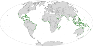
Kirtland’s warblers are an endangered species of lightweight little birds with bright yellow-bellies that summer in North America and winter in the Bahamas. But be
Martha Anderson, a research scientist at the U.S. Department of Agriculture, uses images from the Landsat satellite program to monitor water use and drought on
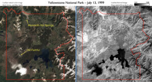
Yellowstone National Park sits on top of a vast, ancient, and still active volcano. Heat pours off its underground magma chamber, and is the fuel
Scientists at UC Santa Barbara have developed new methods for studying how environmental factors and climate affect giant kelp forest ecosystems at unprecedented spatial and
Scientists have created a mosaic of digital images collected from space showing the frozen continent of Antarctica—one of the most remote and least known places
If your summer travels have taken you across the Rocky Mountains, you’ve probably seen large swaths of reddish trees dotting otherwise green forests. While it
The most definitive map of Earth’s mangrove forests has been created with Landsat data. A group of scientists, led by Chandra Giri from USGS-EROS, has
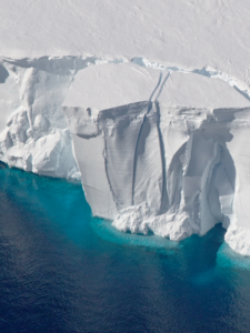
Antarctica may not be the world’s largest landmass — it’s the fifth-largest continent — but resting on top of that land is the world’s largest
A single, huge, violent storm that swept across the whole Amazon forest in 2005 killed half a billion trees, according to a new study funded
Every spring, migratory birds like the Black-throated Blue Warbler journey from tropical Caribbean or South American refuges to North American forests. But which forest patch
Every year, hurricanes and droughts wreak havoc on human lives and property around the world. And according to a pair of new NASA-funded studies, migratory
NASA researchers studying urban landscapes have found that the intensity of the “heat island” created by a city depends on the ecosystem it replaced and
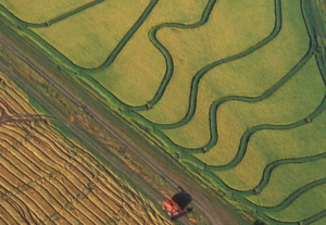
Horticultural crops account for almost 50% of crop sales in the United States, and these crops are carefully managed to ensure good quality. But more
A new set of vegetation maps for five islands of the Caribbean Lesser Antilles, including Grenada, St. Kitts, Nevis, St. Eustatius and Barbados, appear in
For the first time, scientists have used satellite images to demonstrate a link between rapid city growth and rainfall patterns, as well as to assess
