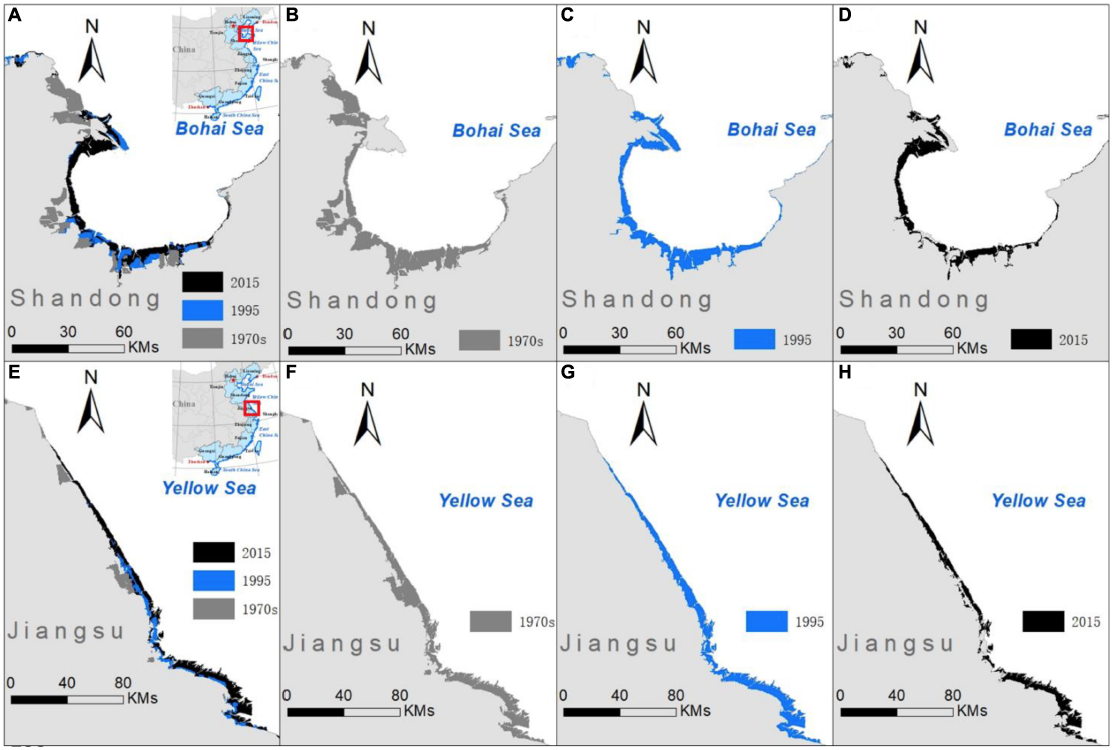
Using archives of [NASA/USGS Landsat] satellite imaging data, a study in Frontiers in Earth Science has conducted the most in-depth study of China’s intertidal wetlands to date and found a 37.62% decrease in area between 1970 and 2015.
Intertidal wetlands significantly contribute to China’s environmental and ecological diversity, but are facing unprecedented pressures from anthropogenic development, as well as the threat of future sea level rise.
Despite the ecological and economic significance of China’s vast areas of intertidal wetlands, such as storm protection, pollution purification and carbon sequestration, their distribution and variation over time have not been well documented. This study highlights the urgency for conservation measures of these valuable habitats by showing the scale of their decline for the first time.
“Intertidal wetlands are buffer zones, linking freshwater river systems and the salty oceanic system. Despite their significant contributions to environmental, ecological and hydrological services, China’s intertidal wetlands have not received sufficient protection,” says study lead Dr. Song, from the School of Geographical Sciences at Guangzhou University.
The research team at Guangzhou University utilized archives of remote sensing data from earth observation satellites to map intertidal wetland patterns on a national scale, following the continental coastline over 18,000km. The use of archival data in this study has provided the most integrated and complete perspective for use in natural resource management and land-use change research to date.
Satellite image data was collected from the 1970s, 1995 and 2015 from the Landsat-MSS/TM/8 satellites and was integrated with coastal maps from corresponding time periods to improve map accuracy. 653 field survey points were also selected by random sampling from different coastline types and compared with the interpreted data for further precision validation. The results show worrying trends for these valuable habitats if effective protective measures are not put in place.
The area of intertidal flats along China’s coast showed extensive decline from 7848.21km2 in the 1970’s to 4895km2 in 2015, equating to a 37.62% area loss of the intertidal wetlands in the last 40 years. These areas have also become increasingly fragmented as anthropogenic development continues to encroach further towards the coast.

At an annual loss rate of between 0.94% and 1.17%, China’s intertidal wetlands are disappearing almost twice as fast as the global average, due to an explosive growth of economies and populations in coastal regions. Huge reclamations of open-coast wetland are also being used for aquaculture, agriculture, tourism construction and hydrologic engineering due to intensified land use conflicts. These new coastal developments have led to expanding seawall construction, which is being dubbed ‘the new Great Wall of China’.
In the long run, accelerated sea level rise due to climate change will have the largest impact on coastal wetlands, putting ecosystems under increased strain. The combined pressures of land reclamation and sea level rise reduce the space for the wetland to retreat inland, leading to further decline.
Dr. Song emphasizes, “Intertidal flats and wetlands are confronting unprecedented pressure, because of the interference of human activity and the expected future sea level rise. Due to the region’s development plan of coastal regions, and the government favored ‘blue economy’, the human activity in the near-shore region is going to become more intensive.”
“A high priority should be given to intertidal wetland conservation and habitat reconstruction, with a view to a sustainable future.”
Reference:
Song, Song, Zhifeng Wu, Yuefeng Wang, Zheng Cao, Zhenyu He, and Yongsong Su. 2020. “Mapping the Rapid Decline of the Intertidal Wetlands of China Over the Past Half Century Based on Remote Sensing.” Frontiers in Earth Science 8 (16). doi: 10.3389/feart.2020.00016.


