
This Earth Day, NASA and the U.S. Geological Survey celebrates the environment by looking back at some of the impressive data sets from Landsat, a joint mission of NASA and U.S. Geological Survey. Through these Earth images and others, scientists can monitor the place that over seven billion people call home. + more
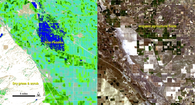
Image courtesy of Ayse Kilic, University of Nebraska-Lincoln. The image was acquired on Feb. 26, 2014 from the Landsat 8 satellite.
Further Reading:
+ Environmental Watch with Landsat satellites

Be Part of What’s Next: Emerging Applications of Landsat at AGU24
Anyone making innovative use of Landsat data to meet societal needs today and during coming decades is encouraged to submit and abstract for the upcoming “Emerging Science Applications of Landsat” session at AGU24.


