
Source: NASA Land-Cover / Land-Use Change Program
The NASA Land-Cover / Land-Use Change Program announced the release of the Global 30m Landsat Tree Canopy Version 4. This latest version was created by mining and processing the entire Landsat archive.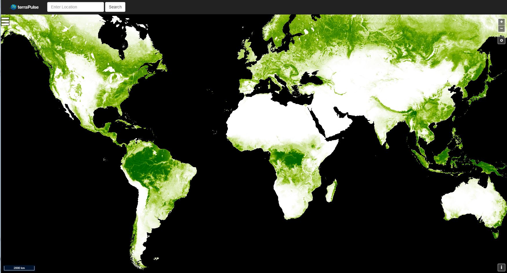
Selected details:
The version 4 Tree Canopy Cover (TCC) product replaces the previous version of global tree canopy cover estimates for 2000, 2005, 2010, and 2015. It also includes annual tree cover estimates from 2010 to 2015 for North and South America.
Previous versions of TCC were derived using the Landsat Global Land Survey collection, however for version 4 we mined and processed the entire Landsat archive, providing an improved and accurate representation for a given year. The observations from neighboring years were only used to fill gaps when there was no valid observation in the year. For more information about this dataset please visit http://landcover.org/data/landsatTreecover.
The data is available for download via FTP and Earth Science Data Interface. To visualize the 2015 tree cover product please visit https://www.terrapulse.com/terraView.
The Landsat Vegetation Continuous Fields (VCF) tree cover layers contain estimates of the percentage of horizontal ground in each 30-m pixel covered by woody vegetation greater than 5 meters in height. The product is derived from all seven bands of Landsat 5 Thematic Mapper (TM) and/or Landsat 7 Enhanced Thematic Mapper Plus (ETM+).
Tree cover, the proportional, vertically projected area of vegetation (including leaves, stems, branches, etc.) of woody plants above a given height, affects terrestrial energy and water exchanges, photosynthesis and transpiration, net primary production, and carbon and nutrient fluxes.
Tree cover also affects habitat quality and movements of wildlife, residential property value for humans, and other ecosystem services. The continuous classification scheme of the VCF product enables better depiction of land cover gradients than traditional discrete classification schemes. Importantly for detection and monitoring of forest changes (e.g., deforestation and degradation), tree cover provides a measurable attribute upon which to define forest cover and its changes. Changes in tree cover over time can be used to monitor and retrieve site-specific histories of forest change.
Available in GeoTiff and other formats for convenience at 30m resolution globally.
+ Read full description on the LCLUC site

Be Part of What’s Next: Emerging Applications of Landsat at AGU24
Anyone making innovative use of Landsat data to meet societal needs today and during coming decades is encouraged to submit and abstract for the upcoming “Emerging Science Applications of Landsat” session at AGU24.


